Castle Dome Topo Map California
To zoom in, hover over the map of Castle Dome
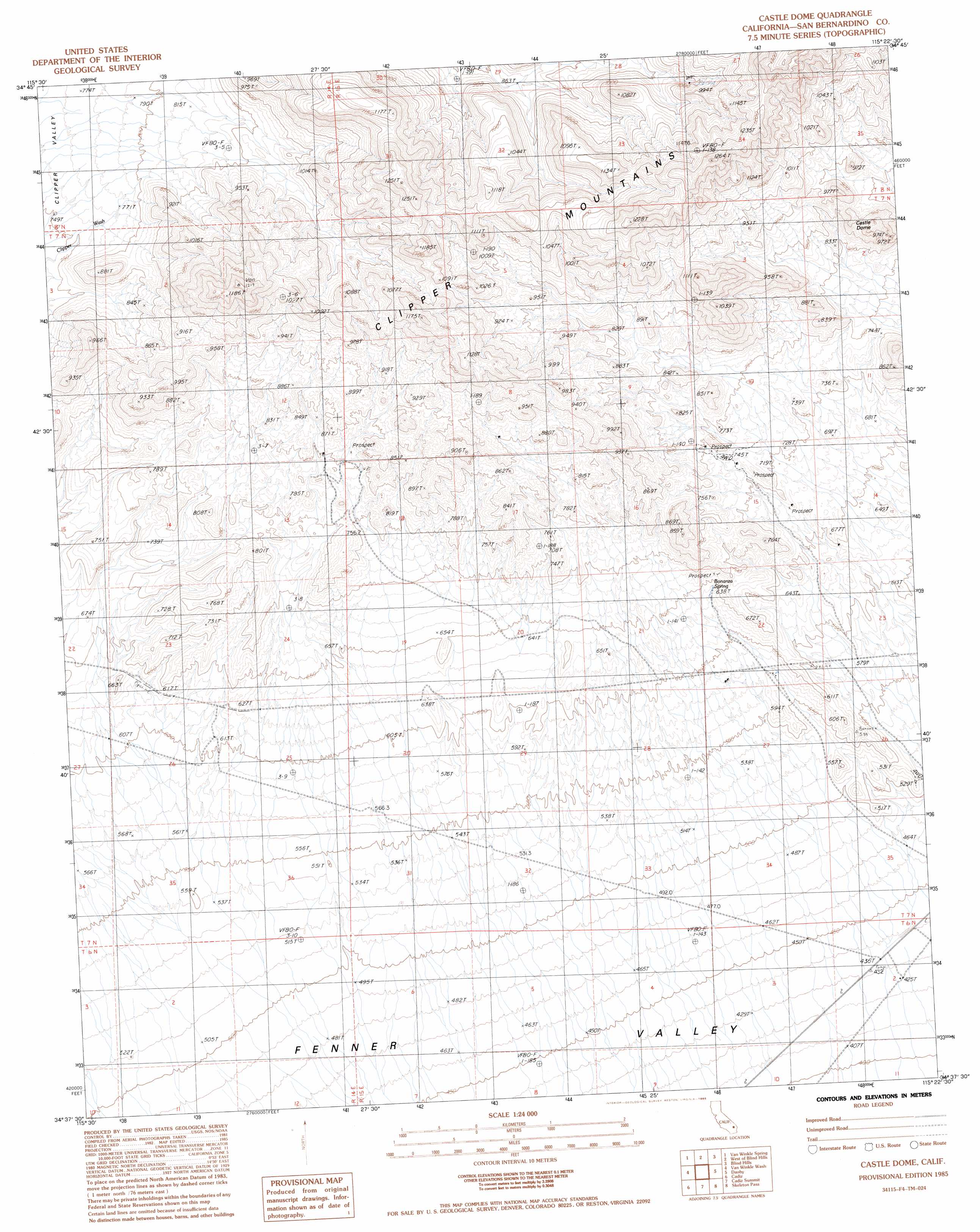
USGS Topo Quad 34115f4 - 1:24,000 scale
| Topo Map Name: | Castle Dome |
| USGS Topo Quad ID: | 34115f4 |
| Print Size: | ca. 21 1/4" wide x 27" high |
| Southeast Coordinates: | 34.625° N latitude / 115.375° W longitude |
| Map Center Coordinates: | 34.6875° N latitude / 115.4375° W longitude |
| U.S. State: | CA |
| Filename: | o34115f4.jpg |
| Download Map JPG Image: | Castle Dome topo map 1:24,000 scale |
| Map Type: | Topographic |
| Topo Series: | 7.5´ |
| Map Scale: | 1:24,000 |
| Source of Map Images: | United States Geological Survey (USGS) |
| Alternate Map Versions: |
Castle Dome CA 1985, updated 1985 Download PDF Buy paper map Castle Dome CA 2012 Download PDF Buy paper map Castle Dome CA 2015 Download PDF Buy paper map |
1:24,000 Topo Quads surrounding Castle Dome
Kelso Dunes |
Fountain Peak |
Colton Well |
Desert Spring |
Fenner Hills |
Bighorn Basin |
Van Winkle Spring |
West Of Blind Hills |
Blind Hills |
Fenner |
Brown Buttes |
Van Winkle Wash |
Castle Dome |
Danby |
Essex |
Amboy |
Cadiz |
Cadiz Summit |
Skeleton Pass |
Old Woman Statue |
Bristol Lake Nw |
Calumet Mine |
Cadiz Lake Nw |
Cadiz Lake Ne |
Sheep Camp Spring |
> Back to 34115e1 at 1:100,000 scale
> Back to 34114a1 at 1:250,000 scale
> Back to U.S. Topo Maps home
Castle Dome topo map: Gazetteer
Castle Dome: Mines
Tom Reed Mine elevation 722m 2368′Castle Dome: Springs
Bonanza Spring elevation 649m 2129′Castle Dome: Summits
Castle Dome elevation 965m 3166′Castle Dome digital topo map on disk
Buy this Castle Dome topo map showing relief, roads, GPS coordinates and other geographical features, as a high-resolution digital map file on DVD: