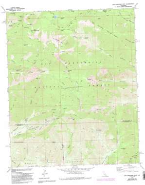
San Gorgonio Mountain Topo Map California
To zoom in, hover over the map of San Gorgonio Mountain
USGS Topo Quad 34116a7 - 1:24,000 scale
| Topo Map Name: | San Gorgonio Mountain |
| USGS Topo Quad ID: | 34116a7 |
| Print Size: | ca. 21 1/4" wide x 27" high |
| Southeast Coordinates: | 34° N latitude / 116.75° W longitude |
| Map Center Coordinates: | 34.0625° N latitude / 116.8125° W longitude |
| U.S. State: | CA |
| Filename: | o34116a7.jpg |
| Download Map JPG Image: | San Gorgonio Mountain topo map 1:24,000 scale |
| Map Type: | Topographic |
| Topo Series: | 7.5´ |
| Map Scale: | 1:24,000 |
| Source of Map Images: | United States Geological Survey (USGS) |
| Alternate Map Versions: |
San Gorgonio Mtn CA 1970, updated 1975 Download PDF Buy paper map San Gorgonio Mtn CA 1970, updated 1984 Download PDF Buy paper map San Gorgonio Mtn CA 1970, updated 1988 Download PDF Buy paper map San Gorgonio Mtn CA 1970, updated 1994 Download PDF Buy paper map San Gorgonio Mtn CA 1970, updated 1994 Download PDF Buy paper map San Gorgonio Mountain CA 1996, updated 1999 Download PDF Buy paper map San Gorgonio Mountain CA 2012 Download PDF Buy paper map San Gorgonio Mountain CA 2015 Download PDF Buy paper map |
| FStopo: | US Forest Service topo San Gorgonio Mountain is available: Download FStopo PDF Download FStopo TIF |
1:24,000 Topo Quads surrounding San Gorgonio Mountain
> Back to 34116a1 at 1:100,000 scale
> Back to 34116a1 at 1:250,000 scale
> Back to U.S. Topo Maps home
San Gorgonio Mountain topo map: Gazetteer
San Gorgonio Mountain: Falls
Silverwood Falls elevation 2462m 8077′San Gorgonio Mountain: Flats
North Fork Meadows elevation 2577m 8454′Plummer Meadows elevation 2629m 8625′
Raywood Flat elevation 2147m 7043′
Red Rock Flat elevation 3045m 9990′
San Gorgonio Mountain: Gaps
Dollar Lake Saddle elevation 3048m 10000′Gunsight Pass elevation 2230m 7316′
Middle Fork Jumpoff elevation 2359m 7739′
Mill Creek Jumpoff elevation 2577m 8454′
Mine Shaft Saddle elevation 3041m 9977′
San Gorgonio Mountain: Lakes
Dollar Lake elevation 2831m 9288′Dry Lake elevation 2764m 9068′
The Tarn elevation 3229m 10593′
San Gorgonio Mountain: Mines
Mill Creek Mine elevation 2168m 7112′San Gorgonio Mountain: Ridges
Ten Thousand Foot Ridge elevation 2943m 9655′San Gorgonio Mountain: Springs
Bear Wallow Spring elevation 1490m 4888′Deer Spring elevation 1676m 5498′
High Meadow Springs elevation 3056m 10026′
Lodgepole Spring elevation 2806m 9206′
San Gorgonio Mountain: Streams
East Fork South Fork Whitewater River elevation 1908m 6259′East Fork Whitewater River elevation 1913m 6276′
High Creek elevation 2190m 7185′
West Branch Hathaway Creek elevation 1086m 3562′
San Gorgonio Mountain: Summits
Charlton Peak elevation 3291m 10797′Dobbs Peak elevation 3185m 10449′
Galena Peak elevation 2839m 9314′
Jepson Peak elevation 3416m 11207′
Lake Peak elevation 3095m 10154′
Little Charlton Peak elevation 3248m 10656′
San Gorgonio Mountain elevation 3502m 11489′
Snow Peak elevation 2415m 7923′
San Gorgonio Mountain: Swamps
Fish Creek Meadows elevation 2485m 8152′San Gorgonio Mountain: Trails
Dry Lake Trail elevation 2806m 9206′Fish Creek Trail elevation 2914m 9560′
North Fork Meadows Trail elevation 2751m 9025′
Raywood Flat Trail elevation 2246m 7368′
Sky High Trail elevation 3384m 11102′
Vivian Creek Trail elevation 2738m 8982′
San Gorgonio Mountain: Valleys
Big Oaks Canyon elevation 1584m 5196′Burnt Canyon elevation 1704m 5590′
Middle Branch Millard Canyon elevation 1328m 4356′
Sawmill Canyon elevation 1708m 5603′
San Gorgonio Mountain digital topo map on disk
Buy this San Gorgonio Mountain topo map showing relief, roads, GPS coordinates and other geographical features, as a high-resolution digital map file on DVD:


