Deadman Lake Sw Topo Map California
To zoom in, hover over the map of Deadman Lake Sw
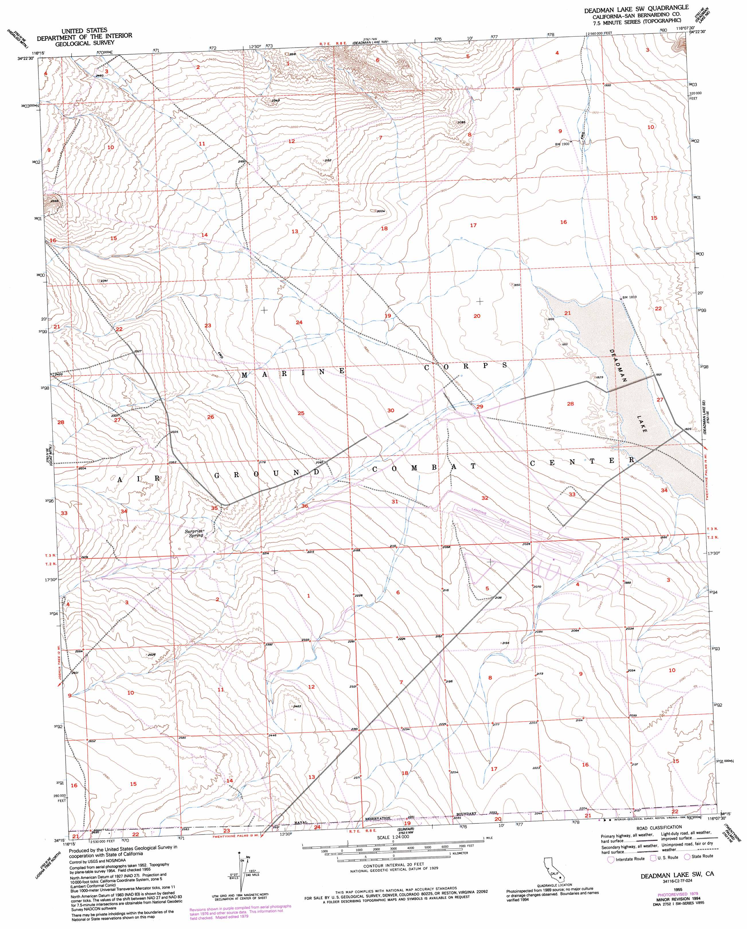
USGS Topo Quad 34116c2 - 1:24,000 scale
| Topo Map Name: | Deadman Lake Sw |
| USGS Topo Quad ID: | 34116c2 |
| Print Size: | ca. 21 1/4" wide x 27" high |
| Southeast Coordinates: | 34.25° N latitude / 116.125° W longitude |
| Map Center Coordinates: | 34.3125° N latitude / 116.1875° W longitude |
| U.S. State: | CA |
| Filename: | o34116c2.jpg |
| Download Map JPG Image: | Deadman Lake Sw topo map 1:24,000 scale |
| Map Type: | Topographic |
| Topo Series: | 7.5´ |
| Map Scale: | 1:24,000 |
| Source of Map Images: | United States Geological Survey (USGS) |
| Alternate Map Versions: |
Deadman Lake SW CA 1955, updated 1955 Download PDF Buy paper map Deadman Lake SW CA 1955, updated 1975 Download PDF Buy paper map Deadman Lake SW CA 1955, updated 1979 Download PDF Buy paper map Deadman Lake SW CA 1955, updated 1979 Download PDF Buy paper map Deadman Lake SW CA 1955, updated 1994 Download PDF Buy paper map Deadman Lake SW CA 2012 Download PDF Buy paper map Deadman Lake SW CA 2015 Download PDF Buy paper map |
1:24,000 Topo Quads surrounding Deadman Lake Sw
Galway Lake |
Lavic Se |
Morgans Well |
Ludlow Se |
Bagdad Sw |
Emerson Lake |
Hidalgo Mountain |
Deadman Lake Nw |
Deadman Lake Ne |
Lead Mountain |
Landers |
Goat Mountain |
Deadman Lake Sw |
Deadman Lake Se |
Lead Mountain Sw |
Yucca Valley North |
Joshua Tree North |
Sunfair |
Twentynine Palms |
Valley Mountain |
Yucca Valley South |
Joshua Tree South |
Indian Cove |
Queen Mountain |
Twentynine Palms Mountain |
> Back to 34116a1 at 1:100,000 scale
> Back to 34116a1 at 1:250,000 scale
> Back to U.S. Topo Maps home
Deadman Lake Sw topo map: Gazetteer
Deadman Lake Sw: Dams
Keys Dam Lower elevation 565m 1853′Deadman Lake Sw: Flats
Deadman Lake elevation 554m 1817′Deadman Lake Sw: Reservoirs
Keys Lake elevation 565m 1853′Deadman Lake Sw: Springs
Surprise Spring elevation 683m 2240′Deadman Lake Sw: Valleys
Bullion Wash elevation 605m 1984′Deadman Lake Sw digital topo map on disk
Buy this Deadman Lake Sw topo map showing relief, roads, GPS coordinates and other geographical features, as a high-resolution digital map file on DVD: