Bighorn Canyon Topo Map California
To zoom in, hover over the map of Bighorn Canyon
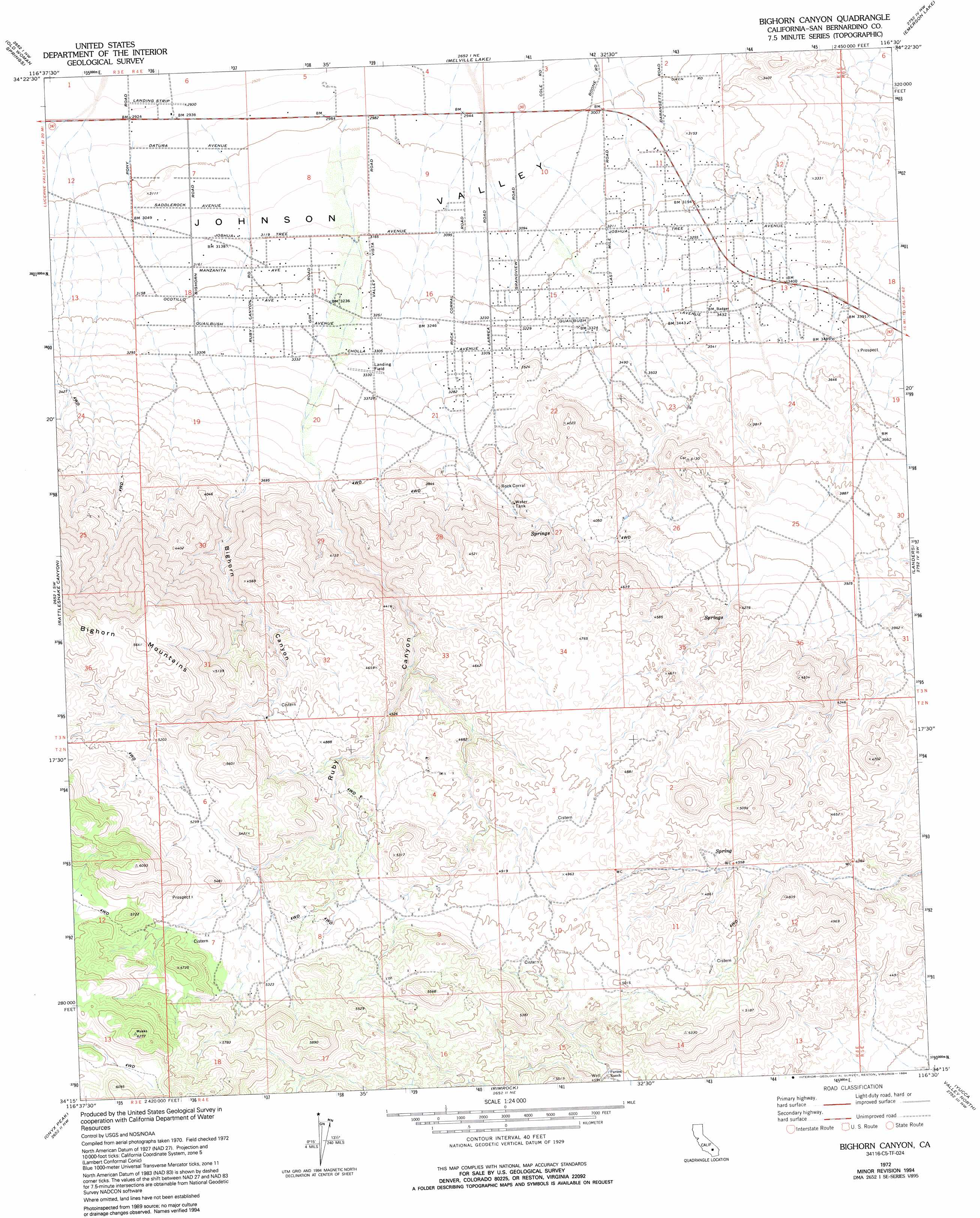
USGS Topo Quad 34116c5 - 1:24,000 scale
| Topo Map Name: | Bighorn Canyon |
| USGS Topo Quad ID: | 34116c5 |
| Print Size: | ca. 21 1/4" wide x 27" high |
| Southeast Coordinates: | 34.25° N latitude / 116.5° W longitude |
| Map Center Coordinates: | 34.3125° N latitude / 116.5625° W longitude |
| U.S. State: | CA |
| Filename: | o34116c5.jpg |
| Download Map JPG Image: | Bighorn Canyon topo map 1:24,000 scale |
| Map Type: | Topographic |
| Topo Series: | 7.5´ |
| Map Scale: | 1:24,000 |
| Source of Map Images: | United States Geological Survey (USGS) |
| Alternate Map Versions: |
Bighorn Canyon CA 1972, updated 1975 Download PDF Buy paper map Bighorn Canyon CA 1972, updated 1994 Download PDF Buy paper map Bighorn Canyon CA 1972, updated 1994 Download PDF Buy paper map Bighorn Canyon CA 2012 Download PDF Buy paper map Bighorn Canyon CA 2015 Download PDF Buy paper map |
| FStopo: | US Forest Service topo Bighorn Canyon is available: Download FStopo PDF Download FStopo TIF |
1:24,000 Topo Quads surrounding Bighorn Canyon
Grand View Mine |
Fry Mountains |
Iron Ridge |
Galway Lake |
Lavic Se |
Cougar Buttes |
Old Woman Springs |
Melville Lake |
Emerson Lake |
Hidalgo Mountain |
Big Bear City |
Rattlesnake Canyon |
Bighorn Canyon |
Landers |
Goat Mountain |
Moonridge |
Onyx Peak |
Rimrock |
Yucca Valley North |
Joshua Tree North |
San Gorgonio Mountain |
Catclaw Flat |
Morongo Valley |
Yucca Valley South |
Joshua Tree South |
> Back to 34116a1 at 1:100,000 scale
> Back to 34116a1 at 1:250,000 scale
> Back to U.S. Topo Maps home
Bighorn Canyon topo map: Gazetteer
Bighorn Canyon: Airports
Valley Vista Airport elevation 1019m 3343′Bighorn Canyon: Springs
Saddlerock Spring elevation 1435m 4708′Bighorn Canyon: Valleys
Bighorn Canyon elevation 1086m 3562′Rubber Drain Two elevation 1043m 3421′
Bighorn Canyon digital topo map on disk
Buy this Bighorn Canyon topo map showing relief, roads, GPS coordinates and other geographical features, as a high-resolution digital map file on DVD: