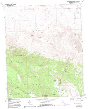
Rattlesnake Canyon Topo Map California
To zoom in, hover over the map of Rattlesnake Canyon
USGS Topo Quad 34116c6 - 1:24,000 scale
| Topo Map Name: | Rattlesnake Canyon |
| USGS Topo Quad ID: | 34116c6 |
| Print Size: | ca. 21 1/4" wide x 27" high |
| Southeast Coordinates: | 34.25° N latitude / 116.625° W longitude |
| Map Center Coordinates: | 34.3125° N latitude / 116.6875° W longitude |
| U.S. State: | CA |
| Filename: | o34116c6.jpg |
| Download Map JPG Image: | Rattlesnake Canyon topo map 1:24,000 scale |
| Map Type: | Topographic |
| Topo Series: | 7.5´ |
| Map Scale: | 1:24,000 |
| Source of Map Images: | United States Geological Survey (USGS) |
| Alternate Map Versions: |
Rattlesnake Canyon CA 1972, updated 1976 Download PDF Buy paper map Rattlesnake Canyon CA 1972, updated 1980 Download PDF Buy paper map Rattlesnake Canyon CA 1972, updated 1988 Download PDF Buy paper map Rattlesnake Canyon CA 1972, updated 1994 Download PDF Buy paper map Rattlesnake Canyon CA 1996, updated 1999 Download PDF Buy paper map Rattlesnake Canyon CA 2012 Download PDF Buy paper map Rattlesnake Canyon CA 2015 Download PDF Buy paper map |
| FStopo: | US Forest Service topo Rattlesnake Canyon is available: Download FStopo PDF Download FStopo TIF |
1:24,000 Topo Quads surrounding Rattlesnake Canyon
> Back to 34116a1 at 1:100,000 scale
> Back to 34116a1 at 1:250,000 scale
> Back to U.S. Topo Maps home
Rattlesnake Canyon topo map: Gazetteer
Rattlesnake Canyon: Ranges
Bighorn Mountains elevation 1744m 5721′Rattlesnake Canyon: Springs
Mound Spring elevation 1656m 5433′One Hole Spring elevation 1121m 3677′
Rattlesnake Spring elevation 1182m 3877′
Two Hole Spring elevation 1166m 3825′
Vaughn Spring elevation 1658m 5439′
Viscera Spring elevation 1635m 5364′
Rattlesnake Canyon: Summits
Granite Peaks elevation 2293m 7522′Tip Top Mountain elevation 2316m 7598′
Rattlesnake Canyon: Valleys
Rattlesnake Canyon elevation 1094m 3589′Rattlesnake Canyon digital topo map on disk
Buy this Rattlesnake Canyon topo map showing relief, roads, GPS coordinates and other geographical features, as a high-resolution digital map file on DVD:


