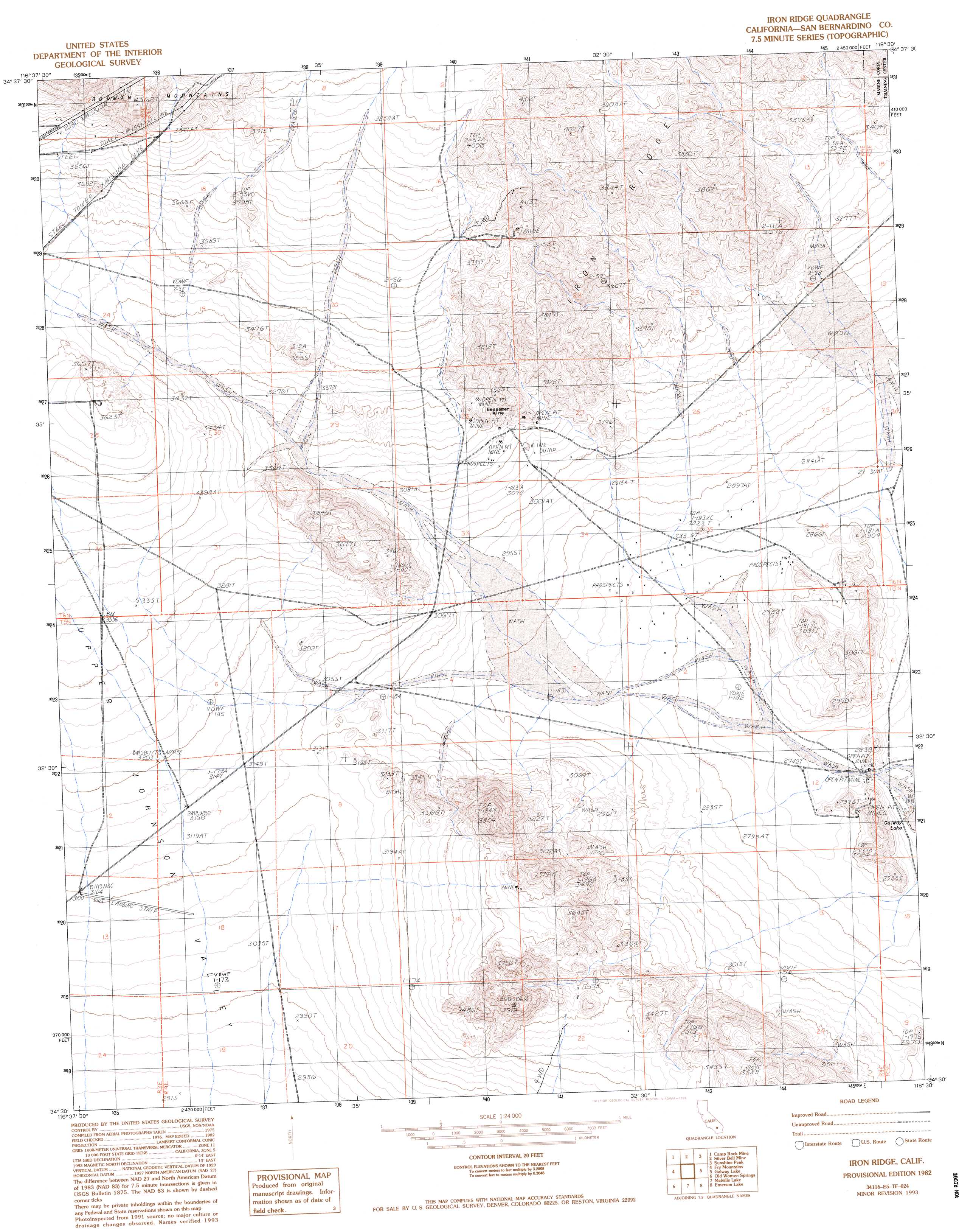
Iron Ridge Topo Map California
To zoom in, hover over the map of Iron Ridge
USGS Topo Quad 34116e5 - 1:24,000 scale
| Topo Map Name: | Iron Ridge |
| USGS Topo Quad ID: | 34116e5 |
| Print Size: | ca. 21 1/4" wide x 27" high |
| Southeast Coordinates: | 34.5° N latitude / 116.5° W longitude |
| Map Center Coordinates: | 34.5625° N latitude / 116.5625° W longitude |
| U.S. State: | CA |
| Filename: | o34116e5.jpg |
| Download Map JPG Image: | Iron Ridge topo map 1:24,000 scale |
| Map Type: | Topographic |
| Topo Series: | 7.5´ |
| Map Scale: | 1:24,000 |
| Source of Map Images: | United States Geological Survey (USGS) |
| Alternate Map Versions: |
Iron Ridge CA 1982, updated 1982 Download PDF Buy paper map Iron Ridge CA 1982, updated 1993 Download PDF Buy paper map Iron Ridge CA 1993, updated 1993 Download PDF Buy paper map Iron Ridge CA 2012 Download PDF Buy paper map Iron Ridge CA 2015 Download PDF Buy paper map |
1:24,000 Topo Quads surrounding Iron Ridge
Minneola |
Newberry Springs |
Troy Lake |
Hector |
Sleeping Beauty |
Ord Mountain |
Camp Rock Mine |
Silver Bell Mine |
Sunshine Peak |
Lavic Lake |
Grand View Mine |
Fry Mountains |
Iron Ridge |
Galway Lake |
Lavic Se |
Cougar Buttes |
Old Woman Springs |
Melville Lake |
Emerson Lake |
Hidalgo Mountain |
Big Bear City |
Rattlesnake Canyon |
Bighorn Canyon |
Landers |
Goat Mountain |
> Back to 34116e1 at 1:100,000 scale
> Back to 34116a1 at 1:250,000 scale
> Back to U.S. Topo Maps home
Iron Ridge topo map: Gazetteer
Iron Ridge: Mines
Bessemer Mine elevation 960m 3149′Iron Ridge: Ridges
Iron Ridge elevation 1184m 3884′Iron Ridge digital topo map on disk
Buy this Iron Ridge topo map showing relief, roads, GPS coordinates and other geographical features, as a high-resolution digital map file on DVD: