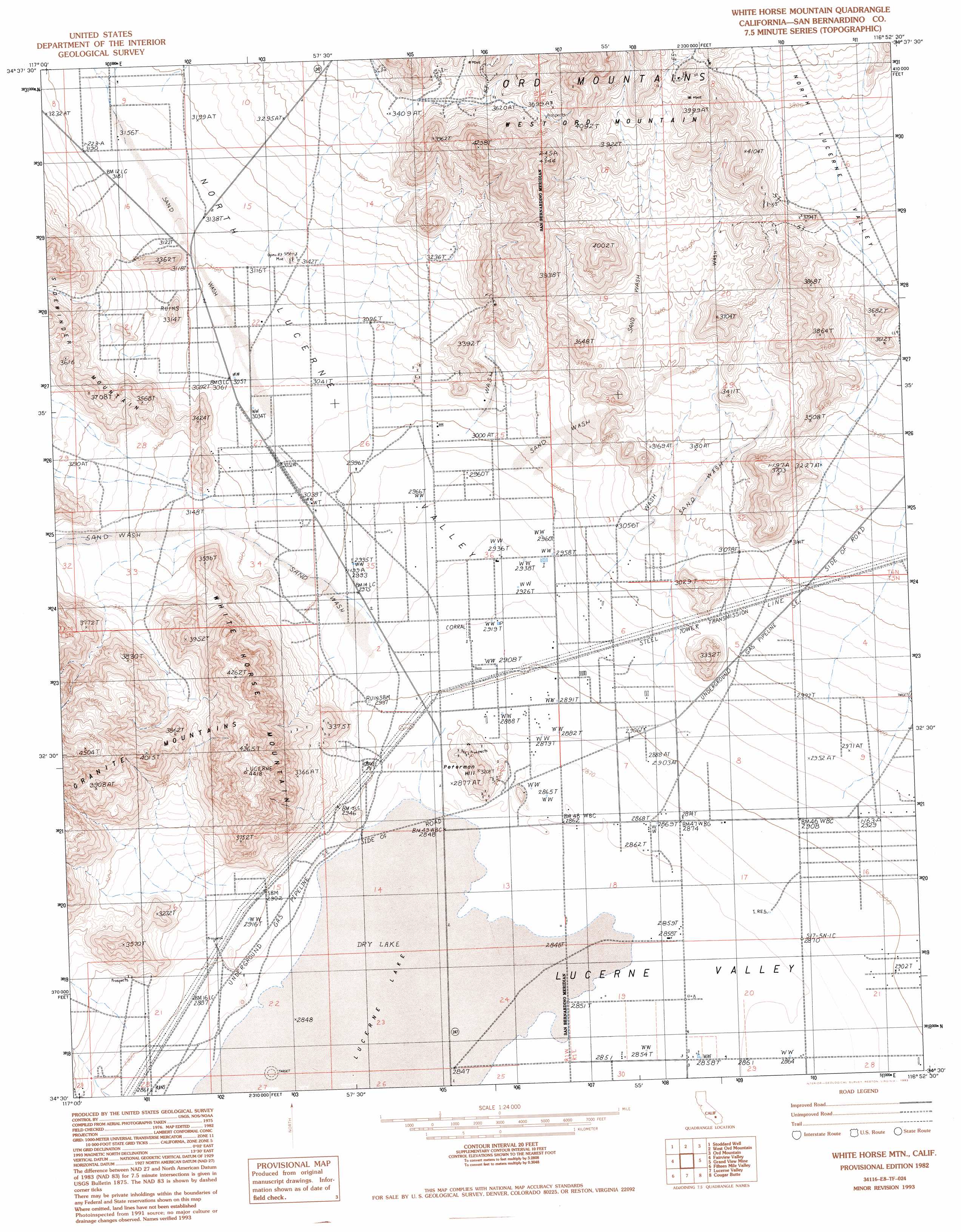
White Horse Mountain Topo Map California
To zoom in, hover over the map of White Horse Mountain
USGS Topo Quad 34116e8 - 1:24,000 scale
| Topo Map Name: | White Horse Mountain |
| USGS Topo Quad ID: | 34116e8 |
| Print Size: | ca. 21 1/4" wide x 27" high |
| Southeast Coordinates: | 34.5° N latitude / 116.875° W longitude |
| Map Center Coordinates: | 34.5625° N latitude / 116.9375° W longitude |
| U.S. State: | CA |
| Filename: | o34116e8.jpg |
| Download Map JPG Image: | White Horse Mountain topo map 1:24,000 scale |
| Map Type: | Topographic |
| Topo Series: | 7.5´ |
| Map Scale: | 1:24,000 |
| Source of Map Images: | United States Geological Survey (USGS) |
| Alternate Map Versions: |
White Horse Mtn CA 1982, updated 1982 Download PDF Buy paper map White Horse Mtn CA 1982, updated 1993 Download PDF Buy paper map White Horse Mountain CA 2012 Download PDF Buy paper map White Horse Mountain CA 2015 Download PDF Buy paper map |
1:24,000 Topo Quads surrounding White Horse Mountain
Hodge |
Barstow Se |
Daggett |
Minneola |
Newberry Springs |
Turtle Valley |
Stoddard Well |
West Ord Mountain |
Ord Mountain |
Camp Rock Mine |
Apple Valley North |
Fairview Valley |
White Horse Mountain |
Grand View Mine |
Fry Mountains |
Apple Valley South |
Fifteenmile Valley |
Lucerne Valley |
Cougar Buttes |
Old Woman Springs |
Lake Arrowhead |
Butler Peak |
Fawnskin |
Big Bear City |
Rattlesnake Canyon |
> Back to 34116e1 at 1:100,000 scale
> Back to 34116a1 at 1:250,000 scale
> Back to U.S. Topo Maps home
White Horse Mountain topo map: Gazetteer
White Horse Mountain: Flats
Lucerne Lake elevation 869m 2851′White Horse Mountain: Summits
Peterman Hill elevation 965m 3166′White Horse Mountain elevation 1342m 4402′
White Horse Mountain: Valleys
Lucerne Valley elevation 870m 2854′North Lucerne Valley elevation 873m 2864′
White Horse Mountain digital topo map on disk
Buy this White Horse Mountain topo map showing relief, roads, GPS coordinates and other geographical features, as a high-resolution digital map file on DVD: