Minneola Topo Map California
To zoom in, hover over the map of Minneola
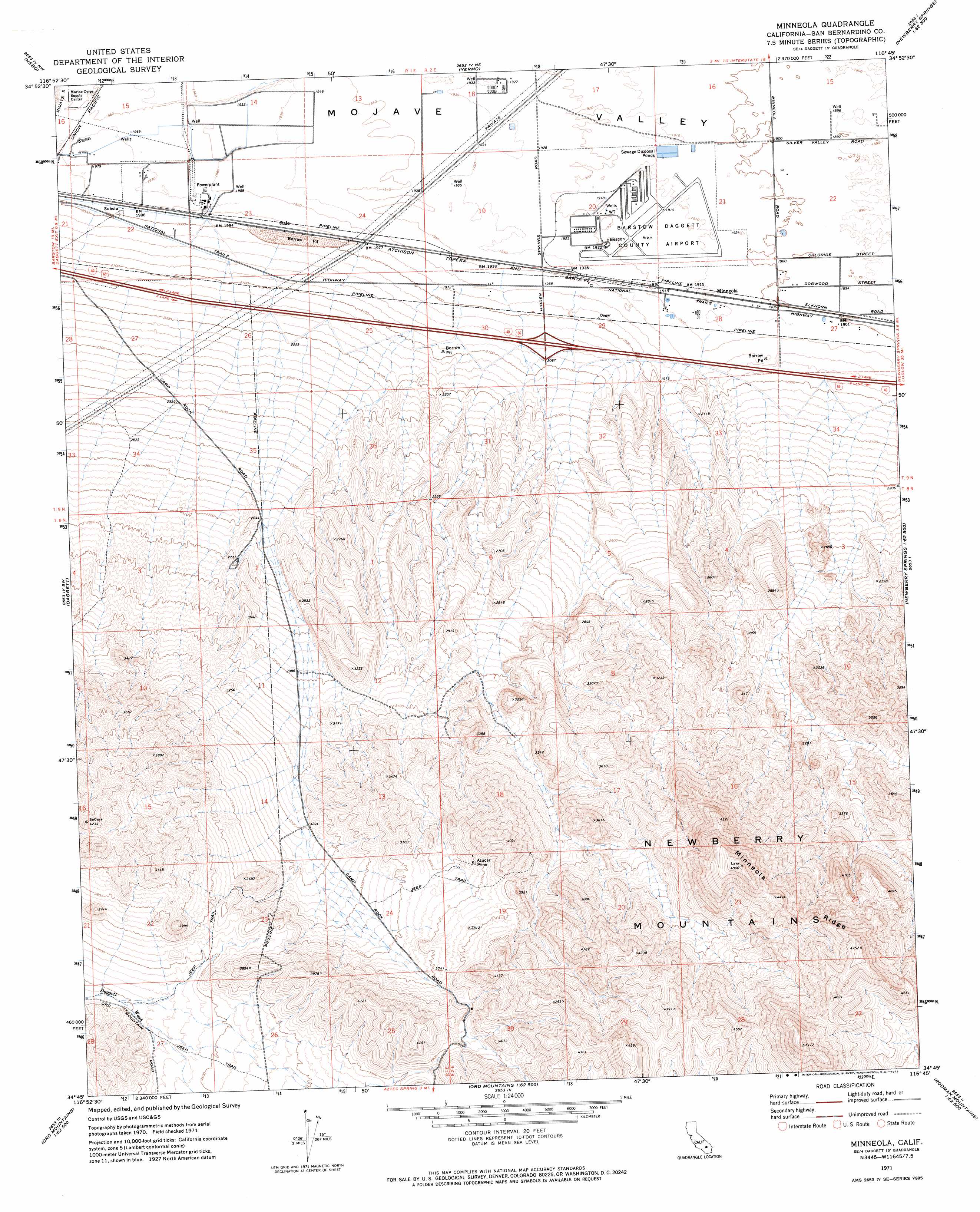
USGS Topo Quad 34116g7 - 1:24,000 scale
| Topo Map Name: | Minneola |
| USGS Topo Quad ID: | 34116g7 |
| Print Size: | ca. 21 1/4" wide x 27" high |
| Southeast Coordinates: | 34.75° N latitude / 116.75° W longitude |
| Map Center Coordinates: | 34.8125° N latitude / 116.8125° W longitude |
| U.S. State: | CA |
| Filename: | o34116g7.jpg |
| Download Map JPG Image: | Minneola topo map 1:24,000 scale |
| Map Type: | Topographic |
| Topo Series: | 7.5´ |
| Map Scale: | 1:24,000 |
| Source of Map Images: | United States Geological Survey (USGS) |
| Alternate Map Versions: |
Minneola CA 1971, updated 1973 Download PDF Buy paper map Minneola CA 1971, updated 1992 Download PDF Buy paper map Minneola CA 2012 Download PDF Buy paper map Minneola CA 2015 Download PDF Buy paper map |
1:24,000 Topo Quads surrounding Minneola
Mud Hills |
Lane Mountain |
Coyote Lake |
Alvord Mountain West |
Alvord Mountain East |
Barstow |
Nebo |
Yermo |
Harvard Hill |
Manix |
Barstow Se |
Daggett |
Minneola |
Newberry Springs |
Troy Lake |
Stoddard Well |
West Ord Mountain |
Ord Mountain |
Camp Rock Mine |
Silver Bell Mine |
Fairview Valley |
White Horse Mountain |
Grand View Mine |
Fry Mountains |
Iron Ridge |
> Back to 34116e1 at 1:100,000 scale
> Back to 34116a1 at 1:250,000 scale
> Back to U.S. Topo Maps home
Minneola topo map: Gazetteer
Minneola: Airports
Barstow Daggett County Airport elevation 585m 1919′SCE Solar I Heliport elevation 593m 1945′
Minneola: Mines
Azucar Mine elevation 1119m 3671′Minneola: Populated Places
Gale elevation 604m 1981′Minneola elevation 583m 1912′
Minneola: Ridges
Minneola Ridge elevation 1368m 4488′Minneola digital topo map on disk
Buy this Minneola topo map showing relief, roads, GPS coordinates and other geographical features, as a high-resolution digital map file on DVD: