Daggett Topo Map California
To zoom in, hover over the map of Daggett
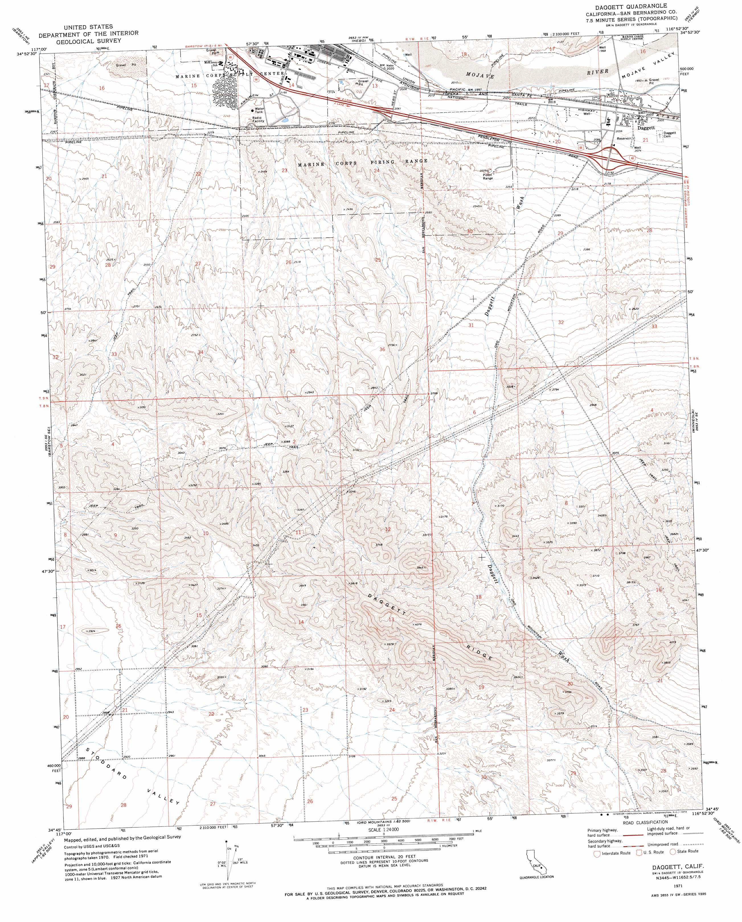
USGS Topo Quad 34116g8 - 1:24,000 scale
| Topo Map Name: | Daggett |
| USGS Topo Quad ID: | 34116g8 |
| Print Size: | ca. 21 1/4" wide x 27" high |
| Southeast Coordinates: | 34.75° N latitude / 116.875° W longitude |
| Map Center Coordinates: | 34.8125° N latitude / 116.9375° W longitude |
| U.S. State: | CA |
| Filename: | o34116g8.jpg |
| Download Map JPG Image: | Daggett topo map 1:24,000 scale |
| Map Type: | Topographic |
| Topo Series: | 7.5´ |
| Map Scale: | 1:24,000 |
| Source of Map Images: | United States Geological Survey (USGS) |
| Alternate Map Versions: |
Daggett CA 1971, updated 1973 Download PDF Buy paper map Daggett CA 1971, updated 1973 Download PDF Buy paper map Daggett CA 2012 Download PDF Buy paper map Daggett CA 2015 Download PDF Buy paper map |
1:24,000 Topo Quads surrounding Daggett
Water Valley |
Mud Hills |
Lane Mountain |
Coyote Lake |
Alvord Mountain West |
Hinkley |
Barstow |
Nebo |
Yermo |
Harvard Hill |
Hodge |
Barstow Se |
Daggett |
Minneola |
Newberry Springs |
Turtle Valley |
Stoddard Well |
West Ord Mountain |
Ord Mountain |
Camp Rock Mine |
Apple Valley North |
Fairview Valley |
White Horse Mountain |
Grand View Mine |
Fry Mountains |
> Back to 34116e1 at 1:100,000 scale
> Back to 34116a1 at 1:250,000 scale
> Back to U.S. Topo Maps home
Daggett topo map: Gazetteer
Daggett: Airports
Barstow Service Center Heliport elevation 680m 2230′Ord Mountain Heliport elevation 680m 2230′
Daggett: Populated Places
Daggett elevation 614m 2014′Desert View Housing Area elevation 668m 2191′
Eniwetok Housing Area elevation 655m 2148′
Daggett: Post Offices
Daggett Post Office elevation 616m 2020′Daggett: Ridges
Daggett Ridge elevation 1236m 4055′Daggett: Streams
Daggett Wash elevation 604m 1981′Daggett digital topo map on disk
Buy this Daggett topo map showing relief, roads, GPS coordinates and other geographical features, as a high-resolution digital map file on DVD: