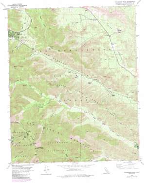
Telegraph Peak Topo Map California
To zoom in, hover over the map of Telegraph Peak
USGS Topo Quad 34117c5 - 1:24,000 scale
| Topo Map Name: | Telegraph Peak |
| USGS Topo Quad ID: | 34117c5 |
| Print Size: | ca. 21 1/4" wide x 27" high |
| Southeast Coordinates: | 34.25° N latitude / 117.5° W longitude |
| Map Center Coordinates: | 34.3125° N latitude / 117.5625° W longitude |
| U.S. State: | CA |
| Filename: | o34117c5.jpg |
| Download Map JPG Image: | Telegraph Peak topo map 1:24,000 scale |
| Map Type: | Topographic |
| Topo Series: | 7.5´ |
| Map Scale: | 1:24,000 |
| Source of Map Images: | United States Geological Survey (USGS) |
| Alternate Map Versions: |
Telegraph Peak CA 1955, updated 1980 Download PDF Buy paper map Telegraph Peak CA 1956, updated 1957 Download PDF Buy paper map Telegraph Peak CA 1956, updated 1961 Download PDF Buy paper map Telegraph Peak CA 1956, updated 1969 Download PDF Buy paper map Telegraph Peak CA 1956, updated 1988 Download PDF Buy paper map Telegraph Peak CA 1996, updated 1999 Download PDF Buy paper map Telegraph Peak CA 2012 Download PDF Buy paper map Telegraph Peak CA 2015 Download PDF Buy paper map |
| FStopo: | US Forest Service topo Telegraph Peak is available: Download FStopo PDF Download FStopo TIF |
1:24,000 Topo Quads surrounding Telegraph Peak
> Back to 34117a1 at 1:100,000 scale
> Back to 34116a1 at 1:250,000 scale
> Back to U.S. Topo Maps home
Telegraph Peak topo map: Gazetteer
Telegraph Peak: Basins
Miners Bowl elevation 2292m 7519′Stone Basin elevation 1181m 3874′
Telegraph Peak: Flats
Stockton Flat elevation 1786m 5859′Telegraph Peak: Gaps
Mount Baldy Notch elevation 2384m 7821′Telegraph Peak: Parks
Pioneer Historic Marker elevation 1173m 3848′Telegraph Peak: Populated Places
Lytle Creek elevation 1042m 3418′Telegraph Peak: Post Offices
Lytle Creek Post Office elevation 1043m 3421′Telegraph Peak: Ridges
Devils Backbone elevation 2666m 8746′Gold Ridge elevation 2504m 8215′
Upper Lytle Creek Ridge elevation 1711m 5613′
Telegraph Peak: Summits
Telegraph Peak elevation 2713m 8900′Thunder Mountain elevation 2613m 8572′
Telegraph Peak: Valleys
Coldwater Canyon elevation 1551m 5088′Dog Bone Canyon elevation 1970m 6463′
Heath Canyon elevation 1741m 5711′
Manker Canyon elevation 1930m 6332′
Sheep Canyon elevation 1826m 5990′
Slover Canyon elevation 1836m 6023′
Swarthout Valley elevation 1716m 5629′
Telegraph Peak digital topo map on disk
Buy this Telegraph Peak topo map showing relief, roads, GPS coordinates and other geographical features, as a high-resolution digital map file on DVD:


