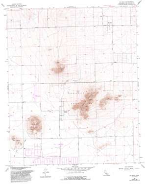
Hi Vista Topo Map California
To zoom in, hover over the map of Hi Vista
USGS Topo Quad 34117f7 - 1:24,000 scale
| Topo Map Name: | Hi Vista |
| USGS Topo Quad ID: | 34117f7 |
| Print Size: | ca. 21 1/4" wide x 27" high |
| Southeast Coordinates: | 34.625° N latitude / 117.75° W longitude |
| Map Center Coordinates: | 34.6875° N latitude / 117.8125° W longitude |
| U.S. State: | CA |
| Filename: | o34117f7.jpg |
| Download Map JPG Image: | Hi Vista topo map 1:24,000 scale |
| Map Type: | Topographic |
| Topo Series: | 7.5´ |
| Map Scale: | 1:24,000 |
| Source of Map Images: | United States Geological Survey (USGS) |
| Alternate Map Versions: |
Hi Vista CA 1957, updated 1958 Download PDF Buy paper map Hi Vista CA 1957, updated 1965 Download PDF Buy paper map Hi Vista CA 1957, updated 1975 Download PDF Buy paper map Hi Vista CA 1957, updated 1993 Download PDF Buy paper map Hi Vista CA 2012 Download PDF Buy paper map Hi Vista CA 2015 Download PDF Buy paper map |
1:24,000 Topo Quads surrounding Hi Vista
> Back to 34117e1 at 1:100,000 scale
> Back to 34116a1 at 1:250,000 scale
> Back to U.S. Topo Maps home
Hi Vista topo map: Gazetteer
Hi Vista: Parks
Antelope Valley Indian Museum State Historic Park elevation 818m 2683′Butte Valley Wildflower Sanctuary elevation 901m 2956′
Saddleback Butte State Park elevation 893m 2929′
Hi Vista: Populated Places
Hi Vista elevation 933m 3061′Wilsona Gardens elevation 783m 2568′
Hi Vista: Ranges
Long Buttes elevation 950m 3116′Hi Vista: Streams
Big Rock Wash elevation 772m 2532′Hi Vista: Summits
Little Butte elevation 862m 2828′Piute Butte elevation 964m 3162′
Rocky Buttes elevation 842m 2762′
Saddleback Butte elevation 1077m 3533′
Hi Vista digital topo map on disk
Buy this Hi Vista topo map showing relief, roads, GPS coordinates and other geographical features, as a high-resolution digital map file on DVD:


