Neenach School Topo Map California
To zoom in, hover over the map of Neenach School
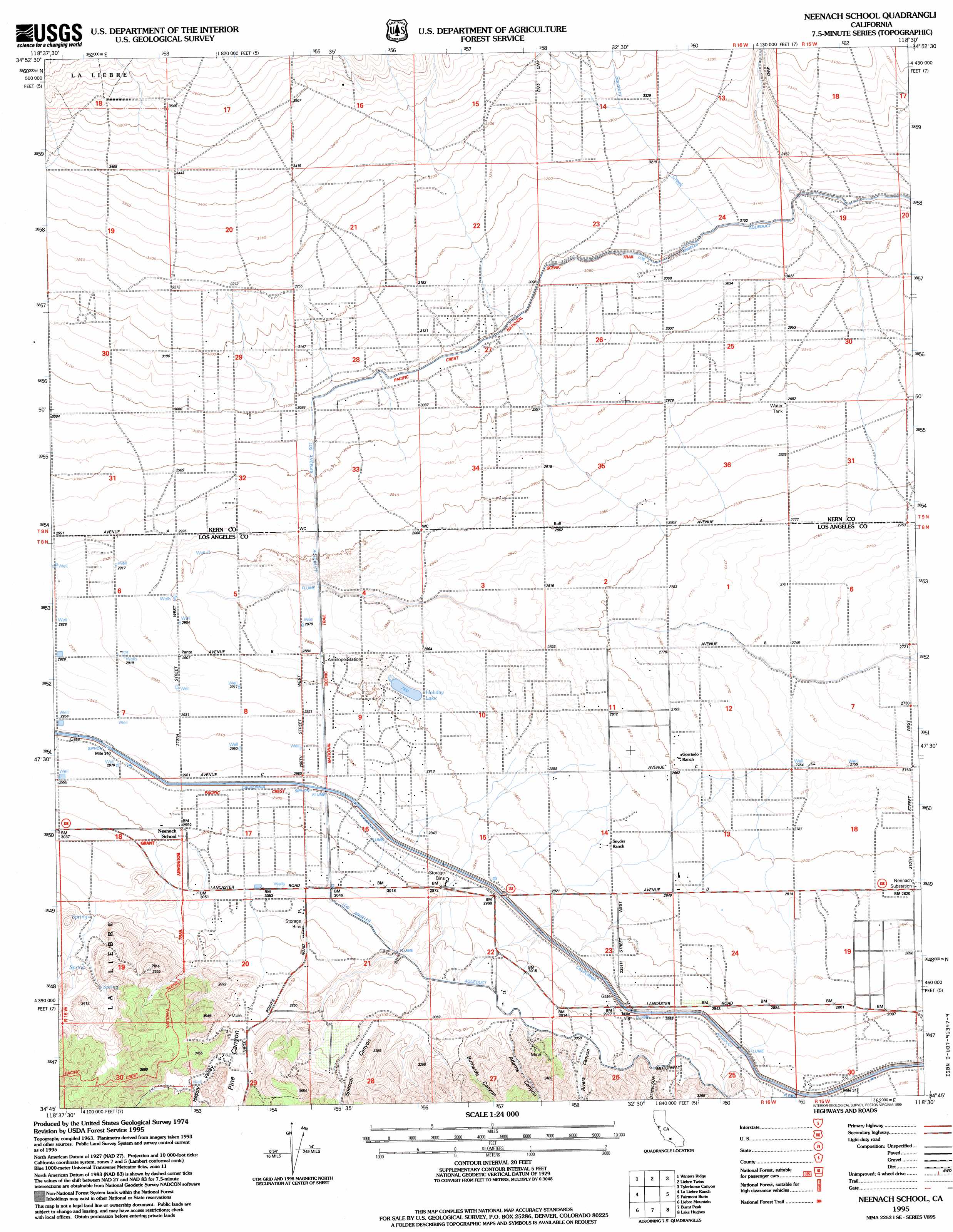
USGS Topo Quad 34118g5 - 1:24,000 scale
| Topo Map Name: | Neenach School |
| USGS Topo Quad ID: | 34118g5 |
| Print Size: | ca. 21 1/4" wide x 27" high |
| Southeast Coordinates: | 34.75° N latitude / 118.5° W longitude |
| Map Center Coordinates: | 34.8125° N latitude / 118.5625° W longitude |
| U.S. State: | CA |
| Filename: | o34118g5.jpg |
| Download Map JPG Image: | Neenach School topo map 1:24,000 scale |
| Map Type: | Topographic |
| Topo Series: | 7.5´ |
| Map Scale: | 1:24,000 |
| Source of Map Images: | United States Geological Survey (USGS) |
| Alternate Map Versions: |
Neenach School CA 1965, updated 1966 Download PDF Buy paper map Neenach School CA 1965, updated 1975 Download PDF Buy paper map Neenach School CA 1965, updated 1987 Download PDF Buy paper map Neenach School CA 1995, updated 1999 Download PDF Buy paper map Neenach School CA 2012 Download PDF Buy paper map Neenach School CA 2015 Download PDF Buy paper map |
| FStopo: | US Forest Service topo Neenach School is available: Download FStopo PDF Download FStopo TIF |
1:24,000 Topo Quads surrounding Neenach School
Tejon Hills |
Tejon Ranch |
Cummings Mountain |
Tehachapi South |
Monolith |
Pastoria Creek |
Winters Ridge |
Liebre Twins |
Tylerhorse Canyon |
Willow Springs |
Lebec |
La Liebre Ranch |
Neenach School |
Fairmont Butte |
Little Buttes |
Black Mountain |
Liebre Mountain |
Burnt Peak |
Lake Hughes |
Del Sur |
Cobblestone Mountain |
Whitaker Peak |
Warm Springs Mountain |
Green Valley |
Sleepy Valley |
> Back to 34118e1 at 1:100,000 scale
> Back to 34118a1 at 1:250,000 scale
> Back to U.S. Topo Maps home
Neenach School topo map: Gazetteer
Neenach School: Lakes
Holiday Lake elevation 880m 2887′Neenach School: Parks
Arthur B. Ripley Desert Woodland State Park elevation 887m 2910′Neenach School: Valleys
Adams Canyon elevation 934m 3064′Baldwin Grade Canyon elevation 932m 3057′
Burnside Canyon elevation 940m 3083′
Canyon Del Secretario elevation 952m 3123′
Happy Valley elevation 985m 3231′
Pine Canyon elevation 957m 3139′
Rivera Canyon elevation 933m 3061′
Spencer Canyon elevation 936m 3070′
Neenach School digital topo map on disk
Buy this Neenach School topo map showing relief, roads, GPS coordinates and other geographical features, as a high-resolution digital map file on DVD: