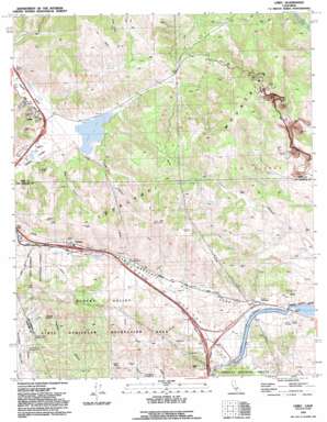
Lebec Topo Map California
To zoom in, hover over the map of Lebec
USGS Topo Quad 34118g7 - 1:24,000 scale
| Topo Map Name: | Lebec |
| USGS Topo Quad ID: | 34118g7 |
| Print Size: | ca. 21 1/4" wide x 27" high |
| Southeast Coordinates: | 34.75° N latitude / 118.75° W longitude |
| Map Center Coordinates: | 34.8125° N latitude / 118.8125° W longitude |
| U.S. State: | CA |
| Filename: | o34118g7.jpg |
| Download Map JPG Image: | Lebec topo map 1:24,000 scale |
| Map Type: | Topographic |
| Topo Series: | 7.5´ |
| Map Scale: | 1:24,000 |
| Source of Map Images: | United States Geological Survey (USGS) |
| Alternate Map Versions: |
Lebec CA 1958, updated 1959 Download PDF Buy paper map Lebec CA 1958, updated 1965 Download PDF Buy paper map Lebec CA 1958, updated 1975 Download PDF Buy paper map Lebec CA 1991, updated 1992 Download PDF Buy paper map Lebec CA 1991, updated 1992 Download PDF Buy paper map Lebec CA 1995, updated 2000 Download PDF Buy paper map Lebec CA 2012 Download PDF Buy paper map Lebec CA 2015 Download PDF Buy paper map |
| FStopo: | US Forest Service topo Lebec is available: Download FStopo PDF Download FStopo TIF |
1:24,000 Topo Quads surrounding Lebec
> Back to 34118e1 at 1:100,000 scale
> Back to 34118a1 at 1:250,000 scale
> Back to U.S. Topo Maps home
Lebec topo map: Gazetteer
Lebec: Canals
Lower Quail Canal elevation 1013m 3323′Lebec: Gaps
Quail Pass elevation 1118m 3667′Lebec: Lakes
Castac Lake elevation 1062m 3484′Lebec: Parks
Hungry Valley State Vehicular Recreation Area elevation 1197m 3927′Lebec: Populated Places
Gorman elevation 1167m 3828′Holland Summit (historical) elevation 1264m 4146′
Lebec elevation 1061m 3480′
Lebec: Reservoirs
Quail Lake elevation 1017m 3336′Lebec: Summits
Mount Pines elevation 1406m 4612′Lebec: Valleys
Bear Canyon elevation 1082m 3549′Crane Canyon elevation 1069m 3507′
Trust Me Canyon elevation 1009m 3310′
Lebec digital topo map on disk
Buy this Lebec topo map showing relief, roads, GPS coordinates and other geographical features, as a high-resolution digital map file on DVD:


