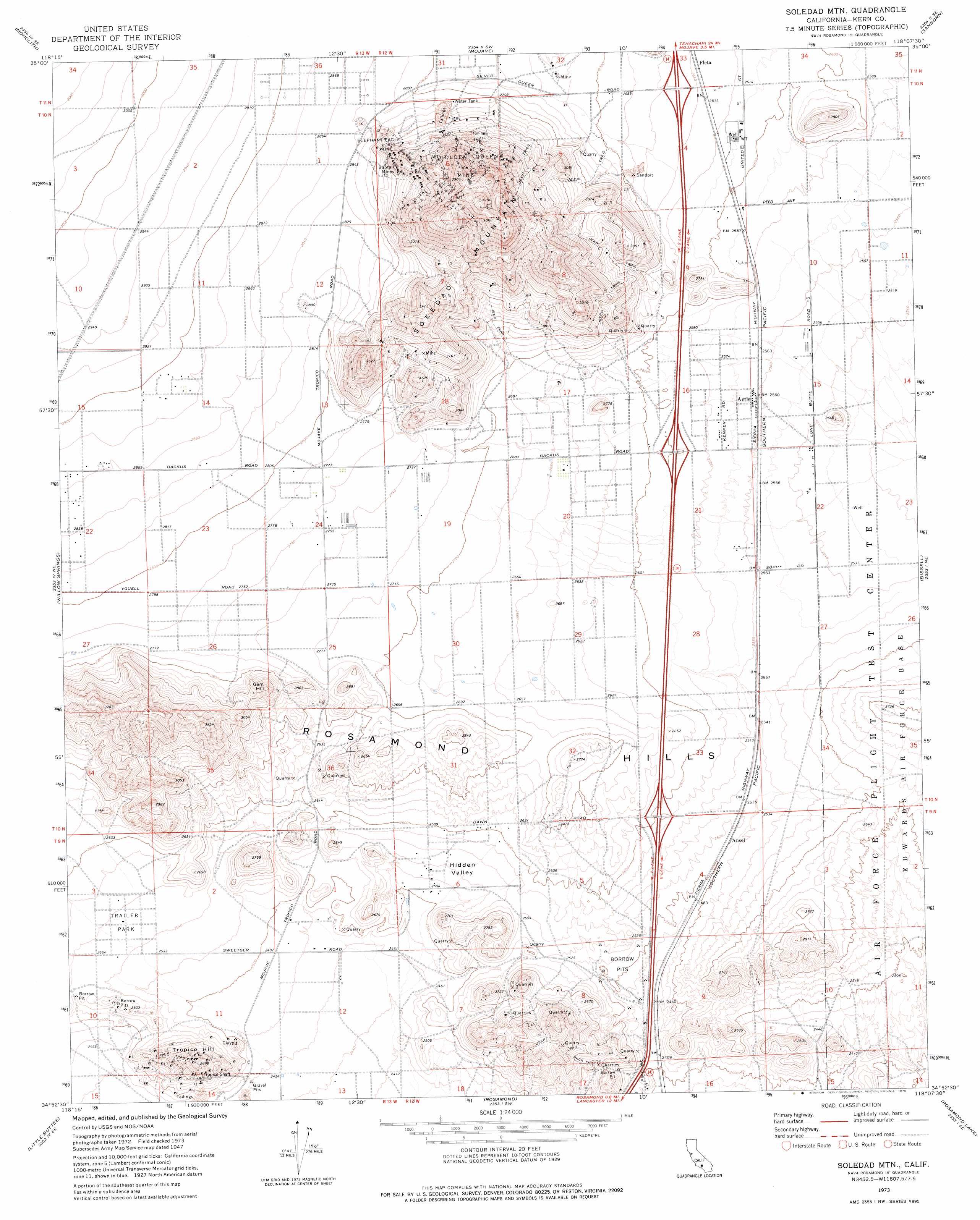
Soledad Mountain Topo Map California
To zoom in, hover over the map of Soledad Mountain
USGS Topo Quad 34118h2 - 1:24,000 scale
| Topo Map Name: | Soledad Mountain |
| USGS Topo Quad ID: | 34118h2 |
| Print Size: | ca. 21 1/4" wide x 27" high |
| Southeast Coordinates: | 34.875° N latitude / 118.125° W longitude |
| Map Center Coordinates: | 34.9375° N latitude / 118.1875° W longitude |
| U.S. State: | CA |
| Filename: | o34118h2.jpg |
| Download Map JPG Image: | Soledad Mountain topo map 1:24,000 scale |
| Map Type: | Topographic |
| Topo Series: | 7.5´ |
| Map Scale: | 1:24,000 |
| Source of Map Images: | United States Geological Survey (USGS) |
| Alternate Map Versions: |
Soledad Mountain CA 1947, updated 1947 Download PDF Buy paper map Soledad Mtn CA 1973, updated 1976 Download PDF Buy paper map Soledad Mountain CA 2012 Download PDF Buy paper map Soledad Mountain CA 2015 Download PDF Buy paper map |
1:24,000 Topo Quads surrounding Soledad Mountain
Tehachapi North |
Tehachapi Ne |
Cache Peak |
Mojave Ne |
California City North |
Tehachapi South |
Monolith |
Mojave |
Sanborn |
California City South |
Tylerhorse Canyon |
Willow Springs |
Soledad Mountain |
Bissell |
Edwards |
Fairmont Butte |
Little Buttes |
Rosamond |
Rosamond Lake |
Redman |
Lake Hughes |
Del Sur |
Lancaster West |
Lancaster East |
Alpine Butte |
> Back to 34118e1 at 1:100,000 scale
> Back to 34118a1 at 1:250,000 scale
> Back to U.S. Topo Maps home
Soledad Mountain topo map: Gazetteer
Soledad Mountain: Airports
Pontious Airport elevation 798m 2618′Soledad Mountain: Basins
Hidden Valley elevation 780m 2559′Soledad Mountain: Mines
Bobtail Mines elevation 962m 3156′Double Eagle Mine elevation 839m 2752′
Elephant Eagle Mine elevation 916m 3005′
Golden Queen Mine elevation 1037m 3402′
Tip Top Mine elevation 879m 2883′
Tropico Shaft elevation 806m 2644′
Soledad Mountain: Populated Places
Actis elevation 781m 2562′Ansel elevation 767m 2516′
Eaires (historical) elevation 781m 2562′
Gloster elevation 781m 2562′
Soledad Mountain: Summits
Fiss Hill elevation 795m 2608′Gem Hill elevation 917m 3008′
Soledad Mountain elevation 1262m 4140′
Tropico Hill elevation 882m 2893′
Soledad Mountain digital topo map on disk
Buy this Soledad Mountain topo map showing relief, roads, GPS coordinates and other geographical features, as a high-resolution digital map file on DVD: