Liebre Twins Topo Map California
To zoom in, hover over the map of Liebre Twins
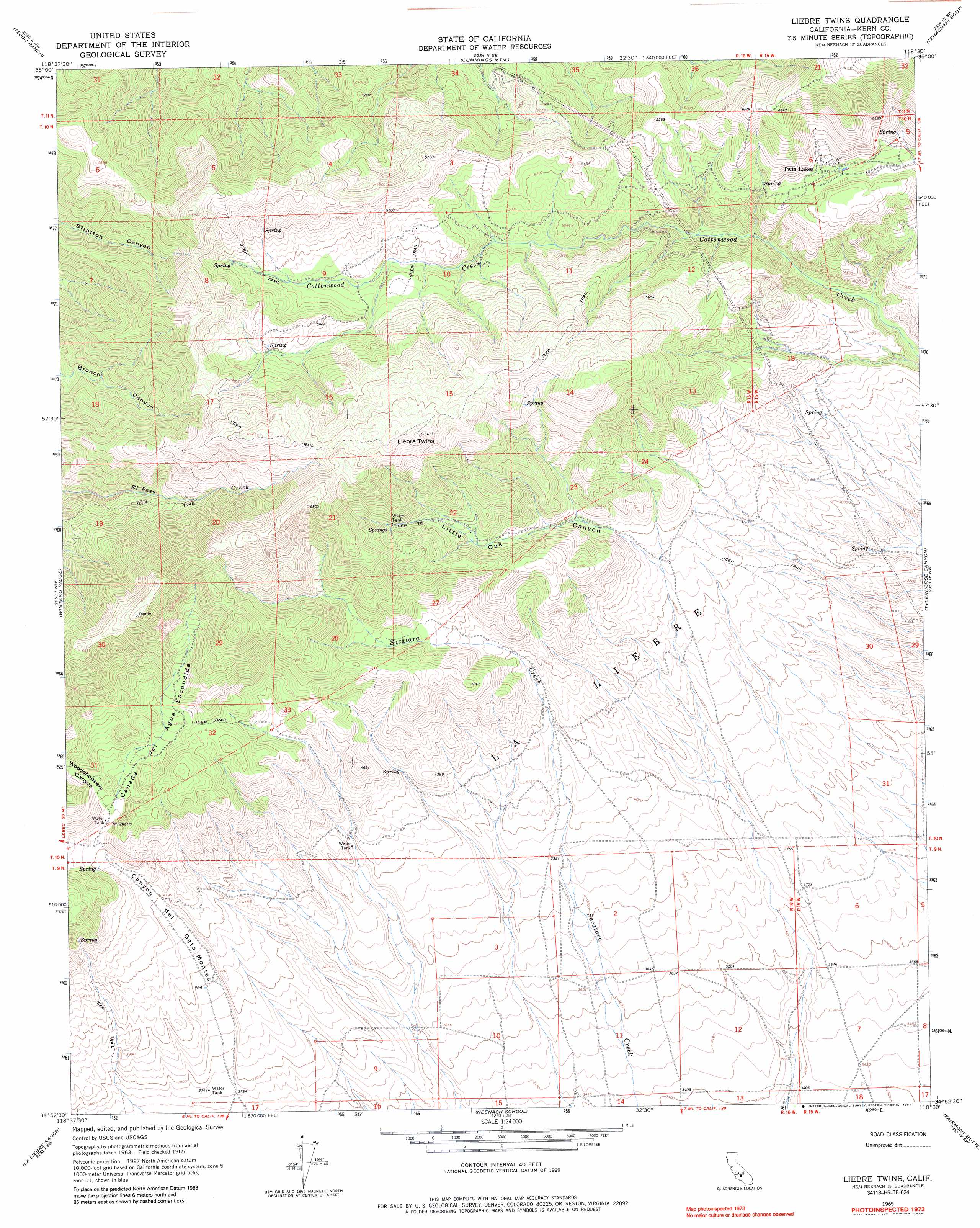
USGS Topo Quad 34118h5 - 1:24,000 scale
| Topo Map Name: | Liebre Twins |
| USGS Topo Quad ID: | 34118h5 |
| Print Size: | ca. 21 1/4" wide x 27" high |
| Southeast Coordinates: | 34.875° N latitude / 118.5° W longitude |
| Map Center Coordinates: | 34.9375° N latitude / 118.5625° W longitude |
| U.S. State: | CA |
| Filename: | o34118h5.jpg |
| Download Map JPG Image: | Liebre Twins topo map 1:24,000 scale |
| Map Type: | Topographic |
| Topo Series: | 7.5´ |
| Map Scale: | 1:24,000 |
| Source of Map Images: | United States Geological Survey (USGS) |
| Alternate Map Versions: |
Liebre Twins CA 1965, updated 1967 Download PDF Buy paper map Liebre Twins CA 1965, updated 1987 Download PDF Buy paper map Liebre Twins CA 2012 Download PDF Buy paper map Liebre Twins CA 2015 Download PDF Buy paper map |
1:24,000 Topo Quads surrounding Liebre Twins
Arvin |
Bear Mountain |
Keene |
Tehachapi North |
Tehachapi Ne |
Tejon Hills |
Tejon Ranch |
Cummings Mountain |
Tehachapi South |
Monolith |
Pastoria Creek |
Winters Ridge |
Liebre Twins |
Tylerhorse Canyon |
Willow Springs |
Lebec |
La Liebre Ranch |
Neenach School |
Fairmont Butte |
Little Buttes |
Black Mountain |
Liebre Mountain |
Burnt Peak |
Lake Hughes |
Del Sur |
> Back to 34118e1 at 1:100,000 scale
> Back to 34118a1 at 1:250,000 scale
> Back to U.S. Topo Maps home
Liebre Twins topo map: Gazetteer
Liebre Twins: Populated Places
Twin Lakes elevation 1576m 5170′Liebre Twins: Streams
Sacatara Creek elevation 1159m 3802′Liebre Twins: Summits
Liebre Twins elevation 1941m 6368′Liebre Twins: Valleys
Cañada del Agua Escondida elevation 1355m 4445′Canyon del Gato-Montes elevation 1142m 3746′
Little Oak Canyon elevation 1298m 4258′
Woodchoppers Canyon elevation 1382m 4534′
Liebre Twins digital topo map on disk
Buy this Liebre Twins topo map showing relief, roads, GPS coordinates and other geographical features, as a high-resolution digital map file on DVD: