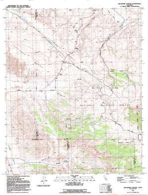
Ballinger Canyon Topo Map California
To zoom in, hover over the map of Ballinger Canyon
USGS Topo Quad 34119h4 - 1:24,000 scale
| Topo Map Name: | Ballinger Canyon |
| USGS Topo Quad ID: | 34119h4 |
| Print Size: | ca. 21 1/4" wide x 27" high |
| Southeast Coordinates: | 34.875° N latitude / 119.375° W longitude |
| Map Center Coordinates: | 34.9375° N latitude / 119.4375° W longitude |
| U.S. State: | CA |
| Filename: | o34119h4.jpg |
| Download Map JPG Image: | Ballinger Canyon topo map 1:24,000 scale |
| Map Type: | Topographic |
| Topo Series: | 7.5´ |
| Map Scale: | 1:24,000 |
| Source of Map Images: | United States Geological Survey (USGS) |
| Alternate Map Versions: |
Ballinger Canyon CA 1942, updated 1958 Download PDF Buy paper map Ballinger Canyon CA 1943, updated 1959 Download PDF Buy paper map Ballinger Canyon CA 1943, updated 1969 Download PDF Buy paper map Ballinger Canyon CA 1943, updated 1969 Download PDF Buy paper map Ballinger Canyon CA 1943, updated 1975 Download PDF Buy paper map Ballinger Canyon CA 1977 Download PDF Buy paper map Ballinger Canyon CA 1991, updated 1991 Download PDF Buy paper map Ballinger Canyon CA 1995, updated 2000 Download PDF Buy paper map Ballinger Canyon CA 2012 Download PDF Buy paper map Ballinger Canyon CA 2015 Download PDF Buy paper map |
| FStopo: | US Forest Service topo Ballinger Canyon is available: Download FStopo PDF Download FStopo TIF |
1:24,000 Topo Quads surrounding Ballinger Canyon
> Back to 34119e1 at 1:100,000 scale
> Back to 34118a1 at 1:250,000 scale
> Back to U.S. Topo Maps home
Ballinger Canyon topo map: Gazetteer
Ballinger Canyon: Airports
7R Ranch Airport elevation 929m 3047′Ballinger Canyon: Parks
Bitter Creek National Wildlife Refuge elevation 1127m 3697′Ballinger Canyon: Slopes
Grocer Grade elevation 798m 2618′Ballinger Canyon: Valleys
Ballinger Canyon elevation 862m 2828′Sunset Canyon elevation 547m 1794′
Ballinger Canyon digital topo map on disk
Buy this Ballinger Canyon topo map showing relief, roads, GPS coordinates and other geographical features, as a high-resolution digital map file on DVD:


