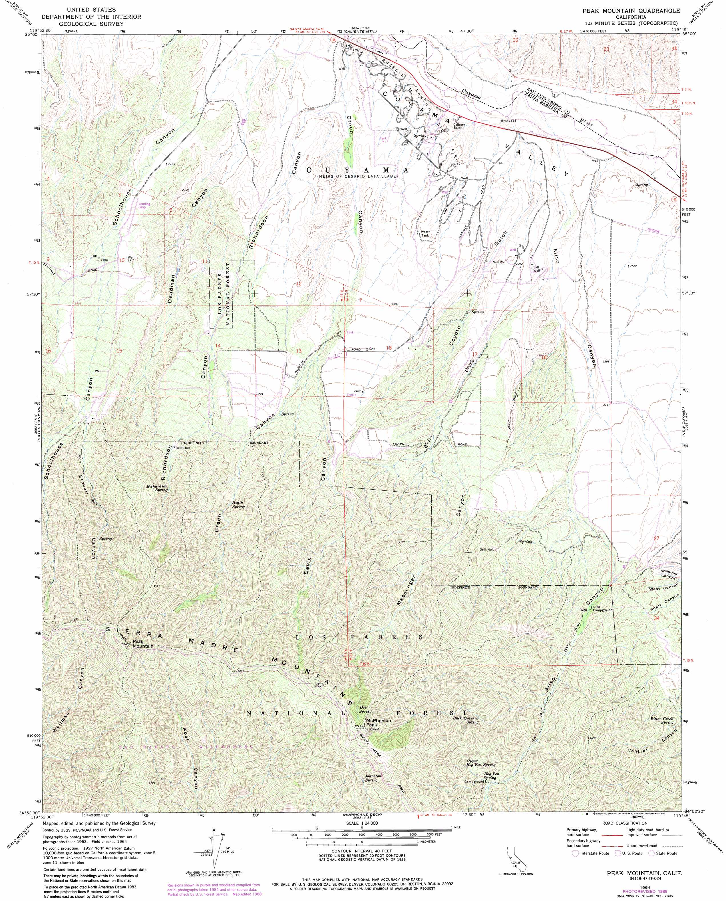
Peak Mountain Topo Map California
To zoom in, hover over the map of Peak Mountain
USGS Topo Quad 34119h7 - 1:24,000 scale
| Topo Map Name: | Peak Mountain |
| USGS Topo Quad ID: | 34119h7 |
| Print Size: | ca. 21 1/4" wide x 27" high |
| Southeast Coordinates: | 34.875° N latitude / 119.75° W longitude |
| Map Center Coordinates: | 34.9375° N latitude / 119.8125° W longitude |
| U.S. State: | CA |
| Filename: | o34119h7.jpg |
| Download Map JPG Image: | Peak Mountain topo map 1:24,000 scale |
| Map Type: | Topographic |
| Topo Series: | 7.5´ |
| Map Scale: | 1:24,000 |
| Source of Map Images: | United States Geological Survey (USGS) |
| Alternate Map Versions: |
Peak Mountain CA 1964, updated 1965 Download PDF Buy paper map Peak Mountain CA 1964, updated 1977 Download PDF Buy paper map Peak Mountain CA 1964, updated 1989 Download PDF Buy paper map Peak Mountain CA 1964, updated 1989 Download PDF Buy paper map Peak Mountain CA 1995, updated 2000 Download PDF Buy paper map Peak Mountain CA 2012 Download PDF Buy paper map Peak Mountain CA 2015 Download PDF Buy paper map |
| FStopo: | US Forest Service topo Peak Mountain is available: Download FStopo PDF Download FStopo TIF |
1:24,000 Topo Quads surrounding Peak Mountain
Branch Mountain |
Chimineas Ranch |
Painted Rock |
Panorama Hills |
Fellows |
Miranda Pine Mountain |
Taylor Canyon |
Caliente Mountain |
Wells Ranch |
Elkhorn Hills |
Manzanita Mountain |
Bates Canyon |
Peak Mountain |
New Cuyama |
Cuyama |
Zaca Lake |
Bald Mountain |
Hurricane Deck |
Salisbury Potrero |
Fox Mountain |
Los Olivos |
Figueroa Mountain |
San Rafael Mountain |
Big Pine Mountain |
Madulce Peak |
> Back to 34119e1 at 1:100,000 scale
> Back to 34118a1 at 1:250,000 scale
> Back to U.S. Topo Maps home
Peak Mountain topo map: Gazetteer
Peak Mountain: Ranges
Sierra Madre Mountains elevation 1783m 5849′Peak Mountain: Springs
Bitter Creek Spring elevation 971m 3185′Buck Opening Spring elevation 1108m 3635′
Deer Spring elevation 1627m 5337′
Heath Spring elevation 958m 3143′
Hog Pen Spring elevation 1128m 3700′
Johnston Spring elevation 1461m 4793′
Richardson Spring elevation 1047m 3435′
Upper Hog Pen Spring elevation 1210m 3969′
Peak Mountain: Streams
Wells Creek elevation 621m 2037′Peak Mountain: Summits
McPherson Peak elevation 1748m 5734′Peak Mountain elevation 1773m 5816′
Peak Mountain: Valleys
Aliso Canyon elevation 586m 1922′Coyote Gulch elevation 554m 1817′
Davis Canyon elevation 745m 2444′
Deadman Canyon elevation 556m 1824′
Green Canyon elevation 552m 1811′
Messenger Canyon elevation 755m 2477′
Richardson Canyon elevation 580m 1902′
Stovall Canyon elevation 867m 2844′
West Canyon elevation 803m 2634′
Peak Mountain digital topo map on disk
Buy this Peak Mountain topo map showing relief, roads, GPS coordinates and other geographical features, as a high-resolution digital map file on DVD: