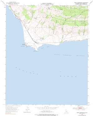
Point Conception Topo Map California
To zoom in, hover over the map of Point Conception
USGS Topo Quad 34120d4 - 1:24,000 scale
| Topo Map Name: | Point Conception |
| USGS Topo Quad ID: | 34120d4 |
| Print Size: | ca. 21 1/4" wide x 27" high |
| Southeast Coordinates: | 34.375° N latitude / 120.375° W longitude |
| Map Center Coordinates: | 34.4375° N latitude / 120.4375° W longitude |
| U.S. State: | CA |
| Filename: | o34120d4.jpg |
| Download Map JPG Image: | Point Conception topo map 1:24,000 scale |
| Map Type: | Topographic |
| Topo Series: | 7.5´ |
| Map Scale: | 1:24,000 |
| Source of Map Images: | United States Geological Survey (USGS) |
| Alternate Map Versions: |
Point Conception CA 1953, updated 1954 Download PDF Buy paper map Point Conception CA 1953, updated 1959 Download PDF Buy paper map Point Conception CA 1953, updated 1968 Download PDF Buy paper map Point Conception CA 1953, updated 1978 Download PDF Buy paper map Point Conception CA 2012 Download PDF Buy paper map Point Conception CA 2015 Download PDF Buy paper map |
1:24,000 Topo Quads surrounding Point Conception
Surf |
Lompoc |
Los Alamos |
Zaca Creek |
|
Point Arguello |
Tranquillon Mountain |
Lompoc Hills |
Santa Rosa Hills |
Solvang |
Point Conception |
Sacate |
Gaviota |
||
> Back to 34120a1 at 1:100,000 scale
> Back to 34120a1 at 1:250,000 scale
> Back to U.S. Topo Maps home
Point Conception topo map: Gazetteer
Point Conception: Bars
Indian Head Rock elevation 0m 0′Point Conception: Bays
Cojo Bay elevation 0m 0′Point Conception: Capes
Government Point elevation 1m 3′Point Conception elevation 15m 49′
Point Conception: Harbors
Cojo Anchorage elevation 0m 0′Point Conception: Populated Places
Concepcion elevation 36m 118′Gato elevation 21m 68′
Jalama elevation 40m 131′
Kunuqug (historical) elevation 6m 19′
Shisholop (historical) elevation 17m 55′
Point Conception: Springs
Las Animas Spring elevation 177m 580′Willow Spring elevation 99m 324′
Point Conception: Summits
Palo Alto Hill elevation 416m 1364′Point Conception: Valleys
Barranca Honda elevation 0m 0′Black Canyon elevation 31m 101′
Cañada Del Cementerio elevation 23m 75′
Cañada Del Cojo elevation 0m 0′
Cañada del Gato elevation 13m 42′
Damsite Canyon elevation 0m 0′
La Olla elevation 131m 429′
Wood Canyon elevation 0m 0′
Point Conception digital topo map on disk
Buy this Point Conception topo map showing relief, roads, GPS coordinates and other geographical features, as a high-resolution digital map file on DVD:


