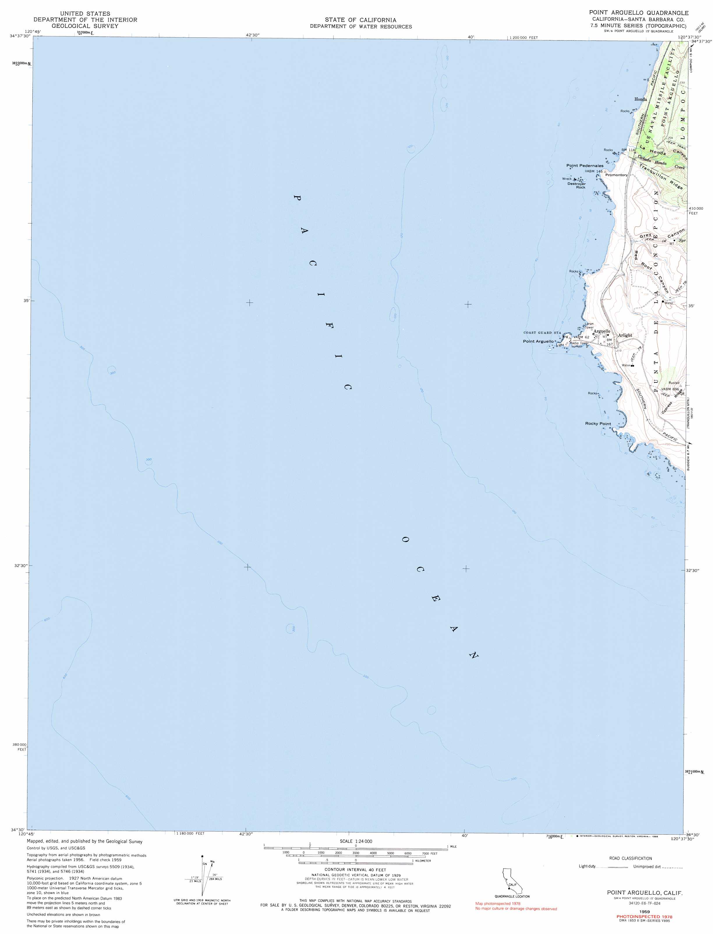
Point Arguello Topo Map California
To zoom in, hover over the map of Point Arguello
USGS Topo Quad 34120e6 - 1:24,000 scale
| Topo Map Name: | Point Arguello |
| USGS Topo Quad ID: | 34120e6 |
| Print Size: | ca. 21 1/4" wide x 27" high |
| Southeast Coordinates: | 34.5° N latitude / 120.625° W longitude |
| Map Center Coordinates: | 34.5625° N latitude / 120.6875° W longitude |
| U.S. State: | CA |
| Filename: | o34120e6.jpg |
| Download Map JPG Image: | Point Arguello topo map 1:24,000 scale |
| Map Type: | Topographic |
| Topo Series: | 7.5´ |
| Map Scale: | 1:24,000 |
| Source of Map Images: | United States Geological Survey (USGS) |
| Alternate Map Versions: |
Point Arguello CA 1948, updated 1948 Download PDF Buy paper map Point Arguello CA 1959, updated 1960 Download PDF Buy paper map Point Arguello CA 1959, updated 1966 Download PDF Buy paper map Point Arguello CA 1959, updated 1986 Download PDF Buy paper map Point Arguello CA 1959, updated 1986 Download PDF Buy paper map Point Arguello CA 2012 Download PDF Buy paper map Point Arguello CA 2015 Download PDF Buy paper map |
1:24,000 Topo Quads surrounding Point Arguello
Casmalia |
Orcutt |
|||
Surf |
Lompoc |
|||
Point Arguello |
Tranquillon Mountain |
Lompoc Hills |
||
Point Conception |
||||
> Back to 34120e1 at 1:100,000 scale
> Back to 34120a1 at 1:250,000 scale
> Back to U.S. Topo Maps home
Point Arguello topo map: Gazetteer
Point Arguello: Capes
North Point elevation 18m 59′Point Arguello elevation 0m 0′
Point Pedernales elevation 35m 114′
Rocky Point elevation 13m 42′
Point Arguello: Islands
Destroyer Rock elevation 6m 19′Point Arguello: Populated Places
Arguello elevation 36m 118′Arlight elevation 71m 232′
Honda elevation 28m 91′
Point Arguello: Streams
Cañada Honda Creek elevation 0m 0′Point Arguello: Summits
Promontory elevation 35m 114′Point Arguello: Valleys
Grey Canyon elevation 12m 39′La Honda Canyon elevation 0m 0′
Red Roof Canyon elevation 38m 124′
Point Arguello digital topo map on disk
Buy this Point Arguello topo map showing relief, roads, GPS coordinates and other geographical features, as a high-resolution digital map file on DVD: