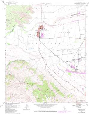
Guadalupe Topo Map California
To zoom in, hover over the map of Guadalupe
USGS Topo Quad 34120h5 - 1:24,000 scale
| Topo Map Name: | Guadalupe |
| USGS Topo Quad ID: | 34120h5 |
| Print Size: | ca. 21 1/4" wide x 27" high |
| Southeast Coordinates: | 34.875° N latitude / 120.5° W longitude |
| Map Center Coordinates: | 34.9375° N latitude / 120.5625° W longitude |
| U.S. State: | CA |
| Filename: | o34120h5.jpg |
| Download Map JPG Image: | Guadalupe topo map 1:24,000 scale |
| Map Type: | Topographic |
| Topo Series: | 7.5´ |
| Map Scale: | 1:24,000 |
| Source of Map Images: | United States Geological Survey (USGS) |
| Alternate Map Versions: |
Guadalupe CA 1947, updated 1947 Download PDF Buy paper map Guadalupe CA 1959, updated 1960 Download PDF Buy paper map Guadalupe CA 1959, updated 1977 Download PDF Buy paper map Guadalupe CA 1959, updated 1982 Download PDF Buy paper map Guadalupe CA 1959, updated 1982 Download PDF Buy paper map Guadalupe CA 2012 Download PDF Buy paper map Guadalupe CA 2015 Download PDF Buy paper map |
1:24,000 Topo Quads surrounding Guadalupe
Port San Luis |
Pismo Beach |
Arroyo Grande Ne |
Tar Spring Ridge |
Caldwell Mesa |
Oceano |
Nipomo |
Huasna Peak |
||
Point Sal |
Guadalupe |
Santa Maria |
Twitchell Dam |
|
Casmalia |
Orcutt |
Sisquoc |
||
Surf |
Lompoc |
Los Alamos |
> Back to 34120e1 at 1:100,000 scale
> Back to 34120a1 at 1:250,000 scale
> Back to U.S. Topo Maps home
Guadalupe topo map: Gazetteer
Guadalupe: Lakes
Guadalupe Lake elevation 29m 95′Guadalupe: Mines
N T U Mine elevation 281m 921′Guadalupe: Parks
Le Roy Park elevation 23m 75′Guadalupe: Populated Places
Barsug elevation 27m 88′Betteravia elevation 47m 154′
Betteravia Junction elevation 40m 131′
Bragur elevation 34m 111′
Carr elevation 49m 160′
Guadalupe elevation 26m 85′
Gum elevation 46m 150′
Iremel elevation 43m 141′
Waldorf elevation 60m 196′
Guadalupe: Post Offices
Guadalupe Post Office elevation 26m 85′Guadalupe: Streams
Orcutt Creek elevation 29m 95′Guadalupe: Summits
Mount Lospe elevation 502m 1646′Guadalupe: Valleys
Corralitos Canyon elevation 36m 118′Guadalupe digital topo map on disk
Buy this Guadalupe topo map showing relief, roads, GPS coordinates and other geographical features, as a high-resolution digital map file on DVD:


