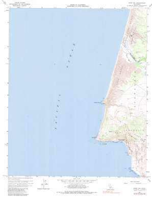
Point Sal Topo Map California
To zoom in, hover over the map of Point Sal
USGS Topo Quad 34120h6 - 1:24,000 scale
| Topo Map Name: | Point Sal |
| USGS Topo Quad ID: | 34120h6 |
| Print Size: | ca. 21 1/4" wide x 27" high |
| Southeast Coordinates: | 34.875° N latitude / 120.625° W longitude |
| Map Center Coordinates: | 34.9375° N latitude / 120.6875° W longitude |
| U.S. State: | CA |
| Filename: | o34120h6.jpg |
| Download Map JPG Image: | Point Sal topo map 1:24,000 scale |
| Map Type: | Topographic |
| Topo Series: | 7.5´ |
| Map Scale: | 1:24,000 |
| Source of Map Images: | United States Geological Survey (USGS) |
| Alternate Map Versions: |
Point Sal CA 1948, updated 1948 Download PDF Buy paper map Point Sal CA 1958, updated 1960 Download PDF Buy paper map Point Sal CA 1958, updated 1967 Download PDF Buy paper map Point Sal CA 1958, updated 1980 Download PDF Buy paper map Point Sal CA 2012 Download PDF Buy paper map Point Sal CA 2015 Download PDF Buy paper map |
1:24,000 Topo Quads surrounding Point Sal
Port San Luis |
Pismo Beach |
Arroyo Grande Ne |
Tar Spring Ridge |
|
Oceano |
Nipomo |
|||
Point Sal |
Guadalupe |
Santa Maria |
||
Casmalia |
Orcutt |
|||
Surf |
Lompoc |
> Back to 34120e1 at 1:100,000 scale
> Back to 34120a1 at 1:250,000 scale
> Back to U.S. Topo Maps home
Point Sal topo map: Gazetteer
Point Sal: Areas
Mussel Rock Dunes elevation 34m 111′Point Sal: Capes
Mussel Point elevation 49m 160′Mussel Rock elevation 30m 98′
Point Sal elevation 41m 134′
Point Sal: Islands
Lion Rock elevation 6m 19′Seal Rock elevation 0m 0′
Point Sal: Oilfields
Guadalupe Oil Field elevation 35m 114′Point Sal: Parks
Point Sal Beach State Park elevation 15m 49′Point Sal: Ridges
Point Sal Ridge elevation 364m 1194′Point Sal: Streams
Santa Maria River elevation 3m 9′Point Sal: Valleys
Santa Maria Valley elevation 7m 22′Point Sal digital topo map on disk
Buy this Point Sal topo map showing relief, roads, GPS coordinates and other geographical features, as a high-resolution digital map file on DVD:


