Engelhard Ne Topo Map North Carolina
To zoom in, hover over the map of Engelhard Ne
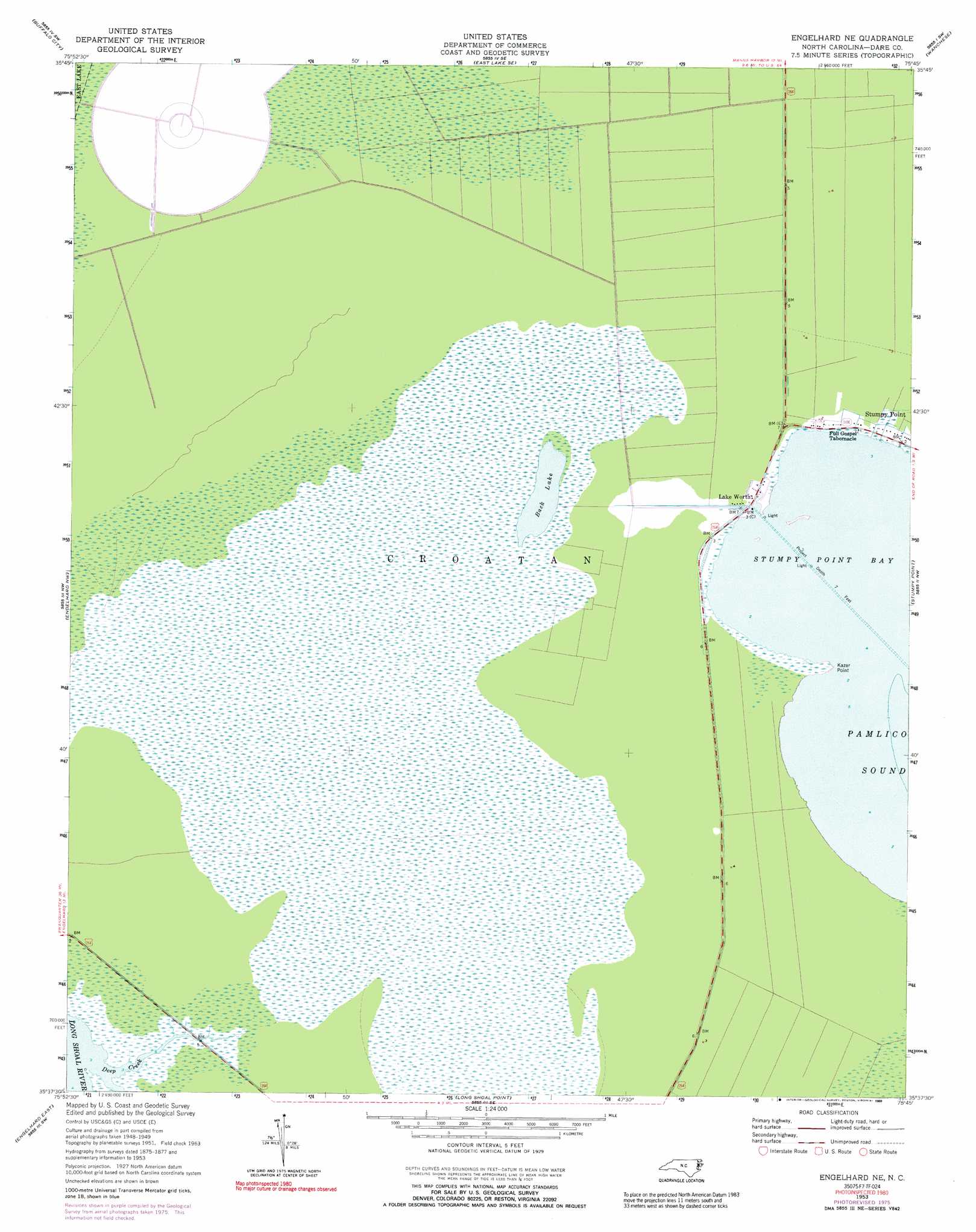
USGS Topo Quad 35075f7 - 1:24,000 scale
| Topo Map Name: | Engelhard Ne |
| USGS Topo Quad ID: | 35075f7 |
| Print Size: | ca. 21 1/4" wide x 27" high |
| Southeast Coordinates: | 35.625° N latitude / 75.75° W longitude |
| Map Center Coordinates: | 35.6875° N latitude / 75.8125° W longitude |
| U.S. State: | NC |
| Filename: | o35075f7.jpg |
| Download Map JPG Image: | Engelhard Ne topo map 1:24,000 scale |
| Map Type: | Topographic |
| Topo Series: | 7.5´ |
| Map Scale: | 1:24,000 |
| Source of Map Images: | United States Geological Survey (USGS) |
| Alternate Map Versions: |
Engelhard NE NC 1953, updated 1956 Download PDF Buy paper map Engelhard NE NC 1953, updated 1977 Download PDF Buy paper map Engelhard NE NC 1953, updated 1989 Download PDF Buy paper map Engelhard NE NC 2000, updated 2002 Download PDF Buy paper map Engelhard NE NC 2011 Download PDF Buy paper map Engelhard NE NC 2013 Download PDF Buy paper map Engelhard NE NC 2016 Download PDF Buy paper map |
1:24,000 Topo Quads surrounding Engelhard Ne
Fort Landing |
East Lake |
Manns Harbor |
Manteo |
Roanoke Island Ne |
Frying Pan |
Buffalo City |
East Lake Se |
Wanchese |
Oregon Inlet |
Fairfield Ne |
Engelhard Nw |
Engelhard Ne |
Stumpy Point |
|
Engelhard West |
Engelhard East |
Long Shoal Point |
||
Middletown Anchorage |
> Back to 35075e1 at 1:100,000 scale
> Back to 35074a1 at 1:250,000 scale
> Back to U.S. Topo Maps home
Engelhard Ne topo map: Gazetteer
Engelhard Ne: Bays
Stumpy Point Bay elevation 0m 0′Engelhard Ne: Capes
Kazer Point elevation 0m 0′Engelhard Ne: Lakes
Back Lake elevation 1m 3′Engelhard Ne: Populated Places
Lake Worth elevation 1m 3′Engelhard Ne: Streams
Deep Creek elevation 0m 0′Engelhard Ne digital topo map on disk
Buy this Engelhard Ne topo map showing relief, roads, GPS coordinates and other geographical features, as a high-resolution digital map file on DVD:
Atlantic Coast (NY, NJ, PA, DE, MD, VA, NC)
Buy digital topo maps: Atlantic Coast (NY, NJ, PA, DE, MD, VA, NC)
 map DVD")