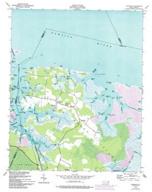
Lowland Topo Map North Carolina
To zoom in, hover over the map of Lowland
USGS Topo Quad 35076c5 - 1:24,000 scale
| Topo Map Name: | Lowland |
| USGS Topo Quad ID: | 35076c5 |
| Print Size: | ca. 21 1/4" wide x 27" high |
| Southeast Coordinates: | 35.25° N latitude / 76.5° W longitude |
| Map Center Coordinates: | 35.3125° N latitude / 76.5625° W longitude |
| U.S. State: | NC |
| Filename: | o35076c5.jpg |
| Download Map JPG Image: | Lowland topo map 1:24,000 scale |
| Map Type: | Topographic |
| Topo Series: | 7.5´ |
| Map Scale: | 1:24,000 |
| Source of Map Images: | United States Geological Survey (USGS) |
| Alternate Map Versions: |
Lowland NC 1950, updated 1952 Download PDF Buy paper map Lowland NC 1950, updated 1977 Download PDF Buy paper map Lowland NC 1950, updated 1993 Download PDF Buy paper map Lowland NC 1950, updated 1993 Download PDF Buy paper map Lowland NC 2000, updated 2001 Download PDF Buy paper map Lowland NC 2010 Download PDF Buy paper map Lowland NC 2013 Download PDF Buy paper map Lowland NC 2016 Download PDF Buy paper map |
1:24,000 Topo Quads surrounding Lowland
> Back to 35076a1 at 1:100,000 scale
> Back to 35076a1 at 1:250,000 scale
> Back to U.S. Topo Maps home
Lowland topo map: Gazetteer
Lowland: Bays
Boat Creek elevation 1m 3′Cow Creek elevation 1m 3′
Cow Hole Bay elevation 0m 0′
Sand Beach Creek elevation 0m 0′
Lowland: Canals
Leary Canal elevation 0m 0′Mouse Harbor Ditch elevation 0m 0′
Reed Hammock Ditch elevation 0m 0′
River Ditch elevation 0m 0′
Lowland: Capes
Beard Island Point elevation 2m 6′Clark Point elevation 0m 0′
Clark Point elevation 0m 0′
Dead Duck Point elevation 0m 0′
Deep Water Point elevation 0m 0′
Deer Watering Point elevation 0m 0′
Dick Point elevation 1m 3′
Dixon Creek Point elevation 0m 0′
Eastham Creek Point elevation 1m 3′
Facing Point elevation 0m 0′
Fulford Point elevation 0m 0′
Holly Point elevation 1m 3′
Huskie Point elevation 0m 0′
James Creek Point elevation 0m 0′
Long Neck Point elevation 0m 0′
Long Point elevation 0m 0′
Old Field Point elevation 1m 3′
Pasture Point elevation 0m 0′
Paton Point elevation 0m 0′
Peterson Point elevation 0m 0′
Store Point elevation 0m 0′
Thorofare Point elevation 0m 0′
Tyndall Point elevation 0m 0′
Wire Point elevation 1m 3′
Lowland: Channels
Cedar Island Thorofare elevation 0m 0′Lowland: Guts
Bill Daniels Gut elevation 0m 0′Boar Creek elevation 1m 3′
Bull Gut elevation 0m 0′
Israel Gut elevation 1m 3′
Wallace Caraway Gut elevation 1m 3′
Lowland: Islands
Cedar Island elevation 1m 3′Goose Creek Island elevation 0m 0′
Pine Hammock elevation 1m 3′
Reed Hammock elevation 0m 0′
Lowland: Populated Places
Lowland elevation 1m 3′Mill Seat Landing elevation 0m 0′
Lowland: Streams
Alligator Creek elevation 0m 0′Big Marsh Gut elevation 0m 0′
Campbell Creek elevation 0m 0′
Capp Creek elevation 0m 0′
Clark Creek elevation 0m 0′
Convoy Gut elevation -1m -4′
Cow Gallus Creek elevation 0m 0′
Dixon Creek elevation 0m 0′
Duck Creek elevation 0m 0′
Eastham Creek elevation 0m 0′
Goose Creek elevation 0m 0′
Horse Island Creek elevation 3m 9′
Hunting Creek elevation 0m 0′
James Creek elevation 0m 0′
Little Clark Creek elevation 0m 0′
Long Creek elevation 0m 0′
Lower Spring Creek elevation 0m 0′
Mallard Creek elevation 5m 16′
Middle Prong elevation 0m 0′
Mud Gut elevation 6m 19′
Otter Creek elevation 1m 3′
Oyster Creek elevation 0m 0′
Pasture Gut elevation 2m 6′
Paton Creek elevation 0m 0′
Peterson Creek elevation 0m 0′
Sampson Landing Creek elevation -2m -7′
Slade Landing Creek elevation 0m 0′
Snode Creek elevation 0m 0′
Upper Spring Creek elevation 0m 0′
Wilkerson Creek elevation 6m 19′
Lowland digital topo map on disk
Buy this Lowland topo map showing relief, roads, GPS coordinates and other geographical features, as a high-resolution digital map file on DVD:
Atlantic Coast (NY, NJ, PA, DE, MD, VA, NC)
Buy digital topo maps: Atlantic Coast (NY, NJ, PA, DE, MD, VA, NC)


