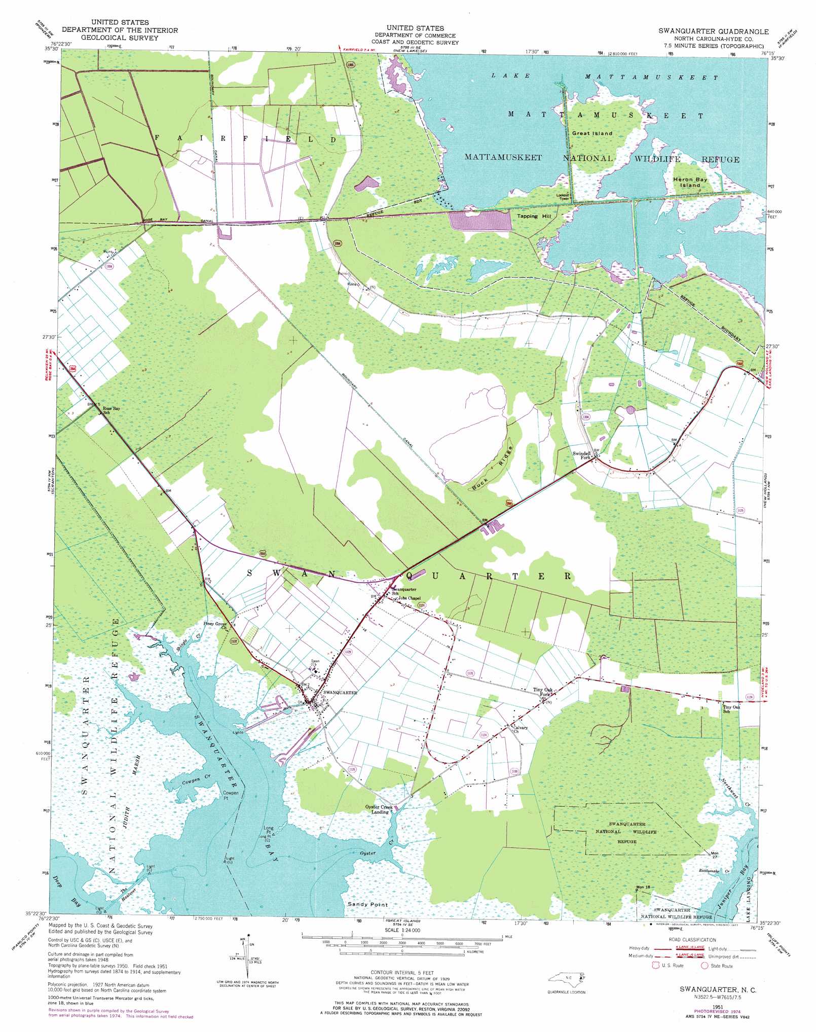
Swanquarter Topo Map North Carolina
To zoom in, hover over the map of Swanquarter
USGS Topo Quad 35076d3 - 1:24,000 scale
| Topo Map Name: | Swanquarter |
| USGS Topo Quad ID: | 35076d3 |
| Print Size: | ca. 21 1/4" wide x 27" high |
| Southeast Coordinates: | 35.375° N latitude / 76.25° W longitude |
| Map Center Coordinates: | 35.4375° N latitude / 76.3125° W longitude |
| U.S. State: | NC |
| Filename: | o35076d3.jpg |
| Download Map JPG Image: | Swanquarter topo map 1:24,000 scale |
| Map Type: | Topographic |
| Topo Series: | 7.5´ |
| Map Scale: | 1:24,000 |
| Source of Map Images: | United States Geological Survey (USGS) |
| Alternate Map Versions: |
Swanquarter NC 1951, updated 1953 Download PDF Buy paper map Swanquarter NC 1951, updated 1977 Download PDF Buy paper map Swanquarter NC 2010 Download PDF Buy paper map Swanquarter NC 2013 Download PDF Buy paper map Swanquarter NC 2016 Download PDF Buy paper map |
1:24,000 Topo Quads surrounding Swanquarter
Pungo Lake |
New Lake Nw |
New Lake |
Fairfield Nw |
Fairfield Ne |
Belhaven |
Ponzer |
New Lake Se |
Fairfield |
Engelhard West |
Pamlico Beach |
Scranton |
Swanquarter |
New Holland |
|
Lowland |
Pamlico Point |
Great Island |
Bluff Point |
Middletown |
Jones Bay |
Little Fishing Point |
> Back to 35076a1 at 1:100,000 scale
> Back to 35076a1 at 1:250,000 scale
> Back to U.S. Topo Maps home
Swanquarter topo map: Gazetteer
Swanquarter: Areas
Bell Island elevation 0m 0′Swanquarter: Bays
Cowpen Creek elevation 0m 0′Swanquarter: Canals
Rose Bay Canal elevation 0m 0′The Haulover elevation 0m 0′
Swanquarter: Capes
Cowpen Point elevation 0m 0′Long Point elevation 0m 0′
Sandy Point elevation 1m 3′
Swanquarter: Islands
Great Island elevation 1m 3′Heron Bay Island elevation 0m 0′
Swanquarter: Parks
Mattamuskeet National Wildlife Refuge elevation 1m 3′Swanquarter: Populated Places
Oyster Creek Landing elevation 0m 0′Swanquarter elevation 1m 3′
Swindell Fork elevation 1m 3′
Tiny Oak Fork elevation 1m 3′
Swanquarter: Ridges
Buck Ridge elevation 1m 3′Swanquarter: Streams
Rattlesnake Creek elevation 0m 0′Shingle Creek elevation 0m 0′
Swanquarter: Summits
Tapping Hill elevation 0m 0′Swanquarter: Swamps
Judith Marsh elevation 0m 0′Swanquarter digital topo map on disk
Buy this Swanquarter topo map showing relief, roads, GPS coordinates and other geographical features, as a high-resolution digital map file on DVD:
Atlantic Coast (NY, NJ, PA, DE, MD, VA, NC)
Buy digital topo maps: Atlantic Coast (NY, NJ, PA, DE, MD, VA, NC)
 map DVD")