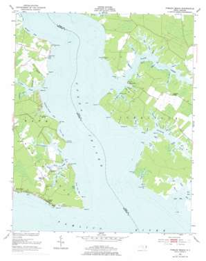
Pamlico Beach Topo Map North Carolina
To zoom in, hover over the map of Pamlico Beach
USGS Topo Quad 35076d5 - 1:24,000 scale
| Topo Map Name: | Pamlico Beach |
| USGS Topo Quad ID: | 35076d5 |
| Print Size: | ca. 21 1/4" wide x 27" high |
| Southeast Coordinates: | 35.375° N latitude / 76.5° W longitude |
| Map Center Coordinates: | 35.4375° N latitude / 76.5625° W longitude |
| U.S. State: | NC |
| Filename: | o35076d5.jpg |
| Download Map JPG Image: | Pamlico Beach topo map 1:24,000 scale |
| Map Type: | Topographic |
| Topo Series: | 7.5´ |
| Map Scale: | 1:24,000 |
| Source of Map Images: | United States Geological Survey (USGS) |
| Alternate Map Versions: |
Pamlico Beach NC 1951, updated 1953 Download PDF Buy paper map Pamlico Beach NC 1951, updated 1977 Download PDF Buy paper map Pamlico Beach NC 2002, updated 2002 Download PDF Buy paper map Pamlico Beach NC 2010 Download PDF Buy paper map Pamlico Beach NC 2013 Download PDF Buy paper map Pamlico Beach NC 2016 Download PDF Buy paper map |
1:24,000 Topo Quads surrounding Pamlico Beach
> Back to 35076a1 at 1:100,000 scale
> Back to 35076a1 at 1:250,000 scale
> Back to U.S. Topo Maps home
Pamlico Beach topo map: Gazetteer
Pamlico Beach: Bays
Abel Bay elevation 0m 0′Cox Creek elevation 0m 0′
Great Gut Bay elevation 0m 0′
Hobb Creek elevation 0m 0′
Kenyon Bay elevation 0m 0′
Liniar Bay elevation 0m 0′
Marie Creek elevation 0m 0′
Pasture Creek elevation 0m 0′
Raffing Creek elevation 0m 0′
Salt Pit Creek elevation 0m 0′
Seer Creek elevation 0m 0′
Tarkiln Creek Bay elevation 0m 0′
Pamlico Beach: Beaches
Bailey Shore elevation 0m 0′Lupton Shore elevation 0m 0′
Pamlico Beach: Capes
Adams Point elevation 1m 3′Asparagus Point elevation 0m 0′
Currituck Point elevation 0m 0′
Dave Moore Point elevation 1m 3′
Fulford Point elevation 0m 0′
Grassy Point elevation 0m 0′
Green Point elevation 0m 0′
Harris Point elevation 0m 0′
Hog Pen Point elevation 0m 0′
July Point elevation 0m 0′
Lamb Point elevation 1m 3′
Lupton Point elevation 0m 0′
Manley Point elevation 0m 0′
Mill Point elevation 2m 6′
Old Field Point elevation 1m 3′
Parmalee Point elevation 0m 0′
Pasture Point elevation 0m 0′
Persimmon Point elevation 0m 0′
Poster elevation 0m 0′
Quilley Point elevation 0m 0′
Sandy Point elevation 0m 0′
Signal Point elevation 0m 0′
Tarkiln Neck elevation 0m 0′
Tyson Point elevation 0m 0′
Wades Point elevation 1m 3′
War Point elevation 1m 3′
Ware Point elevation 0m 0′
Wilkins Point elevation 1m 3′
Woodstock Point elevation 0m 0′
Pamlico Beach: Guts
Great Gut elevation 0m 0′Great Gut elevation 1m 3′
Little Gut elevation 0m 0′
Sparrows Gut elevation 0m 0′
Speer Gut elevation 0m 0′
Pamlico Beach: Populated Places
Makleyville elevation 1m 3′Moores Beach elevation 2m 6′
Pamlico Beach elevation 2m 6′
Schoolhouse Landing elevation 1m 3′
Pamlico Beach: Streams
Alligator Gut elevation 6m 19′Allison Creek elevation 9m 29′
Becky Creek elevation 0m 0′
Box Creek elevation 0m 0′
Bradley Creek elevation 0m 0′
Church Creek elevation 0m 0′
Crooked Creek elevation 0m 0′
Dixon Creek elevation 0m 0′
Foreman Creek elevation 0m 0′
Fortescue Creek elevation 0m 0′
Island Creek elevation 0m 0′
Jarvis Creek elevation 0m 0′
Jones Creek elevation 3m 9′
Jordan Creek elevation 0m 0′
Log Creek elevation 0m 0′
Neal Creek elevation 0m 0′
North Prong Wright Creek elevation 0m 0′
Old Field Creek elevation 0m 0′
Pungo River elevation 0m 0′
Satterthwaite Creek elevation 0m 0′
Slade Creek elevation 0m 0′
Snederker Gut elevation 0m 0′
Snell Creek elevation 0m 0′
South Prong Wright Creek elevation 0m 0′
Speer Creek elevation 0m 0′
Spellman Creek elevation -6m -20′
Spring Creek elevation 1m 3′
Tarkiln Creek elevation 0m 0′
Warner Creek elevation 0m 0′
Wood Creek elevation 0m 0′
Wright Creek elevation 0m 0′
Pamlico Beach: Swamps
One Thousand Marshes elevation 1m 3′Pamlico Beach digital topo map on disk
Buy this Pamlico Beach topo map showing relief, roads, GPS coordinates and other geographical features, as a high-resolution digital map file on DVD:
Atlantic Coast (NY, NJ, PA, DE, MD, VA, NC)
Buy digital topo maps: Atlantic Coast (NY, NJ, PA, DE, MD, VA, NC)


