Frying Pan Topo Map North Carolina
To zoom in, hover over the map of Frying Pan
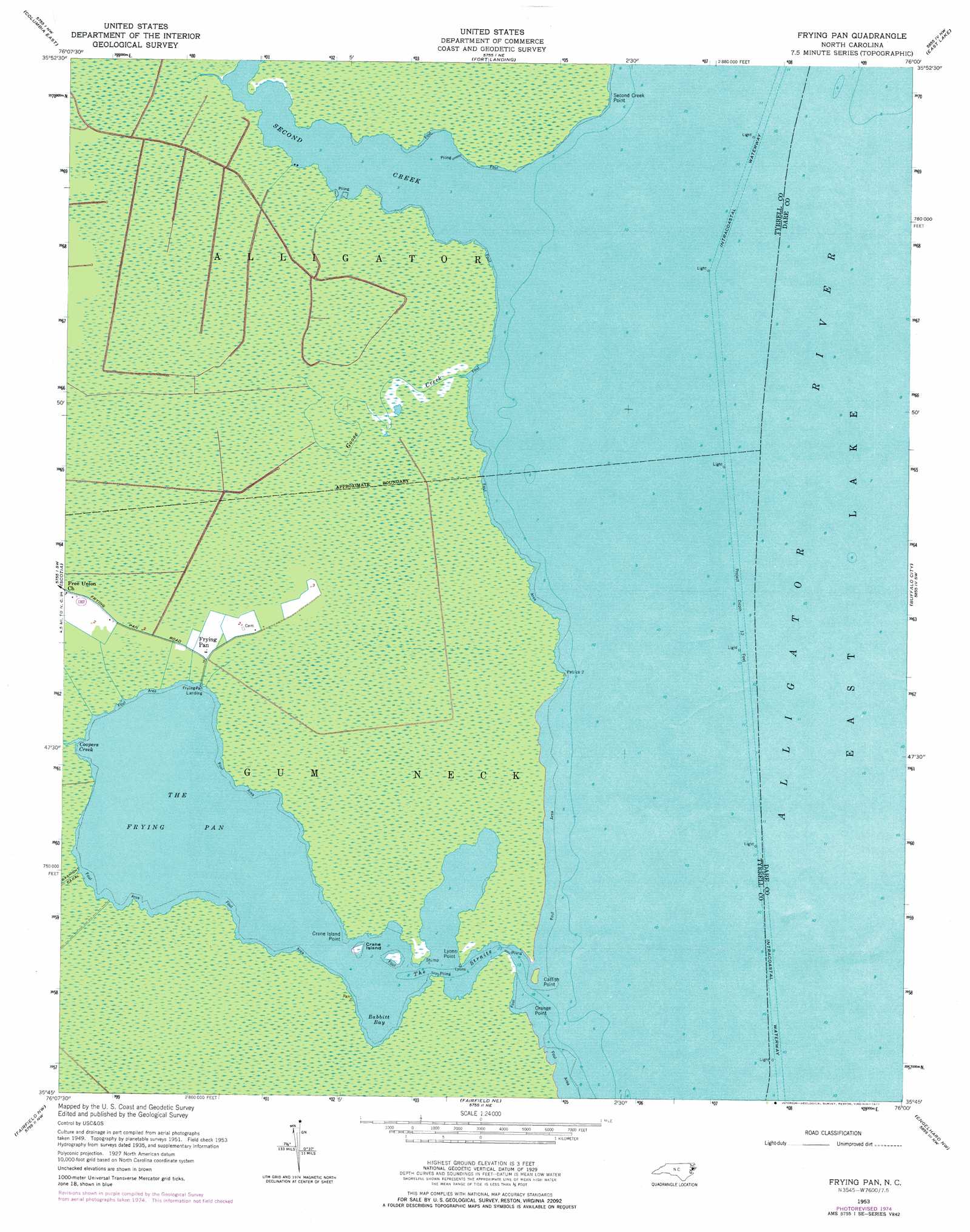
USGS Topo Quad 35076g1 - 1:24,000 scale
| Topo Map Name: | Frying Pan |
| USGS Topo Quad ID: | 35076g1 |
| Print Size: | ca. 21 1/4" wide x 27" high |
| Southeast Coordinates: | 35.75° N latitude / 76° W longitude |
| Map Center Coordinates: | 35.8125° N latitude / 76.0625° W longitude |
| U.S. State: | NC |
| Filename: | o35076g1.jpg |
| Download Map JPG Image: | Frying Pan topo map 1:24,000 scale |
| Map Type: | Topographic |
| Topo Series: | 7.5´ |
| Map Scale: | 1:24,000 |
| Source of Map Images: | United States Geological Survey (USGS) |
| Alternate Map Versions: |
Frying Pan NC 1953, updated 1956 Download PDF Buy paper map Frying Pan NC 1953, updated 1956 Download PDF Buy paper map Frying Pan NC 1953, updated 1977 Download PDF Buy paper map Frying Pan NC 2002, updated 2002 Download PDF Buy paper map Frying Pan NC 2010 Download PDF Buy paper map Frying Pan NC 2013 Download PDF Buy paper map Frying Pan NC 2016 Download PDF Buy paper map |
1:24,000 Topo Quads surrounding Frying Pan
Harvey Neck |
Stevenson Point |
Point Harbor |
||
Columbia West |
Columbia East |
Fort Landing |
East Lake |
Manns Harbor |
Creswell Se |
Scotia |
Frying Pan |
Buffalo City |
East Lake Se |
New Lake |
Fairfield Nw |
Fairfield Ne |
Engelhard Nw |
Engelhard Ne |
New Lake Se |
Fairfield |
Engelhard West |
Engelhard East |
Long Shoal Point |
> Back to 35076e1 at 1:100,000 scale
> Back to 35076a1 at 1:250,000 scale
> Back to U.S. Topo Maps home
Frying Pan topo map: Gazetteer
Frying Pan: Bays
Babbitt Bay elevation -1m -4′The Frying Pan elevation 0m 0′
Frying Pan: Capes
Catfish Point elevation -1m -4′Crane Island Point elevation 0m 0′
Lyons Point elevation 0m 0′
Orange Point elevation 0m 0′
Second Creek Point elevation 0m 0′
Frying Pan: Channels
The Straits elevation 0m 0′Frying Pan: Islands
Crane Island elevation 0m 0′Frying Pan: Populated Places
Frying Pan elevation 1m 3′Frying Pan: Streams
Coopers Creek elevation 0m 0′Goose Creek elevation -1m -4′
Second Creek elevation 0m 0′
Frying Pan digital topo map on disk
Buy this Frying Pan topo map showing relief, roads, GPS coordinates and other geographical features, as a high-resolution digital map file on DVD:
Atlantic Coast (NY, NJ, PA, DE, MD, VA, NC)
Buy digital topo maps: Atlantic Coast (NY, NJ, PA, DE, MD, VA, NC)
 map DVD")