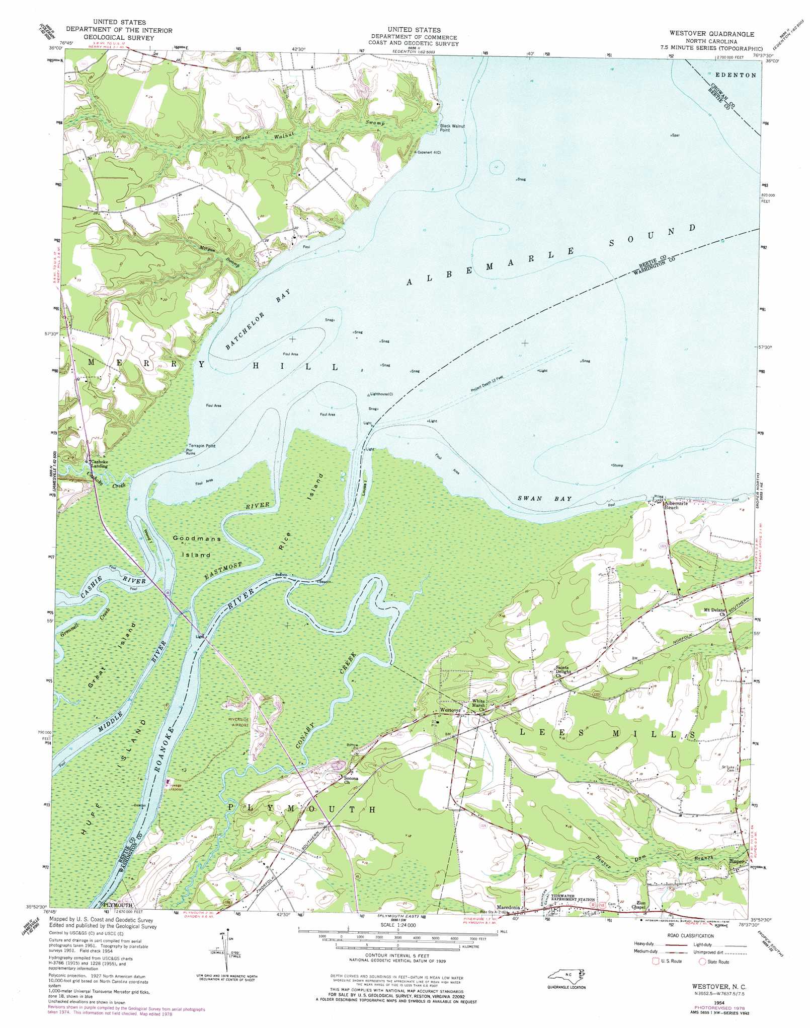
Westover Topo Map North Carolina
To zoom in, hover over the map of Westover
USGS Topo Quad 35076h6 - 1:24,000 scale
| Topo Map Name: | Westover |
| USGS Topo Quad ID: | 35076h6 |
| Print Size: | ca. 21 1/4" wide x 27" high |
| Southeast Coordinates: | 35.875° N latitude / 76.625° W longitude |
| Map Center Coordinates: | 35.9375° N latitude / 76.6875° W longitude |
| U.S. State: | NC |
| Filename: | o35076h6.jpg |
| Download Map JPG Image: | Westover topo map 1:24,000 scale |
| Map Type: | Topographic |
| Topo Series: | 7.5´ |
| Map Scale: | 1:24,000 |
| Source of Map Images: | United States Geological Survey (USGS) |
| Alternate Map Versions: |
Westover NC 1954, updated 1957 Download PDF Buy paper map Westover NC 1954, updated 1978 Download PDF Buy paper map Westover NC 2010 Download PDF Buy paper map Westover NC 2013 Download PDF Buy paper map Westover NC 2016 Download PDF Buy paper map |
1:24,000 Topo Quads surrounding Westover
Powellsville |
Colerain |
Valhalla |
Center Hill |
Hertford |
Windsor North |
Merry Hill |
Edenhouse |
Edenton |
Yeopim River |
Windsor South |
Woodard |
Westover |
Roper North |
Leonards Point |
Jamesville |
Plymouth West |
Plymouth East |
Roper South |
Creswell |
Farmlife |
Hoke |
Pike Road |
Pungo Lake |
New Lake Nw |
> Back to 35076e1 at 1:100,000 scale
> Back to 35076a1 at 1:250,000 scale
> Back to U.S. Topo Maps home
Westover topo map: Gazetteer
Westover: Airports
Riverside Airport elevation 1m 3′Westover: Bays
Batchelor Bay elevation 0m 0′Swan Bay elevation 0m 0′
Westover: Capes
Black Walnut Point elevation 5m 16′Great Island elevation 0m 0′
Terrapin Point elevation 0m 0′
Westover: Islands
Goodmans Island elevation 0m 0′Huff Island elevation 0m 0′
Louse Island elevation 0m 0′
Purchase Islands elevation 0m 0′
Rice Island elevation 0m 0′
Wood Island elevation 8m 26′
Westover: Populated Places
Albemarle Beach elevation 2m 6′Elmwood elevation 6m 19′
Macedonia elevation 4m 13′
Swain (historical) elevation 2m 6′
Westover elevation 3m 9′
Westover: Streams
Cashie River elevation 0m 0′Cashoke Creek elevation 1m 3′
Conaby Creek elevation 0m 0′
Eastmost River elevation 0m 0′
Grennell Creek elevation 0m 0′
Middle River elevation 0m 0′
Morgan Swamp elevation 1m 3′
Roanoke River elevation 0m 0′
Westover digital topo map on disk
Buy this Westover topo map showing relief, roads, GPS coordinates and other geographical features, as a high-resolution digital map file on DVD:
Atlantic Coast (NY, NJ, PA, DE, MD, VA, NC)
Buy digital topo maps: Atlantic Coast (NY, NJ, PA, DE, MD, VA, NC)
 map DVD")