La Grange Topo Map North Carolina
To zoom in, hover over the map of La Grange
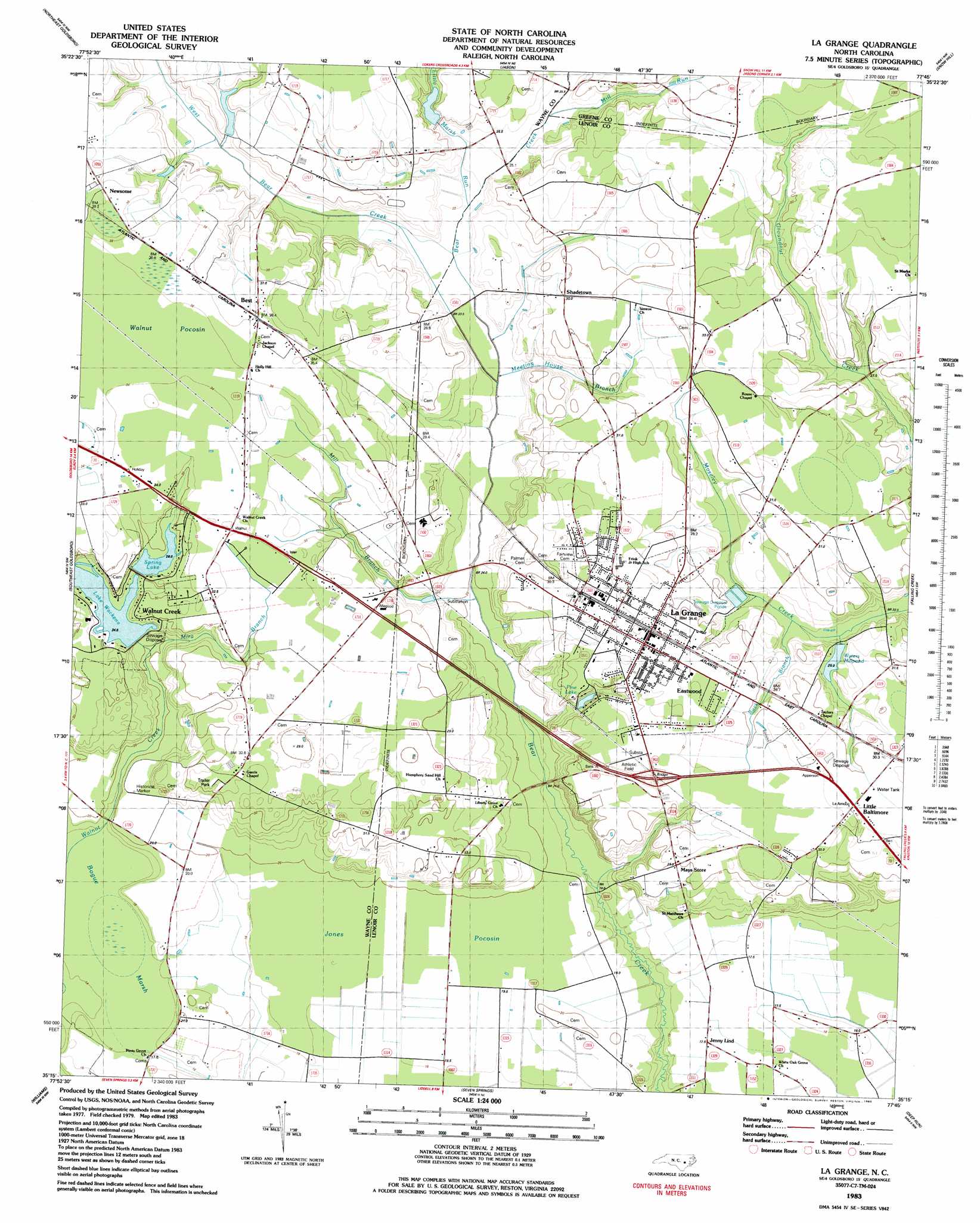
USGS Topo Quad 35077c7 - 1:24,000 scale
| Topo Map Name: | La Grange |
| USGS Topo Quad ID: | 35077c7 |
| Print Size: | ca. 21 1/4" wide x 27" high |
| Southeast Coordinates: | 35.25° N latitude / 77.75° W longitude |
| Map Center Coordinates: | 35.3125° N latitude / 77.8125° W longitude |
| U.S. State: | NC |
| Filename: | o35077c7.jpg |
| Download Map JPG Image: | La Grange topo map 1:24,000 scale |
| Map Type: | Topographic |
| Topo Series: | 7.5´ |
| Map Scale: | 1:24,000 |
| Source of Map Images: | United States Geological Survey (USGS) |
| Alternate Map Versions: |
La Grange NC 1983, updated 1983 Download PDF Buy paper map La Grange NC 2010 Download PDF Buy paper map La Grange NC 2013 Download PDF Buy paper map La Grange NC 2016 Download PDF Buy paper map |
1:24,000 Topo Quads surrounding La Grange
Kenly East |
Fremont |
Stantonsburg |
Walstonburg |
Farmville |
Northwest Goldsboro |
Northeast Goldsboro |
Jason |
Snow Hill |
Hookerton |
Southwest Goldsboro |
Southeast Goldsboro |
La Grange |
Falling Creek |
Kinston |
Mount Olive |
Williams |
Seven Springs |
Deep Run |
Rivermont |
Warsaw North |
Summerlins Crossroads |
Albertson |
Pink Hill |
Comfort |
> Back to 35077a1 at 1:100,000 scale
> Back to 35076a1 at 1:250,000 scale
> Back to U.S. Topo Maps home
La Grange topo map: Gazetteer
La Grange: Dams
Lake Wackena Dam elevation 21m 68′Spring Lake Dam elevation 28m 91′
Walters Millpond Dam elevation 23m 75′
William Creuse Dam elevation 28m 91′
La Grange: Lakes
Pine Lake elevation 27m 88′La Grange: Populated Places
Best elevation 37m 121′Eastwood elevation 31m 101′
Jenny Lind elevation 18m 59′
La Grange elevation 33m 108′
Little Baltimore elevation 30m 98′
Shadetown elevation 30m 98′
Walnut Creek elevation 30m 98′
La Grange: Reservoirs
Bear Creek W/S Lake Number Thirteen elevation 28m 91′Lake Wackena elevation 21m 68′
Spring Lake elevation 28m 91′
Walters Millpond elevation 23m 75′
La Grange: Streams
Buck Branch elevation 23m 75′Little Marsh River elevation 23m 75′
Meeting House Branch elevation 21m 68′
Mill Branch elevation 20m 65′
Mill Run elevation 24m 78′
Mira Branch elevation 22m 72′
West Bear Creek elevation 22m 72′
La Grange: Swamps
Bogue Marsh elevation 15m 49′Jones Pocosin elevation 19m 62′
La Grange digital topo map on disk
Buy this La Grange topo map showing relief, roads, GPS coordinates and other geographical features, as a high-resolution digital map file on DVD:
Atlantic Coast (NY, NJ, PA, DE, MD, VA, NC)
Buy digital topo maps: Atlantic Coast (NY, NJ, PA, DE, MD, VA, NC)
 map DVD")