Wilmar Topo Map North Carolina
To zoom in, hover over the map of Wilmar
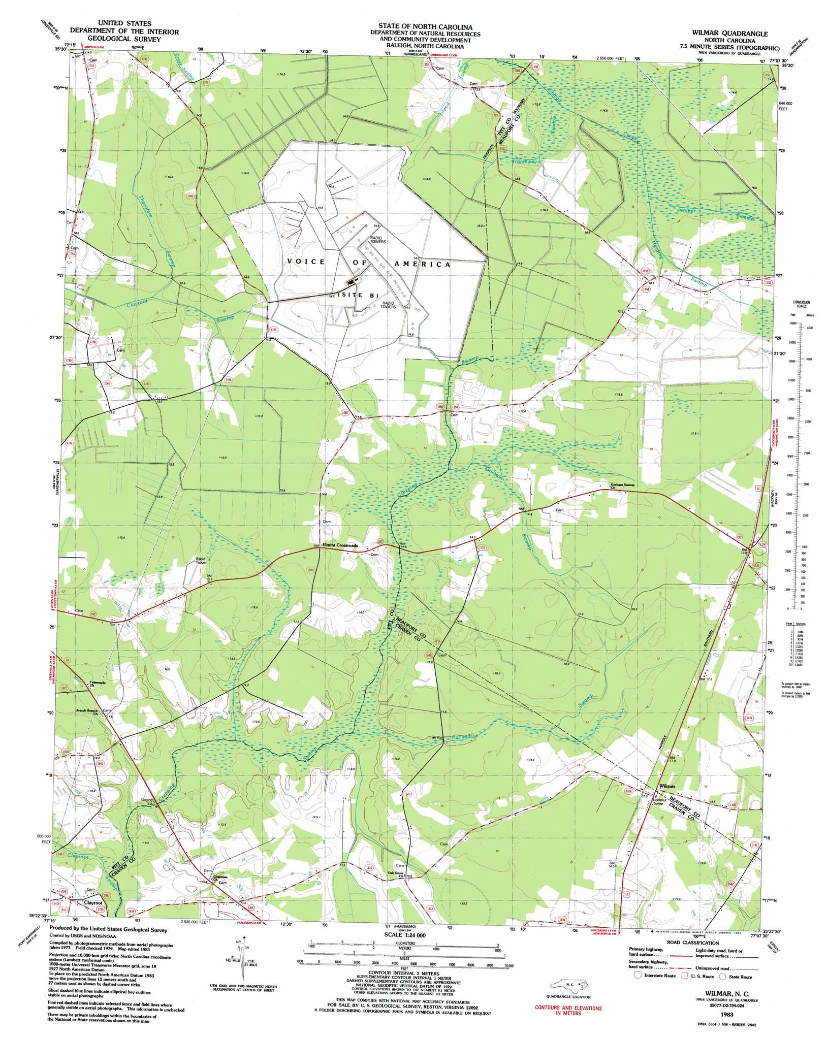
USGS Topo Quad 35077d2 - 1:24,000 scale
| Topo Map Name: | Wilmar |
| USGS Topo Quad ID: | 35077d2 |
| Print Size: | ca. 21 1/4" wide x 27" high |
| Southeast Coordinates: | 35.375° N latitude / 77.125° W longitude |
| Map Center Coordinates: | 35.4375° N latitude / 77.1875° W longitude |
| U.S. State: | NC |
| Filename: | o35077d2.jpg |
| Download Map JPG Image: | Wilmar topo map 1:24,000 scale |
| Map Type: | Topographic |
| Topo Series: | 7.5´ |
| Map Scale: | 1:24,000 |
| Source of Map Images: | United States Geological Survey (USGS) |
| Alternate Map Versions: |
Wilmar NC 1983, updated 1983 Download PDF Buy paper map Wilmar NC 1997, updated 2000 Download PDF Buy paper map Wilmar NC 2010 Download PDF Buy paper map Wilmar NC 2013 Download PDF Buy paper map Wilmar NC 2016 Download PDF Buy paper map |
1:24,000 Topo Quads surrounding Wilmar
Greenville Nw |
Greenville Ne |
Leggetts Crossroads |
Old Ford |
Farmlife |
Greenville Sw |
Greenville Se |
Grimesland |
Washington |
Bunyan |
Ayden |
Gardnerville |
Wilmar |
Hackney |
Blounts Bay |
Grifton |
Fort Barnwell |
Vanceboro |
Ernul |
Edward |
Dover |
Cove City |
Jasper |
Askin |
Reelsboro |
> Back to 35077a1 at 1:100,000 scale
> Back to 35076a1 at 1:250,000 scale
> Back to U.S. Topo Maps home
Wilmar topo map: Gazetteer
Wilmar: Flats
The Opening (historical) elevation 14m 45′Wilmar: Populated Places
Elmira Crossroads elevation 14m 45′Wilmar elevation 17m 55′
Wilmar: Streams
Creeping Swamp elevation 7m 22′Gorham Swamp elevation 11m 36′
Harding Swamp elevation 14m 45′
Horseway Swamp elevation 11m 36′
Juniper Swamp elevation 12m 39′
Polland Swamp elevation 8m 26′
Thorofare Swamp elevation 10m 32′
Wilmar: Swamps
Island Swamp elevation 12m 39′Wilmar digital topo map on disk
Buy this Wilmar topo map showing relief, roads, GPS coordinates and other geographical features, as a high-resolution digital map file on DVD:
Atlantic Coast (NY, NJ, PA, DE, MD, VA, NC)
Buy digital topo maps: Atlantic Coast (NY, NJ, PA, DE, MD, VA, NC)
 map DVD")