Hookerton Topo Map North Carolina
To zoom in, hover over the map of Hookerton
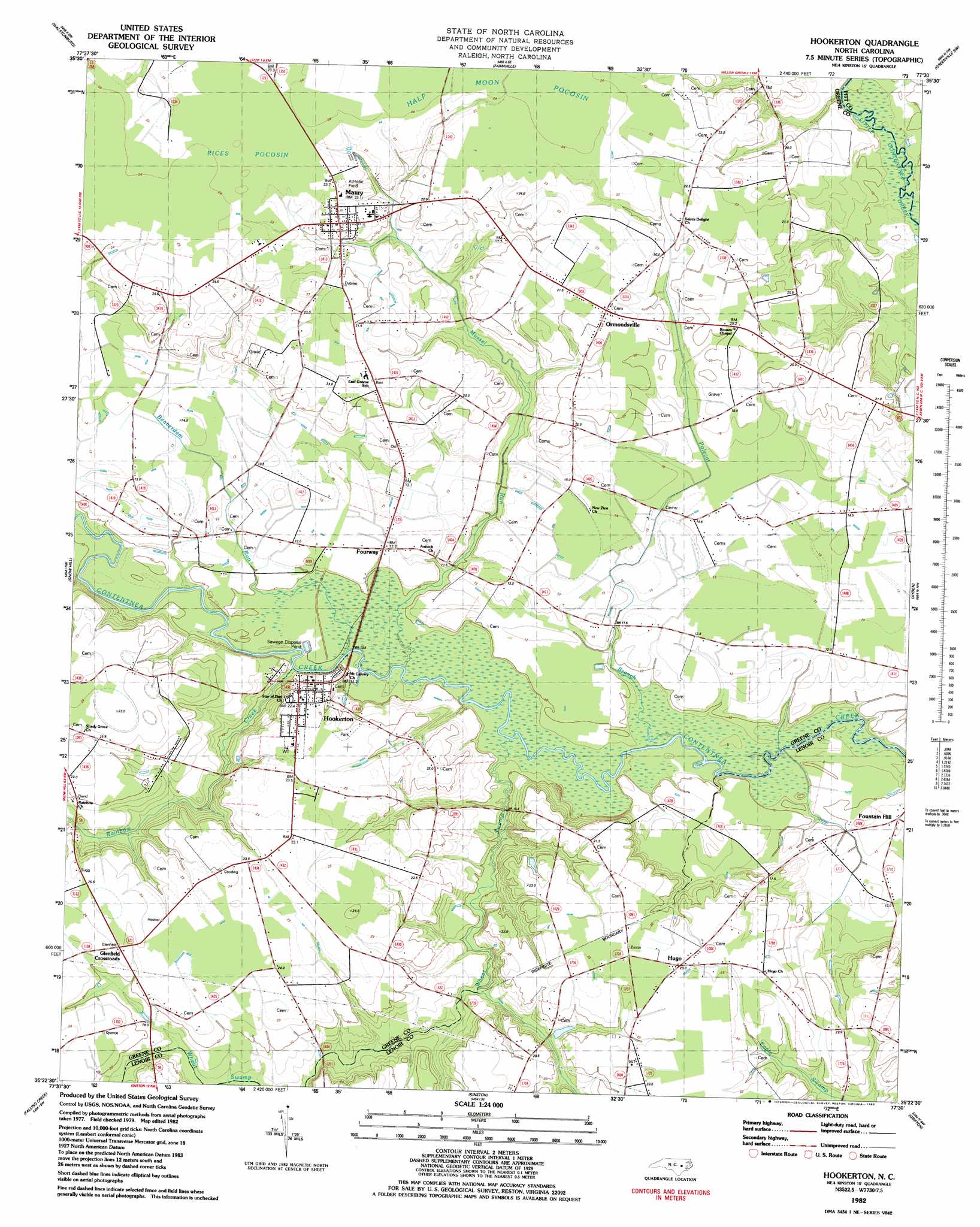
USGS Topo Quad 35077d5 - 1:24,000 scale
| Topo Map Name: | Hookerton |
| USGS Topo Quad ID: | 35077d5 |
| Print Size: | ca. 21 1/4" wide x 27" high |
| Southeast Coordinates: | 35.375° N latitude / 77.5° W longitude |
| Map Center Coordinates: | 35.4375° N latitude / 77.5625° W longitude |
| U.S. State: | NC |
| Filename: | o35077d5.jpg |
| Download Map JPG Image: | Hookerton topo map 1:24,000 scale |
| Map Type: | Topographic |
| Topo Series: | 7.5´ |
| Map Scale: | 1:24,000 |
| Source of Map Images: | United States Geological Survey (USGS) |
| Alternate Map Versions: |
Hookerton NC 1982, updated 1983 Download PDF Buy paper map Hookerton NC 2010 Download PDF Buy paper map Hookerton NC 2013 Download PDF Buy paper map Hookerton NC 2016 Download PDF Buy paper map |
1:24,000 Topo Quads surrounding Hookerton
Saratoga |
Fountain |
Falkland |
Greenville Nw |
Greenville Ne |
Stantonsburg |
Walstonburg |
Farmville |
Greenville Sw |
Greenville Se |
Jason |
Snow Hill |
Hookerton |
Ayden |
Gardnerville |
La Grange |
Falling Creek |
Kinston |
Grifton |
Fort Barnwell |
Seven Springs |
Deep Run |
Rivermont |
Dover |
Cove City |
> Back to 35077a1 at 1:100,000 scale
> Back to 35076a1 at 1:250,000 scale
> Back to U.S. Topo Maps home
Hookerton topo map: Gazetteer
Hookerton: Populated Places
Darewood Estates - Mobile Home Park elevation 23m 75′Fountain Hill elevation 12m 39′
Fourway elevation 11m 36′
Glenfield Crossroads elevation 24m 78′
Hookerton elevation 17m 55′
Hugo elevation 22m 72′
Maury elevation 24m 78′
Ormondsville elevation 22m 72′
Patsy Bran Mobile Home Park elevation 12m 39′
Hookerton: Streams
Beaverdam Run elevation 7m 22′Mussel Run elevation 8m 26′
Polecat Branch elevation 23m 75′
Rainbow Creek elevation 8m 26′
Wheat Swamp elevation 7m 22′
Hookerton: Swamps
Half Moon Pocosin elevation 23m 75′Rices Pocosin elevation 24m 78′
Hookerton digital topo map on disk
Buy this Hookerton topo map showing relief, roads, GPS coordinates and other geographical features, as a high-resolution digital map file on DVD:
Atlantic Coast (NY, NJ, PA, DE, MD, VA, NC)
Buy digital topo maps: Atlantic Coast (NY, NJ, PA, DE, MD, VA, NC)
 map DVD")