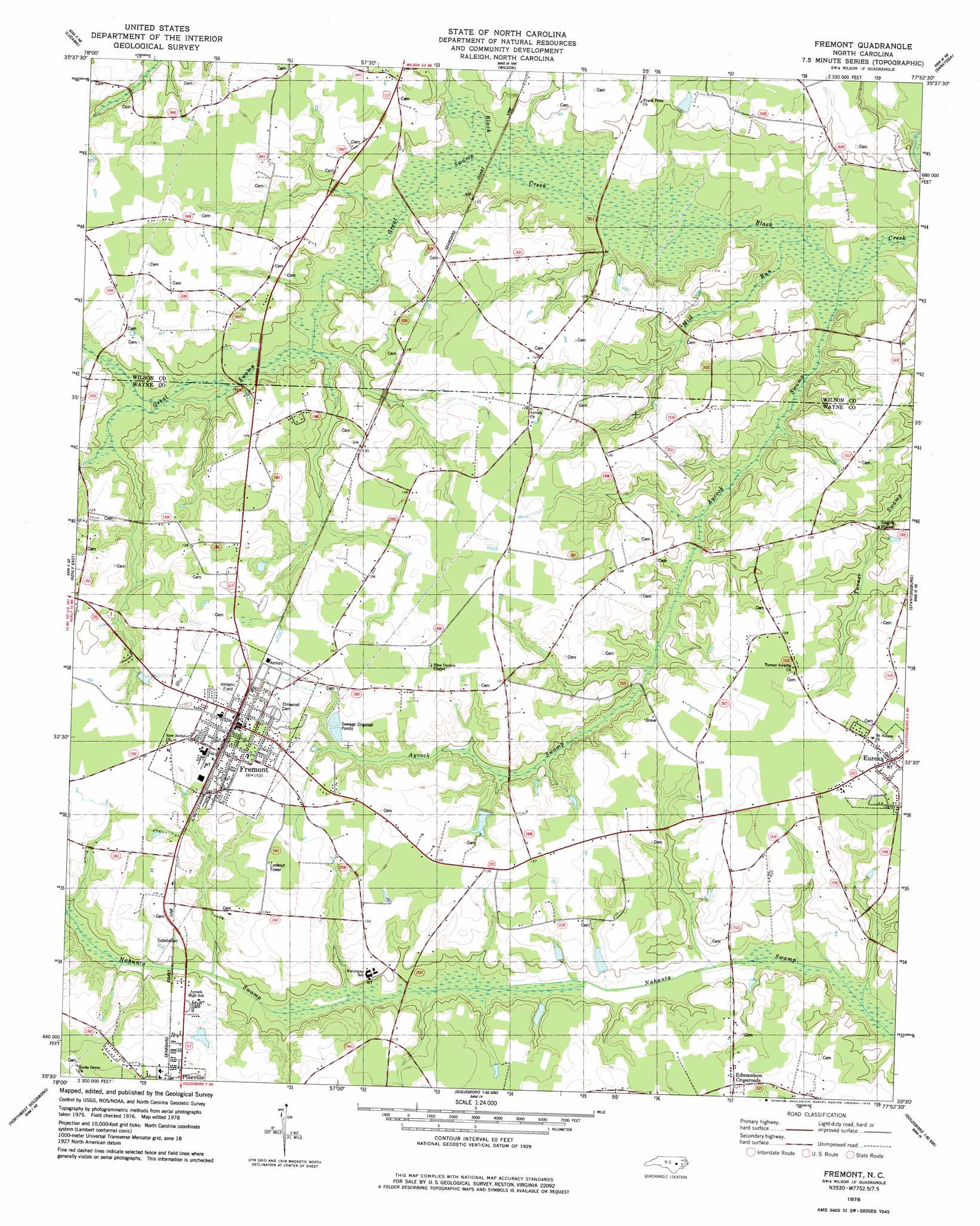
Fremont Topo Map North Carolina
To zoom in, hover over the map of Fremont
USGS Topo Quad 35077e8 - 1:24,000 scale
| Topo Map Name: | Fremont |
| USGS Topo Quad ID: | 35077e8 |
| Print Size: | ca. 21 1/4" wide x 27" high |
| Southeast Coordinates: | 35.5° N latitude / 77.875° W longitude |
| Map Center Coordinates: | 35.5625° N latitude / 77.9375° W longitude |
| U.S. State: | NC |
| Filename: | o35077e8.jpg |
| Download Map JPG Image: | Fremont topo map 1:24,000 scale |
| Map Type: | Topographic |
| Topo Series: | 7.5´ |
| Map Scale: | 1:24,000 |
| Source of Map Images: | United States Geological Survey (USGS) |
| Alternate Map Versions: |
Fremont NC 1978, updated 1978 Download PDF Buy paper map Fremont NC 2010 Download PDF Buy paper map Fremont NC 2013 Download PDF Buy paper map Fremont NC 2016 Download PDF Buy paper map |
1:24,000 Topo Quads surrounding Fremont
Middlesex |
Bailey |
Winstead Crossroads |
Elm City |
Pinetops |
Stancils Chapel |
Lucama |
Wilson |
Saratoga |
Fountain |
Kenly West |
Kenly East |
Fremont |
Stantonsburg |
Walstonburg |
Princeton |
Northwest Goldsboro |
Northeast Goldsboro |
Jason |
Snow Hill |
Grantham |
Southwest Goldsboro |
Southeast Goldsboro |
La Grange |
Falling Creek |
> Back to 35077e1 at 1:100,000 scale
> Back to 35076a1 at 1:250,000 scale
> Back to U.S. Topo Maps home
Fremont topo map: Gazetteer
Fremont: Dams
West Lake Dam elevation 31m 101′Fremont: Populated Places
Collingwood Estates elevation 42m 137′Edmundson Crossroads elevation 38m 124′
Eureka elevation 38m 124′
Fremont elevation 45m 147′
Fremont: Post Offices
Eureka Post Office elevation 45m 147′Fremont Post Office elevation 45m 147′
Fremont: Reservoirs
West Lake elevation 31m 101′Fremont: Streams
Aycock Swamp elevation 19m 62′Great Swamp elevation 22m 72′
Mill Run elevation 19m 62′
Fremont digital topo map on disk
Buy this Fremont topo map showing relief, roads, GPS coordinates and other geographical features, as a high-resolution digital map file on DVD:
Atlantic Coast (NY, NJ, PA, DE, MD, VA, NC)
Buy digital topo maps: Atlantic Coast (NY, NJ, PA, DE, MD, VA, NC)
 map DVD")