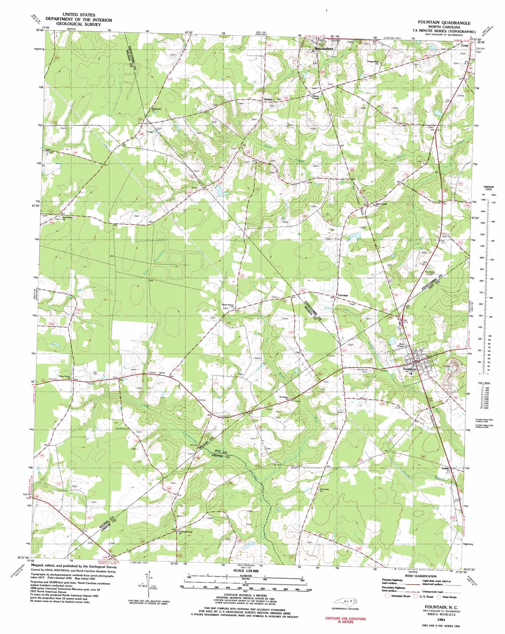
Fountain Topo Map North Carolina
To zoom in, hover over the map of Fountain
USGS Topo Quad 35077f6 - 1:24,000 scale
| Topo Map Name: | Fountain |
| USGS Topo Quad ID: | 35077f6 |
| Print Size: | ca. 21 1/4" wide x 27" high |
| Southeast Coordinates: | 35.625° N latitude / 77.625° W longitude |
| Map Center Coordinates: | 35.6875° N latitude / 77.6875° W longitude |
| U.S. State: | NC |
| Filename: | o35077f6.jpg |
| Download Map JPG Image: | Fountain topo map 1:24,000 scale |
| Map Type: | Topographic |
| Topo Series: | 7.5´ |
| Map Scale: | 1:24,000 |
| Source of Map Images: | United States Geological Survey (USGS) |
| Alternate Map Versions: |
Fountain NC 1981, updated 1982 Download PDF Buy paper map Fountain NC 2010 Download PDF Buy paper map Fountain NC 2013 Download PDF Buy paper map Fountain NC 2016 Download PDF Buy paper map |
1:24,000 Topo Quads surrounding Fountain
Nashville |
Rocky Mount |
Hartsease |
Tarboro |
Speed |
Winstead Crossroads |
Elm City |
Pinetops |
Old Sparta |
Conetoe |
Wilson |
Saratoga |
Fountain |
Falkland |
Greenville Nw |
Fremont |
Stantonsburg |
Walstonburg |
Farmville |
Greenville Sw |
Northeast Goldsboro |
Jason |
Snow Hill |
Hookerton |
Ayden |
> Back to 35077e1 at 1:100,000 scale
> Back to 35076a1 at 1:250,000 scale
> Back to U.S. Topo Maps home
Fountain topo map: Gazetteer
Fountain: Dams
Strickland Pond Dam elevation 30m 98′Fountain: Populated Places
Fountain elevation 34m 111′Reba elevation 35m 114′
Turnage elevation 35m 114′
Webbs elevation 34m 111′
Fountain: Post Offices
Fountain Post Office elevation 34m 111′Fountain: Reservoirs
Strickland Pond elevation 30m 98′Fountain: Streams
Ward Run elevation 23m 75′Fountain: Swamps
The Pocosin elevation 36m 118′Fountain digital topo map on disk
Buy this Fountain topo map showing relief, roads, GPS coordinates and other geographical features, as a high-resolution digital map file on DVD:
Atlantic Coast (NY, NJ, PA, DE, MD, VA, NC)
Buy digital topo maps: Atlantic Coast (NY, NJ, PA, DE, MD, VA, NC)
 map DVD")