Robersonville West Topo Map North Carolina
To zoom in, hover over the map of Robersonville West
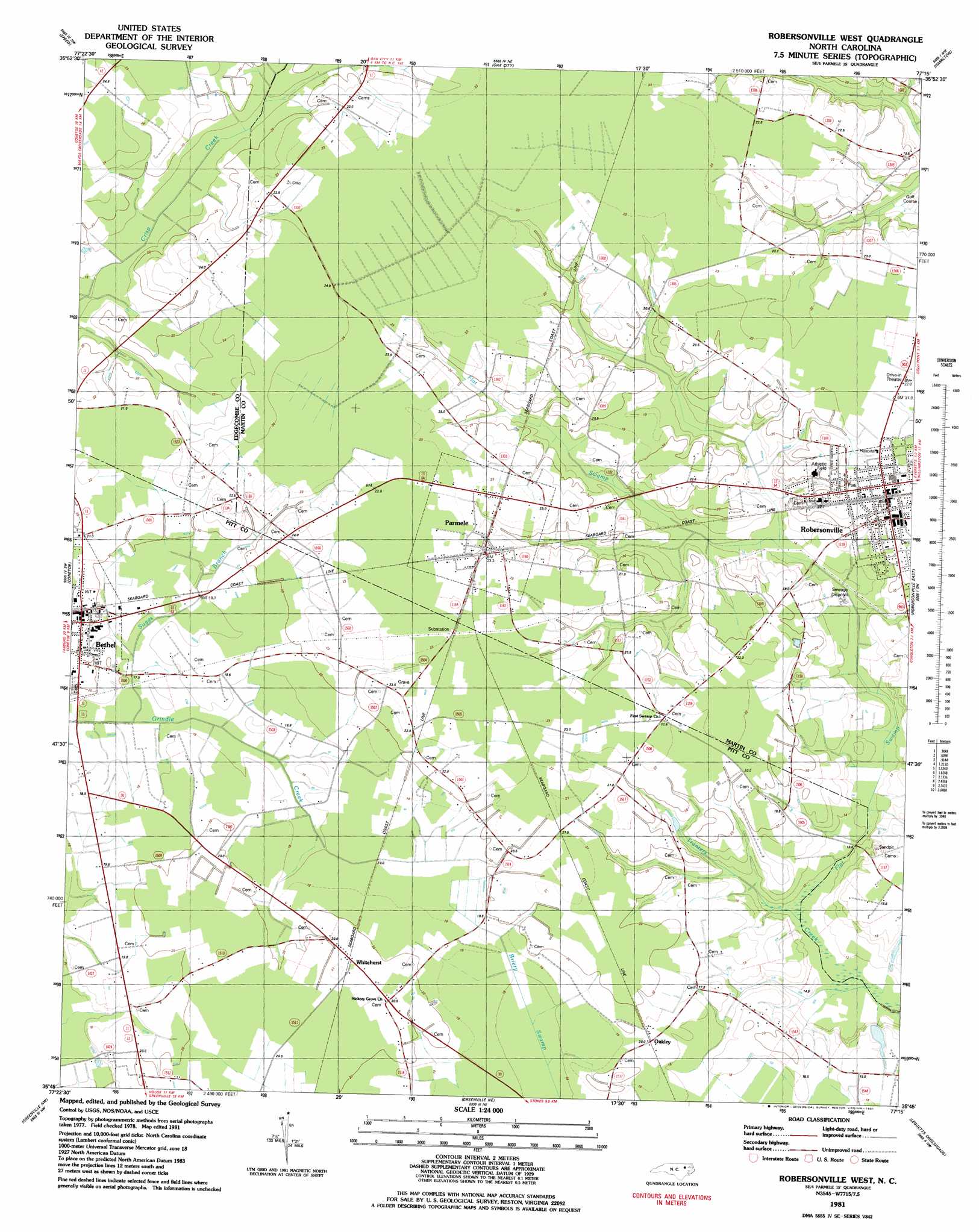
USGS Topo Quad 35077g3 - 1:24,000 scale
| Topo Map Name: | Robersonville West |
| USGS Topo Quad ID: | 35077g3 |
| Print Size: | ca. 21 1/4" wide x 27" high |
| Southeast Coordinates: | 35.75° N latitude / 77.25° W longitude |
| Map Center Coordinates: | 35.8125° N latitude / 77.3125° W longitude |
| U.S. State: | NC |
| Filename: | o35077g3.jpg |
| Download Map JPG Image: | Robersonville West topo map 1:24,000 scale |
| Map Type: | Topographic |
| Topo Series: | 7.5´ |
| Map Scale: | 1:24,000 |
| Source of Map Images: | United States Geological Survey (USGS) |
| Alternate Map Versions: |
Robersonsville West NC 1981, updated 1981 Download PDF Buy paper map Robersonville West NC 2010 Download PDF Buy paper map Robersonville West NC 2013 Download PDF Buy paper map Robersonville West NC 2016 Download PDF Buy paper map |
1:24,000 Topo Quads surrounding Robersonville West
Draughn |
Hobgood |
Palmyra |
Woodville |
Republican |
Tarboro |
Speed |
Oak City |
Hamilton |
Quitsna |
Old Sparta |
Conetoe |
Robersonville West |
Robersonville East |
Williamston |
Falkland |
Greenville Nw |
Greenville Ne |
Leggetts Crossroads |
Old Ford |
Farmville |
Greenville Sw |
Greenville Se |
Grimesland |
Washington |
> Back to 35077e1 at 1:100,000 scale
> Back to 35076a1 at 1:250,000 scale
> Back to U.S. Topo Maps home
Robersonville West topo map: Gazetteer
Robersonville West: Canals
Suggs Branch elevation 19m 62′Robersonville West: Populated Places
Oakley elevation 19m 62′Parmele elevation 22m 72′
Whitehurst elevation 21m 68′
Robersonville West: Streams
Flat Swamp elevation 9m 29′Robersonville West: Swamps
Flat Swamp elevation 13m 42′Robersonville West digital topo map on disk
Buy this Robersonville West topo map showing relief, roads, GPS coordinates and other geographical features, as a high-resolution digital map file on DVD:
Atlantic Coast (NY, NJ, PA, DE, MD, VA, NC)
Buy digital topo maps: Atlantic Coast (NY, NJ, PA, DE, MD, VA, NC)
 map DVD")