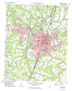
Rocky Mount Topo Map North Carolina
To zoom in, hover over the map of Rocky Mount
USGS Topo Quad 35077h7 - 1:24,000 scale
| Topo Map Name: | Rocky Mount |
| USGS Topo Quad ID: | 35077h7 |
| Print Size: | ca. 21 1/4" wide x 27" high |
| Southeast Coordinates: | 35.875° N latitude / 77.75° W longitude |
| Map Center Coordinates: | 35.9375° N latitude / 77.8125° W longitude |
| U.S. State: | NC |
| Filename: | o35077h7.jpg |
| Download Map JPG Image: | Rocky Mount topo map 1:24,000 scale |
| Map Type: | Topographic |
| Topo Series: | 7.5´ |
| Map Scale: | 1:24,000 |
| Source of Map Images: | United States Geological Survey (USGS) |
| Alternate Map Versions: |
Rocky Mount NC 1975, updated 1978 Download PDF Buy paper map Rocky Mount NC 1977, updated 1977 Download PDF Buy paper map Rocky Mount NC 1998, updated 2000 Download PDF Buy paper map Rocky Mount NC 2010 Download PDF Buy paper map Rocky Mount NC 2013 Download PDF Buy paper map Rocky Mount NC 2016 Download PDF Buy paper map |
1:24,000 Topo Quads surrounding Rocky Mount
> Back to 35077e1 at 1:100,000 scale
> Back to 35076a1 at 1:250,000 scale
> Back to U.S. Topo Maps home
Rocky Mount topo map: Gazetteer
Rocky Mount: Airports
Rocky Mount Downtown Airport (historical) elevation 23m 75′Rocky Mount: Bridges
Lemons Bridge elevation 29m 95′Williford Bridge elevation 25m 82′
Rocky Mount: Dams
Rocky Mount Millpond Dam elevation 22m 72′Rocky Mount: Falls
Little Falls elevation 18m 59′Little Falls elevation 19m 62′
Upper Falls elevation 21m 68′
Rocky Mount: Lakes
City Lake elevation 29m 95′Rocky Mount: Parks
Buck Leonard Park elevation 33m 108′Meadowbrook Park elevation 33m 108′
Rocky Mount Municipal Stadium elevation 35m 114′
Sunset Park elevation 27m 88′
Rocky Mount: Populated Places
Ashburk elevation 34m 111′Bel-Air elevation 33m 108′
Berkeley elevation 41m 134′
Brook Valley Trailer Park elevation 44m 144′
Easonburg elevation 39m 127′
Farmington elevation 34m 111′
Forest Oaks elevation 53m 173′
Fox Run elevation 34m 111′
Green Hills Trailer Park elevation 24m 78′
Halifax Crossing elevation 43m 141′
High Meadows elevation 39m 127′
Joyners Crossing elevation 43m 141′
Little Easonburg elevation 44m 144′
Meadow Brook elevation 32m 104′
Mobile City Trailer Park elevation 25m 82′
North Green elevation 40m 131′
Quail Hollow elevation 34m 111′
Rocky Mount elevation 30m 98′
South Rocky Mount elevation 37m 121′
Swelton Heights elevation 35m 114′
Woodcrest Park elevation 36m 118′
Woodgreen elevation 39m 127′
Woodridge elevation 42m 137′
Rocky Mount: Post Offices
Rocky Mount Post Office elevation 34m 111′Rocky Mount Post Office elevation 30m 98′
Rocky Mount: Reservoirs
Rocky Mount Mill Pond elevation 22m 72′Rocky Mount: Streams
Compass Creek elevation 19m 62′Cowlick Branch elevation 17m 55′
Goose Branch elevation 19m 62′
Grape Branch elevation 26m 85′
Hicks Branch elevation 34m 111′
Hornbeam Branch elevation 18m 59′
Maple Creek elevation 26m 85′
Polecat Branch elevation 33m 108′
Stony Creek elevation 25m 82′
Rocky Mount digital topo map on disk
Buy this Rocky Mount topo map showing relief, roads, GPS coordinates and other geographical features, as a high-resolution digital map file on DVD:
Atlantic Coast (NY, NJ, PA, DE, MD, VA, NC)
Buy digital topo maps: Atlantic Coast (NY, NJ, PA, DE, MD, VA, NC)


