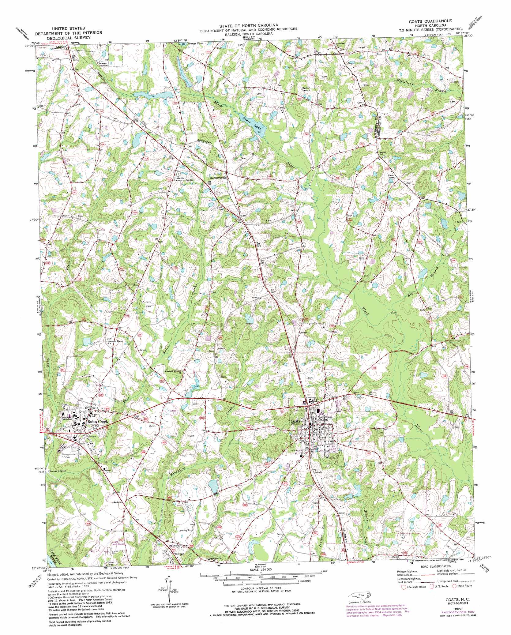
Coats Topo Map North Carolina
To zoom in, hover over the map of Coats
USGS Topo Quad 35078d6 - 1:24,000 scale
| Topo Map Name: | Coats |
| USGS Topo Quad ID: | 35078d6 |
| Print Size: | ca. 21 1/4" wide x 27" high |
| Southeast Coordinates: | 35.375° N latitude / 78.625° W longitude |
| Map Center Coordinates: | 35.4375° N latitude / 78.6875° W longitude |
| U.S. State: | NC |
| Filename: | o35078d6.jpg |
| Download Map JPG Image: | Coats topo map 1:24,000 scale |
| Map Type: | Topographic |
| Topo Series: | 7.5´ |
| Map Scale: | 1:24,000 |
| Source of Map Images: | United States Geological Survey (USGS) |
| Alternate Map Versions: |
Coats NC 1973, updated 1975 Download PDF Buy paper map Coats NC 1973, updated 1980 Download PDF Buy paper map Coats NC 1973, updated 1987 Download PDF Buy paper map Coats NC 1997, updated 2000 Download PDF Buy paper map Coats NC 2010 Download PDF Buy paper map Coats NC 2013 Download PDF Buy paper map Coats NC 2016 Download PDF Buy paper map |
1:24,000 Topo Quads surrounding Coats
New Hill |
Apex |
Lake Wheeler |
Garner |
Clayton |
Cokesbury |
Fuquay-Varina |
Angier |
Edmondson |
Powhatan |
Mamers |
Lillington |
Coats |
Benson |
Four Oaks |
Anderson Creek |
Bunnlevel |
Erwin |
Dunn |
Peacocks Crossroads |
Manchester |
Slocomb |
Wade |
Mingo |
Timothy |
> Back to 35078a1 at 1:100,000 scale
> Back to 35078a1 at 1:250,000 scale
> Back to U.S. Topo Maps home
Coats topo map: Gazetteer
Coats: Airports
Stewart Airport elevation 60m 196′Coats: Dams
Bakers Pond Dam elevation 60m 196′Chesterfield Lake Dam elevation 84m 275′
Gregorys Lake Dam elevation 61m 200′
Guys Pond Dam elevation 74m 242′
Popes Lake Dam elevation 69m 226′
Coats: Lakes
Popes Lake elevation 69m 226′Coats: Populated Places
Barclaysville elevation 102m 334′Buies Creek elevation 63m 206′
Coats elevation 94m 308′
Coats: Reservoirs
Bakers Pond elevation 60m 196′Chesterfield Lake elevation 84m 275′
Gregorys Lake elevation 61m 200′
Guys Pond elevation 74m 242′
Youngs Pond elevation 75m 246′
Coats: Streams
Big Branch elevation 62m 203′East Buies Creek elevation 36m 118′
Coats digital topo map on disk
Buy this Coats topo map showing relief, roads, GPS coordinates and other geographical features, as a high-resolution digital map file on DVD:
South Carolina, Western North Carolina & Northeastern Georgia
Buy digital topo maps: South Carolina, Western North Carolina & Northeastern Georgia