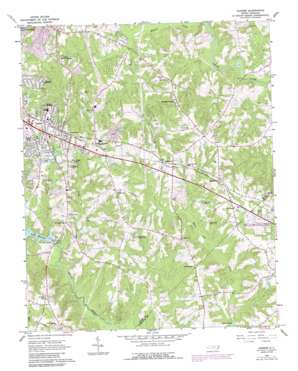
Garner Topo Map North Carolina
To zoom in, hover over the map of Garner
USGS Topo Quad 35078f5 - 1:24,000 scale
| Topo Map Name: | Garner |
| USGS Topo Quad ID: | 35078f5 |
| Print Size: | ca. 21 1/4" wide x 27" high |
| Southeast Coordinates: | 35.625° N latitude / 78.5° W longitude |
| Map Center Coordinates: | 35.6875° N latitude / 78.5625° W longitude |
| U.S. State: | NC |
| Filename: | o35078f5.jpg |
| Download Map JPG Image: | Garner topo map 1:24,000 scale |
| Map Type: | Topographic |
| Topo Series: | 7.5´ |
| Map Scale: | 1:24,000 |
| Source of Map Images: | United States Geological Survey (USGS) |
| Alternate Map Versions: |
Garner NC 1964, updated 1965 Download PDF Buy paper map Garner NC 1964, updated 1976 Download PDF Buy paper map Garner NC 1964, updated 1987 Download PDF Buy paper map Garner NC 1964, updated 1987 Download PDF Buy paper map Garner NC 1993, updated 1999 Download PDF Buy paper map Garner NC 2002, updated 2004 Download PDF Buy paper map Garner NC 2010 Download PDF Buy paper map Garner NC 2013 Download PDF Buy paper map Garner NC 2016 Download PDF Buy paper map |
1:24,000 Topo Quads surrounding Garner
> Back to 35078e1 at 1:100,000 scale
> Back to 35078a1 at 1:250,000 scale
> Back to U.S. Topo Maps home
Garner topo map: Gazetteer
Garner: Crossings
Interchange 303 elevation 86m 282′Interchange 306A elevation 110m 360′
Interchange 306B elevation 90m 295′
Garner: Dams
Bagwell Pond Dam elevation 77m 252′Eagle Crest Golf Course Dam elevation 73m 239′
Lake Benson Dam elevation 66m 216′
Penny Pond Dam elevation 72m 236′
Garner: Populated Places
Auburn elevation 103m 337′Bainbridge elevation 100m 328′
Cloverdale elevation 102m 334′
Dunhaven by the Lake elevation 82m 269′
Emerald Village elevation 95m 311′
Forest Hills elevation 98m 321′
Forest Landing elevation 97m 318′
Garner elevation 110m 360′
Garner Mobile Estates elevation 74m 242′
Heather Hills elevation 103m 337′
Heatheridge elevation 85m 278′
Hillandale elevation 107m 351′
Legend Hills elevation 77m 252′
Malibu Valley elevation 92m 301′
Pine Hurst Park elevation 105m 344′
School Acres elevation 100m 328′
Van Story Hills elevation 94m 308′
Village of White Oak elevation 105m 344′
White Oak elevation 108m 354′
Garner: Post Offices
Garner Post Office elevation 91m 298′Garner: Reservoirs
Bagwell Pond elevation 77m 252′Lake Benson elevation 65m 213′
Noname elevation 73m 239′
Penny Pond elevation 72m 236′
Garner: Streams
Big Branch elevation 53m 173′Mahlers Creek elevation 64m 209′
Neal Branch elevation 63m 206′
Garner digital topo map on disk
Buy this Garner topo map showing relief, roads, GPS coordinates and other geographical features, as a high-resolution digital map file on DVD:
South Carolina, Western North Carolina & Northeastern Georgia
Buy digital topo maps: South Carolina, Western North Carolina & Northeastern Georgia


