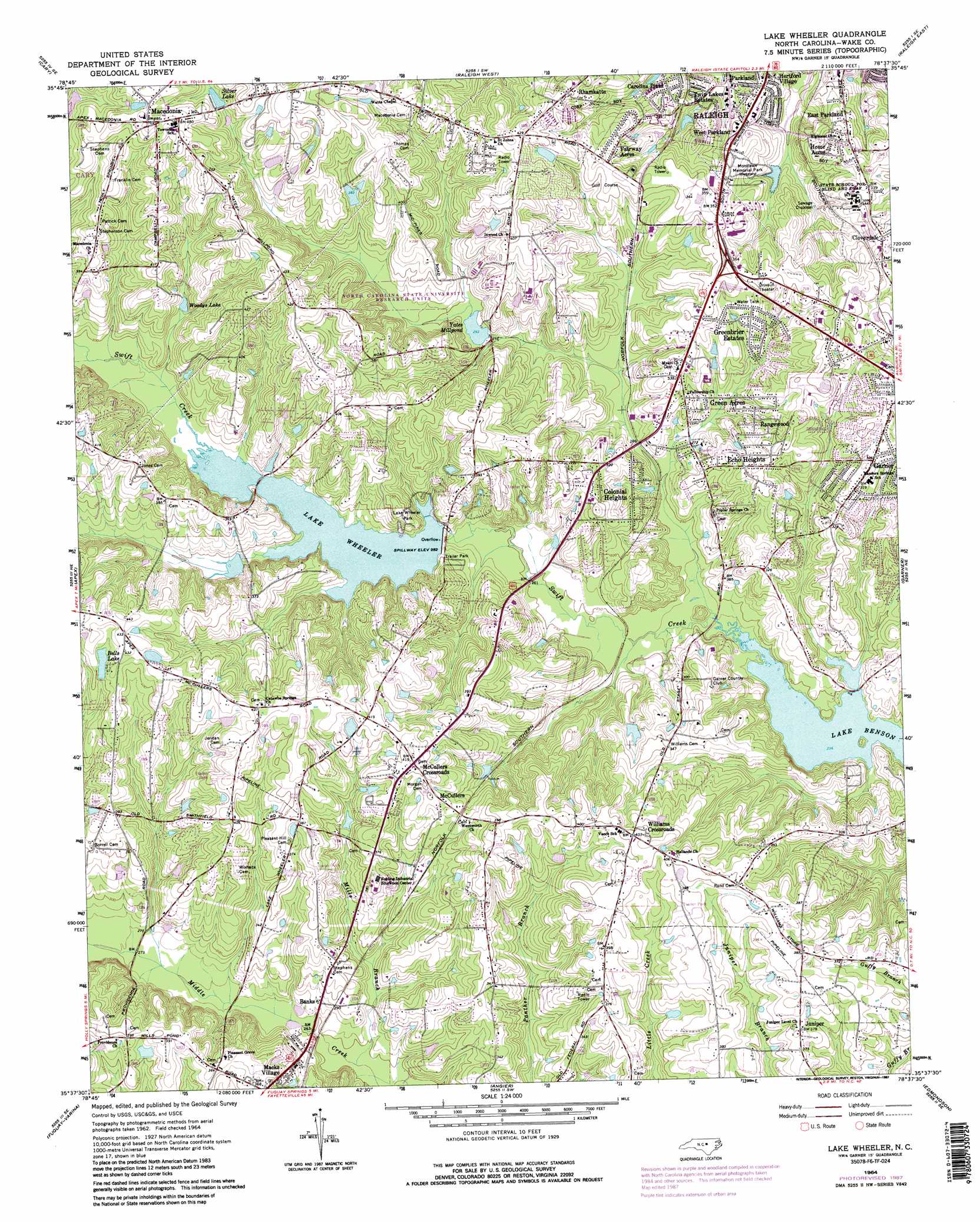
Lake Wheeler Topo Map North Carolina
To zoom in, hover over the map of Lake Wheeler
USGS Topo Quad 35078f6 - 1:24,000 scale
| Topo Map Name: | Lake Wheeler |
| USGS Topo Quad ID: | 35078f6 |
| Print Size: | ca. 21 1/4" wide x 27" high |
| Southeast Coordinates: | 35.625° N latitude / 78.625° W longitude |
| Map Center Coordinates: | 35.6875° N latitude / 78.6875° W longitude |
| U.S. State: | NC |
| Filename: | o35078f6.jpg |
| Download Map JPG Image: | Lake Wheeler topo map 1:24,000 scale |
| Map Type: | Topographic |
| Topo Series: | 7.5´ |
| Map Scale: | 1:24,000 |
| Source of Map Images: | United States Geological Survey (USGS) |
| Alternate Map Versions: |
Lake Wheeler NC 1964, updated 1965 Download PDF Buy paper map Lake Wheeler NC 1964, updated 1975 Download PDF Buy paper map Lake Wheeler NC 1964, updated 1984 Download PDF Buy paper map Lake Wheeler NC 1964, updated 1987 Download PDF Buy paper map Lake Wheeler NC 1964, updated 1987 Download PDF Buy paper map Lake Wheeler NC 1993, updated 1999 Download PDF Buy paper map Lake Wheeler NC 2002, updated 2004 Download PDF Buy paper map Lake Wheeler NC 2010 Download PDF Buy paper map Lake Wheeler NC 2013 Download PDF Buy paper map Lake Wheeler NC 2016 Download PDF Buy paper map |
1:24,000 Topo Quads surrounding Lake Wheeler
Southwest Durham |
Southeast Durham |
Bayleaf |
Wake Forest |
Rolesville |
Green Level |
Cary |
Raleigh West |
Raleigh East |
Knightdale |
New Hill |
Apex |
Lake Wheeler |
Garner |
Clayton |
Cokesbury |
Fuquay-Varina |
Angier |
Edmondson |
Powhatan |
Mamers |
Lillington |
Coats |
Benson |
Four Oaks |
> Back to 35078e1 at 1:100,000 scale
> Back to 35078a1 at 1:250,000 scale
> Back to U.S. Topo Maps home
Lake Wheeler topo map: Gazetteer
Lake Wheeler: Areas
North Carolina State University Research Units elevation 90m 295′Lake Wheeler: Dams
Dix Hill Conf Center Pond Dam elevation 117m 383′Dover Pond A Dam elevation 127m 416′
Lake Wheeler Dam elevation 88m 288′
Matthews Lake Dam elevation 110m 360′
NC State University Farm Unit Number Two Dam elevation 85m 278′
NCSU Pond Number One Dam elevation 117m 383′
Raleigh Municipal Lake Dam elevation 91m 298′
Yates Millpond Dam elevation 89m 291′
Lake Wheeler: Lakes
Woodys Lake elevation 100m 328′Lake Wheeler: Parks
Lake Wheeler Park elevation 103m 337′Lake Wheeler: Populated Places
All Star Mobile Home Park elevation 106m 347′Banks elevation 86m 282′
Barnes (historical) elevation 101m 331′
Carolina Pines elevation 98m 321′
Colonial Heights elevation 102m 334′
East Parkland elevation 93m 305′
Echo Heights elevation 105m 344′
Fairway Acres elevation 109m 357′
Green Acres elevation 87m 285′
Green Springs Mobile Park elevation 82m 269′
Greenbrier Estates elevation 99m 324′
Hertford Village elevation 89m 291′
Home Acres elevation 99m 324′
Hopedale elevation 97m 318′
Juniper elevation 115m 377′
Macedonia elevation 148m 485′
Macks Village elevation 94m 308′
McCullers elevation 118m 387′
McCullers Crossroads elevation 127m 416′
Parkland elevation 77m 252′
Rangewood elevation 91m 298′
Rhamkatte elevation 125m 410′
Rolling Hills elevation 78m 255′
Stagecrest elevation 102m 334′
Sunset Acres elevation 108m 354′
The Woodlands elevation 101m 331′
Tiffany Woods elevation 93m 305′
Twin Lakes Estates elevation 90m 295′
West Parkland elevation 93m 305′
Williams Crossroads elevation 123m 403′
Woodridge elevation 101m 331′
Lake Wheeler: Reservoirs
Bells Lake elevation 124m 406′Dix Hill Conference Center Pond elevation 117m 383′
Dover Pond A elevation 127m 416′
Lake Wheeler elevation 88m 288′
Matthews Lake elevation 110m 360′
McCullers Pond elevation 101m 331′
NC State University Farm Pond Number Two elevation 85m 278′
NCSU Pond Number One elevation 117m 383′
Parkers Pond elevation 75m 246′
Raleigh Municipal Lake elevation 91m 298′
Silver Lake elevation 130m 426′
Yates Millpond elevation 89m 291′
Lake Wheeler: Streams
Buck Branch elevation 71m 232′Dutchmans Branch elevation 86m 282′
Mills Branch elevation 75m 246′
Reedy Branch elevation 71m 232′
Lake Wheeler digital topo map on disk
Buy this Lake Wheeler topo map showing relief, roads, GPS coordinates and other geographical features, as a high-resolution digital map file on DVD:
South Carolina, Western North Carolina & Northeastern Georgia
Buy digital topo maps: South Carolina, Western North Carolina & Northeastern Georgia