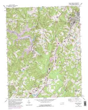
Wake Forest Topo Map North Carolina
To zoom in, hover over the map of Wake Forest
USGS Topo Quad 35078h5 - 1:24,000 scale
| Topo Map Name: | Wake Forest |
| USGS Topo Quad ID: | 35078h5 |
| Print Size: | ca. 21 1/4" wide x 27" high |
| Southeast Coordinates: | 35.875° N latitude / 78.5° W longitude |
| Map Center Coordinates: | 35.9375° N latitude / 78.5625° W longitude |
| U.S. State: | NC |
| Filename: | o35078h5.jpg |
| Download Map JPG Image: | Wake Forest topo map 1:24,000 scale |
| Map Type: | Topographic |
| Topo Series: | 7.5´ |
| Map Scale: | 1:24,000 |
| Source of Map Images: | United States Geological Survey (USGS) |
| Alternate Map Versions: |
Wake Forest NC 1967, updated 1972 Download PDF Buy paper map Wake Forest NC 1967, updated 1976 Download PDF Buy paper map Wake Forest NC 1967, updated 1980 Download PDF Buy paper map Wake Forest NC 1967, updated 1982 Download PDF Buy paper map Wake Forest NC 1967, updated 1987 Download PDF Buy paper map Wake Forest NC 1967, updated 1987 Download PDF Buy paper map Wake Forest NC 1993, updated 1999 Download PDF Buy paper map Wake Forest NC 2010 Download PDF Buy paper map Wake Forest NC 2013 Download PDF Buy paper map Wake Forest NC 2016 Download PDF Buy paper map |
1:24,000 Topo Quads surrounding Wake Forest
> Back to 35078e1 at 1:100,000 scale
> Back to 35078a1 at 1:250,000 scale
> Back to U.S. Topo Maps home
Wake Forest topo map: Gazetteer
Wake Forest: Crossings
Interchange 14 elevation 130m 426′Interchange 16 elevation 83m 272′
Wake Forest: Dams
Brown Lake Dam elevation 70m 229′Camp Durant Lake Number One Dam elevation 75m 246′
Camp Durant Lake Number Two Dam elevation 81m 265′
Camp Kanata Lake Number One Dam elevation 110m 360′
Camp Kanata Lake Number Two Dam elevation 109m 357′
Falls of the Neuse Dam elevation 64m 209′
Fuller Pond Dam elevation 89m 291′
Greshams Lake Dam elevation 77m 252′
Holdings Pond Dam elevation 91m 298′
Jones Pond Dam elevation 95m 311′
Marshalls Pond Dam Number One elevation 71m 232′
North Ridge Lower Dam elevation 86m 282′
North Ridge Upper Dam elevation 108m 354′
Ragsdale Pond Dam elevation 91m 298′
Wakefield Pond Number One Dam elevation 74m 242′
Wakefield Pond Number Two Dam elevation 95m 311′
Wake Forest: Populated Places
Falls elevation 61m 200′Forestville elevation 120m 393′
Neuse elevation 85m 278′
Neuse Crossroads elevation 77m 252′
Stony Hill elevation 124m 406′
Wake Crossroads elevation 75m 246′
Wake Forest elevation 119m 390′
Walkers Crossroads elevation 107m 351′
Wyatt elevation 104m 341′
Wake Forest: Reservoirs
Brown Lake elevation 70m 229′Camp Durant Lake Number One elevation 75m 246′
Camp Durant Lake Number Two elevation 81m 265′
Camp Kanata Lake Number One elevation 110m 360′
Camp Kanata Lake Number Two elevation 109m 357′
Falls Lake elevation 64m 209′
Fuller Pond elevation 89m 291′
Greshams Lake elevation 77m 252′
Holdings Pond elevation 91m 298′
Jones Pond elevation 95m 311′
Marshalls Pond Number One elevation 71m 232′
Ragsdale Pond elevation 91m 298′
Wakefield Pond Number One elevation 74m 242′
Wakefield Pond Number Two elevation 95m 311′
Wake Forest: Streams
Cedar Creek elevation 74m 242′Hatters Branch elevation 70m 229′
Honeycutt Creek elevation 74m 242′
Horse Creek elevation 74m 242′
Jennys Branch elevation 74m 242′
Lowery Creek elevation 76m 249′
Mud Branch elevation 83m 272′
Perry Creek elevation 57m 187′
Pierce Creek elevation 78m 255′
Richland Creek elevation 60m 196′
Sanford Creek elevation 63m 206′
Smith Creek elevation 58m 190′
Toms Creek elevation 58m 190′
Water Fork elevation 76m 249′
Wake Forest digital topo map on disk
Buy this Wake Forest topo map showing relief, roads, GPS coordinates and other geographical features, as a high-resolution digital map file on DVD:
South Carolina, Western North Carolina & Northeastern Georgia
Buy digital topo maps: South Carolina, Western North Carolina & Northeastern Georgia


