Norman Topo Map North Carolina
To zoom in, hover over the map of Norman
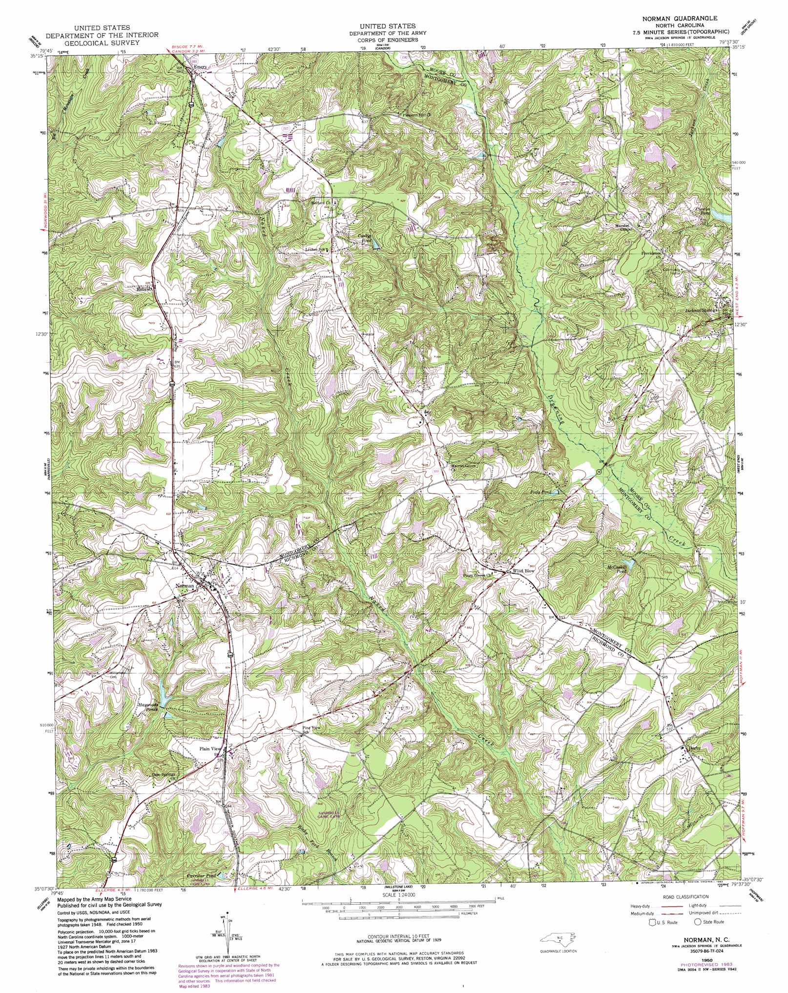
USGS Topo Quad 35079b6 - 1:24,000 scale
| Topo Map Name: | Norman |
| USGS Topo Quad ID: | 35079b6 |
| Print Size: | ca. 21 1/4" wide x 27" high |
| Southeast Coordinates: | 35.125° N latitude / 79.625° W longitude |
| Map Center Coordinates: | 35.1875° N latitude / 79.6875° W longitude |
| U.S. State: | NC |
| Filename: | o35079b6.jpg |
| Download Map JPG Image: | Norman topo map 1:24,000 scale |
| Map Type: | Topographic |
| Topo Series: | 7.5´ |
| Map Scale: | 1:24,000 |
| Source of Map Images: | United States Geological Survey (USGS) |
| Alternate Map Versions: |
Norman NC 1950, updated 1953 Download PDF Buy paper map Norman NC 1950, updated 1983 Download PDF Buy paper map Norman NC 1976, updated 1978 Download PDF Buy paper map Norman NC 2010 Download PDF Buy paper map Norman NC 2013 Download PDF Buy paper map Norman NC 2016 Download PDF Buy paper map |
1:24,000 Topo Quads surrounding Norman
Lovejoy |
Star |
Spies |
Robbins |
Putnam |
Troy |
Biscoe |
Candor |
Zion Grove |
Carthage |
Mount Gilead East |
Harrisville |
Norman |
West End |
Southern Pines |
Mangum |
Ellerbe |
Millstone Lake |
Hoffman |
Pinebluff |
Lilesville |
Rockingham |
Hamlet |
Marston |
Silver Hill |
> Back to 35079a1 at 1:100,000 scale
> Back to 35078a1 at 1:250,000 scale
> Back to U.S. Topo Maps home
Norman topo map: Gazetteer
Norman: Bridges
Currie Bridge elevation 114m 374′Harris Bridge elevation 121m 396′
McKenzie Bridge elevation 137m 449′
Stewart Bridge elevation 127m 416′
Norman: Dams
Chappell Pond Dam elevation 167m 547′Currie Pond Dam elevation 131m 429′
Dewitt Pond Dam elevation 160m 524′
North State Orchard Pond Number One Dam elevation 163m 534′
North State Orchard Pond Number Two Dam elevation 180m 590′
Phillip Bengston Dam Number One elevation 176m 577′
Phillip Bengston Dam Number Two elevation 155m 508′
Research Pond Number One Dam elevation 146m 479′
Research Pond Number Two Dam elevation 167m 547′
Norman: Populated Places
Derby elevation 160m 524′Emery elevation 208m 682′
Jackson Springs elevation 135m 442′
Norman elevation 190m 623′
Plain View elevation 178m 583′
Rubyatt elevation 199m 652′
Wind Blow elevation 170m 557′
Norman: Reservoirs
Carriker Pond elevation 158m 518′Chappell Pond elevation 167m 547′
Currie Pond elevation 131m 429′
Currys Pond elevation 169m 554′
Dewitt Pond elevation 160m 524′
Haywoods Ponds elevation 148m 485′
McCaskill Pond elevation 123m 403′
North State Orchard Pond Number One elevation 163m 534′
North State Orchard Pond Number Two elevation 180m 590′
Pools Pond elevation 131m 429′
Research Pond Number One elevation 146m 479′
Research Pond Number Two elevation 167m 547′
Norman digital topo map on disk
Buy this Norman topo map showing relief, roads, GPS coordinates and other geographical features, as a high-resolution digital map file on DVD:
South Carolina, Western North Carolina & Northeastern Georgia
Buy digital topo maps: South Carolina, Western North Carolina & Northeastern Georgia