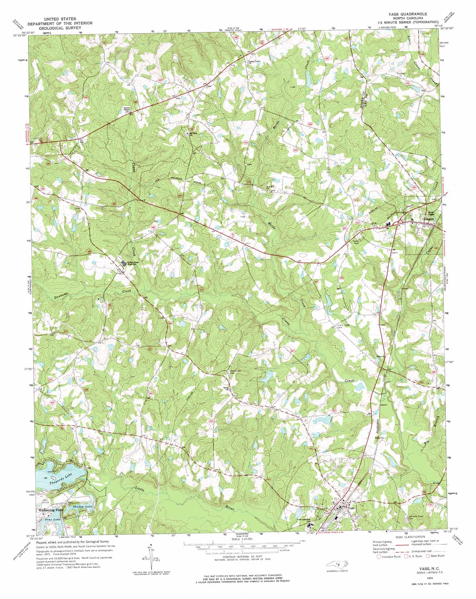
Vass Topo Map North Carolina
To zoom in, hover over the map of Vass
USGS Topo Quad 35079c3 - 1:24,000 scale
| Topo Map Name: | Vass |
| USGS Topo Quad ID: | 35079c3 |
| Print Size: | ca. 21 1/4" wide x 27" high |
| Southeast Coordinates: | 35.25° N latitude / 79.25° W longitude |
| Map Center Coordinates: | 35.3125° N latitude / 79.3125° W longitude |
| U.S. State: | NC |
| Filename: | o35079c3.jpg |
| Download Map JPG Image: | Vass topo map 1:24,000 scale |
| Map Type: | Topographic |
| Topo Series: | 7.5´ |
| Map Scale: | 1:24,000 |
| Source of Map Images: | United States Geological Survey (USGS) |
| Alternate Map Versions: |
Vass NC 1974, updated 1976 Download PDF Buy paper map Vass NC 2010 Download PDF Buy paper map Vass NC 2013 Download PDF Buy paper map Vass NC 2016 Download PDF Buy paper map |
1:24,000 Topo Quads surrounding Vass
Bennett |
Bear Creek |
Goldston |
Colon |
Moncure |
Robbins |
Putnam |
White Hill |
Sanford |
Broadway |
Zion Grove |
Carthage |
Vass |
Murchisontown |
Olivia |
West End |
Southern Pines |
Niagara |
Lobelia |
Overhills |
Hoffman |
Pinebluff |
Mccain |
Nicholson Creek |
Clifdale |
> Back to 35079a1 at 1:100,000 scale
> Back to 35078a1 at 1:250,000 scale
> Back to U.S. Topo Maps home
Vass topo map: Gazetteer
Vass: Dams
Morses Lake Dam elevation 103m 337′Pine Lake Dam elevation 106m 347′
Shadow Lake Dam elevation 96m 314′
Thagads Lake Dam elevation 85m 278′
Thurlows Lake Dam elevation 105m 344′
Troy Lumber Company Dam elevation 88m 288′
Vass: Populated Places
Cameron elevation 109m 357′Vass elevation 93m 305′
Whispering Pines elevation 113m 370′
Vass: Reservoirs
Morses Lake elevation 103m 337′Pine Lake elevation 106m 347′
Shadow Lake elevation 96m 314′
Thagards Lake elevation 85m 278′
Thurlows Lake elevation 105m 344′
Vass: Streams
Big Branch elevation 75m 246′Dunhams Creek elevation 98m 321′
Herds Creek elevation 84m 275′
Little Crane Creek elevation 77m 252′
Vass digital topo map on disk
Buy this Vass topo map showing relief, roads, GPS coordinates and other geographical features, as a high-resolution digital map file on DVD:
South Carolina, Western North Carolina & Northeastern Georgia
Buy digital topo maps: South Carolina, Western North Carolina & Northeastern Georgia