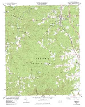
Biscoe Topo Map North Carolina
To zoom in, hover over the map of Biscoe
USGS Topo Quad 35079c7 - 1:24,000 scale
| Topo Map Name: | Biscoe |
| USGS Topo Quad ID: | 35079c7 |
| Print Size: | ca. 21 1/4" wide x 27" high |
| Southeast Coordinates: | 35.25° N latitude / 79.75° W longitude |
| Map Center Coordinates: | 35.3125° N latitude / 79.8125° W longitude |
| U.S. State: | NC |
| Filename: | o35079c7.jpg |
| Download Map JPG Image: | Biscoe topo map 1:24,000 scale |
| Map Type: | Topographic |
| Topo Series: | 7.5´ |
| Map Scale: | 1:24,000 |
| Source of Map Images: | United States Geological Survey (USGS) |
| Alternate Map Versions: |
Biscoe NC 1983, updated 1983 Download PDF Buy paper map Biscoe NC 1994, updated 1996 Download PDF Buy paper map Biscoe NC 2011 Download PDF Buy paper map Biscoe NC 2013 Download PDF Buy paper map Biscoe NC 2016 Download PDF Buy paper map |
| FStopo: | US Forest Service topo Biscoe is available: Download FStopo PDF Download FStopo TIF |
1:24,000 Topo Quads surrounding Biscoe
> Back to 35079a1 at 1:100,000 scale
> Back to 35078a1 at 1:250,000 scale
> Back to U.S. Topo Maps home
Biscoe topo map: Gazetteer
Biscoe: Dams
Capelsie Lake Dam elevation 123m 403′Lewis Millpond Dam elevation 145m 475′
Parson Brothers Pond Dam elevation 216m 708′
Smitherman Millpond Dam elevation 126m 413′
Biscoe: Populated Places
Biscoe elevation 188m 616′Capelsie elevation 128m 419′
Onvil elevation 158m 518′
Biscoe: Reservoirs
Capelsie Lake elevation 123m 403′Lewis Mill Pond elevation 145m 475′
McCullums Pond elevation 189m 620′
Parson Brothers Pond elevation 216m 708′
Smitherman Mill Pond elevation 126m 413′
Biscoe: Streams
Big Branch elevation 147m 482′Big Creek elevation 106m 347′
Bridgers Creek elevation 112m 367′
Cedar Creek elevation 117m 383′
Densons Creek elevation 126m 413′
Gillis Branch elevation 147m 482′
Gold Branch elevation 162m 531′
Half Mile Branch elevation 112m 367′
Hickory Branch elevation 163m 534′
Little Creek elevation 140m 459′
Little Dry Creek elevation 112m 367′
Muddy Branch elevation 133m 436′
Muddy Creek elevation 111m 364′
Reedy Fork elevation 163m 534′
Rock Branch elevation 137m 449′
Sams Creek elevation 114m 374′
Spencer Branch elevation 121m 396′
Taylor Branch elevation 135m 442′
Turkey Creek elevation 112m 367′
White Oak Creek elevation 138m 452′
Biscoe digital topo map on disk
Buy this Biscoe topo map showing relief, roads, GPS coordinates and other geographical features, as a high-resolution digital map file on DVD:
South Carolina, Western North Carolina & Northeastern Georgia
Buy digital topo maps: South Carolina, Western North Carolina & Northeastern Georgia


