Spies Topo Map North Carolina
To zoom in, hover over the map of Spies
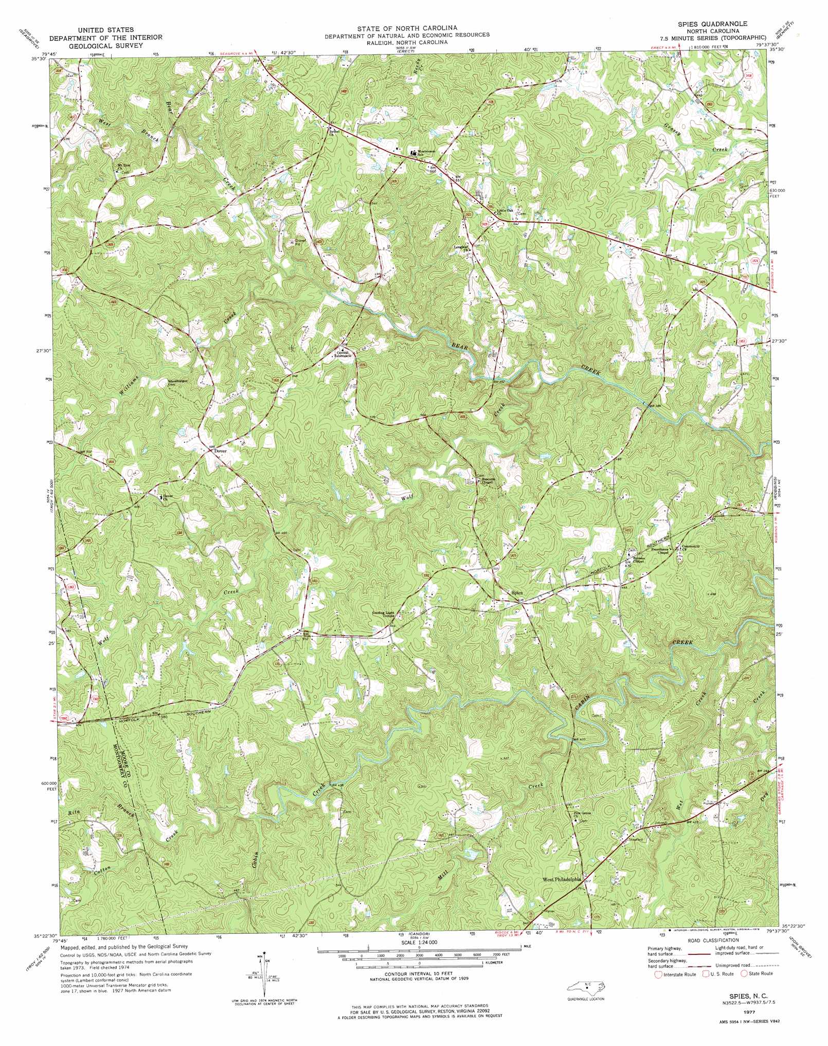
USGS Topo Quad 35079d6 - 1:24,000 scale
| Topo Map Name: | Spies |
| USGS Topo Quad ID: | 35079d6 |
| Print Size: | ca. 21 1/4" wide x 27" high |
| Southeast Coordinates: | 35.375° N latitude / 79.625° W longitude |
| Map Center Coordinates: | 35.4375° N latitude / 79.6875° W longitude |
| U.S. State: | NC |
| Filename: | o35079d6.jpg |
| Download Map JPG Image: | Spies topo map 1:24,000 scale |
| Map Type: | Topographic |
| Topo Series: | 7.5´ |
| Map Scale: | 1:24,000 |
| Source of Map Images: | United States Geological Survey (USGS) |
| Alternate Map Versions: |
Spies NC 1977, updated 1978 Download PDF Buy paper map Spies NC 2010 Download PDF Buy paper map Spies NC 2013 Download PDF Buy paper map Spies NC 2016 Download PDF Buy paper map |
1:24,000 Topo Quads surrounding Spies
Farmer |
Asheboro |
Ramseur |
Coleridge |
Siler City |
Eleazer |
Seagrove |
Erect |
Bennett |
Bear Creek |
Lovejoy |
Star |
Spies |
Robbins |
Putnam |
Troy |
Biscoe |
Candor |
Zion Grove |
Carthage |
Mount Gilead East |
Harrisville |
Norman |
West End |
Southern Pines |
> Back to 35079a1 at 1:100,000 scale
> Back to 35078a1 at 1:250,000 scale
> Back to U.S. Topo Maps home
Spies topo map: Gazetteer
Spies: Dams
Hussey Dam elevation 163m 534′Spies: Populated Places
Dover elevation 179m 587′Spies elevation 164m 538′
West Philadelphia elevation 155m 508′
Spies: Streams
Cotton Creek elevation 134m 439′Dry Creek elevation 109m 357′
Horse Creek elevation 118m 387′
Mill Creek elevation 121m 396′
Rita Branch elevation 154m 505′
West Branch Bear Creek elevation 142m 465′
Wet Creek elevation 108m 354′
Williams Creek elevation 125m 410′
Wolf Creek elevation 114m 374′
Spies digital topo map on disk
Buy this Spies topo map showing relief, roads, GPS coordinates and other geographical features, as a high-resolution digital map file on DVD:
South Carolina, Western North Carolina & Northeastern Georgia
Buy digital topo maps: South Carolina, Western North Carolina & Northeastern Georgia