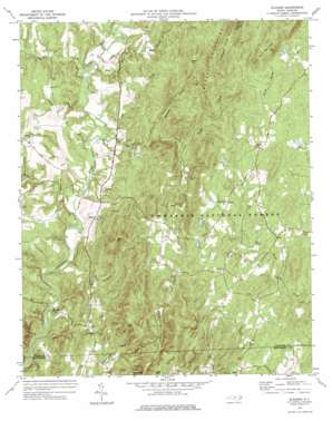
Eleazer Topo Map North Carolina
To zoom in, hover over the map of Eleazer
USGS Topo Quad 35079e8 - 1:24,000 scale
| Topo Map Name: | Eleazer |
| USGS Topo Quad ID: | 35079e8 |
| Print Size: | ca. 21 1/4" wide x 27" high |
| Southeast Coordinates: | 35.5° N latitude / 79.875° W longitude |
| Map Center Coordinates: | 35.5625° N latitude / 79.9375° W longitude |
| U.S. State: | NC |
| Filename: | o35079e8.jpg |
| Download Map JPG Image: | Eleazer topo map 1:24,000 scale |
| Map Type: | Topographic |
| Topo Series: | 7.5´ |
| Map Scale: | 1:24,000 |
| Source of Map Images: | United States Geological Survey (USGS) |
| Alternate Map Versions: |
Eleazer NC 1973, updated 1976 Download PDF Buy paper map Eleazer NC 1994, updated 1996 Download PDF Buy paper map Eleazer NC 2011 Download PDF Buy paper map Eleazer NC 2013 Download PDF Buy paper map Eleazer NC 2016 Download PDF Buy paper map |
| FStopo: | US Forest Service topo Eleazer is available: Download FStopo PDF Download FStopo TIF |
1:24,000 Topo Quads surrounding Eleazer
> Back to 35079e1 at 1:100,000 scale
> Back to 35078a1 at 1:250,000 scale
> Back to U.S. Topo Maps home
Eleazer topo map: Gazetteer
Eleazer: Dams
Springs Lake Dam elevation 242m 793′Eleazer: Populated Places
Eleazer elevation 193m 633′Eleazer: Reservoirs
Springs Lake elevation 242m 793′Eleazer: Streams
Betty McGees Creek elevation 119m 390′Hannahs Creek elevation 113m 370′
Lakes Creek elevation 107m 351′
Laniers Creek elevation 114m 374′
Mill Creek elevation 110m 360′
Narrows Branch elevation 106m 347′
North Prong Hannahs Creek elevation 161m 528′
Robbins Branch elevation 149m 488′
Sand Branch elevation 128m 419′
Second Creek elevation 113m 370′
Silver Run Creek elevation 113m 370′
South Prong Hannahs Creek elevation 161m 528′
Toms Creek elevation 115m 377′
Twomile Creek elevation 117m 383′
Walkers Creek elevation 108m 354′
Eleazer: Summits
Black Mountain elevation 284m 931′Brush Mountain elevation 247m 810′
Cedar Rock Mountain elevation 300m 984′
Coolers Knob Mountain elevation 286m 938′
King Mountain elevation 307m 1007′
Little Long Mountain elevation 280m 918′
Eleazer: Trails
Birkhead Trail elevation 249m 816′Eleazer digital topo map on disk
Buy this Eleazer topo map showing relief, roads, GPS coordinates and other geographical features, as a high-resolution digital map file on DVD:
South Carolina, Western North Carolina & Northeastern Georgia
Buy digital topo maps: South Carolina, Western North Carolina & Northeastern Georgia


