Siler City Ne Topo Map North Carolina
To zoom in, hover over the map of Siler City Ne
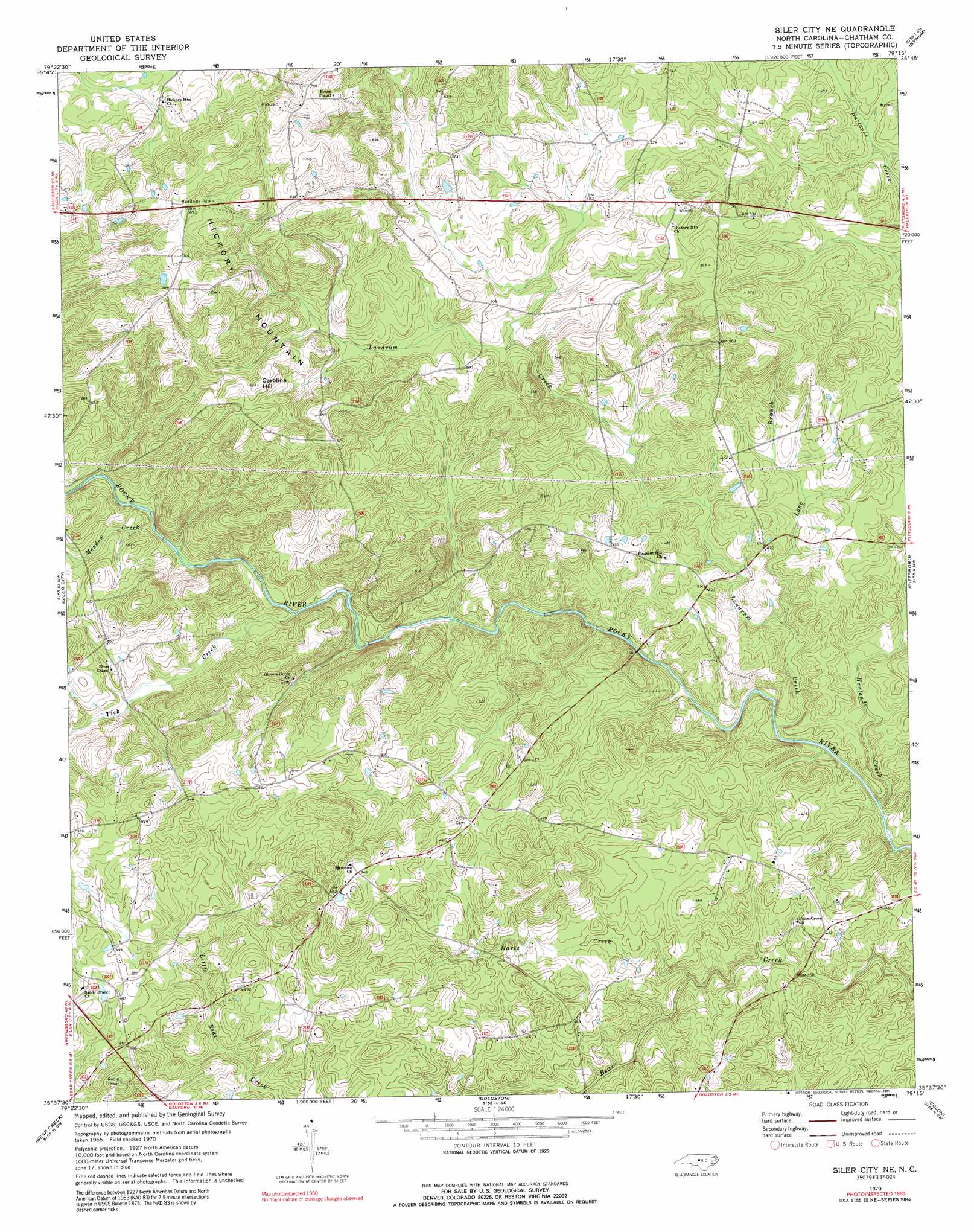
USGS Topo Quad 35079f3 - 1:24,000 scale
| Topo Map Name: | Siler City Ne |
| USGS Topo Quad ID: | 35079f3 |
| Print Size: | ca. 21 1/4" wide x 27" high |
| Southeast Coordinates: | 35.625° N latitude / 79.25° W longitude |
| Map Center Coordinates: | 35.6875° N latitude / 79.3125° W longitude |
| U.S. State: | NC |
| Filename: | o35079f3.jpg |
| Download Map JPG Image: | Siler City Ne topo map 1:24,000 scale |
| Map Type: | Topographic |
| Topo Series: | 7.5´ |
| Map Scale: | 1:24,000 |
| Source of Map Images: | United States Geological Survey (USGS) |
| Alternate Map Versions: |
Siler City NE NC 1970, updated 1973 Download PDF Buy paper map Siler City NE NC 1970, updated 1991 Download PDF Buy paper map Siler City NE NC 2010 Download PDF Buy paper map Siler City NE NC 2013 Download PDF Buy paper map Siler City NE NC 2016 Download PDF Buy paper map |
1:24,000 Topo Quads surrounding Siler City Ne
Kimesville |
Snow Camp |
Saxapahaw |
White Cross |
Chapel Hill |
Liberty |
Crutchfield Crossroads |
Silk Hope |
Bynum |
Farrington |
Coleridge |
Siler City |
Siler City Ne |
Pittsboro |
Merry Oaks |
Bennett |
Bear Creek |
Goldston |
Colon |
Moncure |
Robbins |
Putnam |
White Hill |
Sanford |
Broadway |
> Back to 35079e1 at 1:100,000 scale
> Back to 35078a1 at 1:250,000 scale
> Back to U.S. Topo Maps home
Siler City Ne topo map: Gazetteer
Siler City Ne: Dams
Cameron Pond Dam elevation 128m 419′Hadley Millpond Dam elevation 144m 472′
Siler City Ne: Reservoirs
Cameron Pond elevation 128m 419′Hadleys Mill Pond elevation 144m 472′
Siler City Ne: Streams
Harlands Creek elevation 98m 321′Harts Creek elevation 106m 347′
Landrum Creek elevation 101m 331′
Long Branch elevation 107m 351′
Meadow Creek elevation 132m 433′
Tick Creek elevation 122m 400′
Siler City Ne: Summits
Carolina Hill elevation 192m 629′Hickory Mountain elevation 210m 688′
Siler City Ne digital topo map on disk
Buy this Siler City Ne topo map showing relief, roads, GPS coordinates and other geographical features, as a high-resolution digital map file on DVD:
South Carolina, Western North Carolina & Northeastern Georgia
Buy digital topo maps: South Carolina, Western North Carolina & Northeastern Georgia