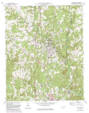
Randleman Topo Map North Carolina
To zoom in, hover over the map of Randleman
USGS Topo Quad 35079g7 - 1:24,000 scale
| Topo Map Name: | Randleman |
| USGS Topo Quad ID: | 35079g7 |
| Print Size: | ca. 21 1/4" wide x 27" high |
| Southeast Coordinates: | 35.75° N latitude / 79.75° W longitude |
| Map Center Coordinates: | 35.8125° N latitude / 79.8125° W longitude |
| U.S. State: | NC |
| Filename: | o35079g7.jpg |
| Download Map JPG Image: | Randleman topo map 1:24,000 scale |
| Map Type: | Topographic |
| Topo Series: | 7.5´ |
| Map Scale: | 1:24,000 |
| Source of Map Images: | United States Geological Survey (USGS) |
| Alternate Map Versions: |
Randleman NC 1970, updated 1973 Download PDF Buy paper map Randleman NC 1970, updated 1982 Download PDF Buy paper map Randleman NC 2010 Download PDF Buy paper map Randleman NC 2013 Download PDF Buy paper map Randleman NC 2016 Download PDF Buy paper map |
1:24,000 Topo Quads surrounding Randleman
> Back to 35079e1 at 1:100,000 scale
> Back to 35078a1 at 1:250,000 scale
> Back to U.S. Topo Maps home
Randleman topo map: Gazetteer
Randleman: Dams
Camp Nawaka Lake Dam Number One elevation 195m 639′Carl Hamlett Lake Dam elevation 208m 682′
Cox Lake Dam elevation 172m 564′
Davis Lake Dam elevation 224m 734′
East Buttke elevation 210m 688′
East Hamlett elevation 201m 659′
Hylton Dam elevation 183m 600′
Oakwinds Dam elevation 224m 734′
Randleman City Lake Dam elevation 179m 587′
Richardson Lake Dam elevation 208m 682′
Worthville Lake Dam elevation 177m 580′
Randleman: Populated Places
Central Falls elevation 197m 646′Dayspring elevation 223m 731′
New Market elevation 244m 800′
Randleman elevation 210m 688′
Salem elevation 231m 757′
Sophia elevation 237m 777′
Worthville elevation 202m 662′
Randleman: Reservoirs
Camp Nawaka Lake elevation 195m 639′Carl Hamlett Lake elevation 208m 682′
Cox Lake elevation 172m 564′
Davis Lake elevation 224m 734′
East Buttke Dam elevation 210m 688′
East Hamlett Lake elevation 201m 659′
Hylton Lake elevation 183m 600′
Oakwinds Lake elevation 224m 734′
Randleman City Lake elevation 179m 587′
Richardson Lake elevation 208m 682′
Worthville Lake elevation 177m 580′
Randleman: Streams
Bob Branch elevation 194m 636′Hasketts Creek elevation 174m 570′
Little Polecat Creek elevation 196m 643′
Muddy Creek elevation 191m 626′
Penwood Branch elevation 187m 613′
Polecat Creek elevation 178m 583′
Randleman digital topo map on disk
Buy this Randleman topo map showing relief, roads, GPS coordinates and other geographical features, as a high-resolution digital map file on DVD:
South Carolina, Western North Carolina & Northeastern Georgia
Buy digital topo maps: South Carolina, Western North Carolina & Northeastern Georgia


