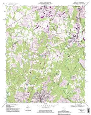
Fort Mill Topo Map South Carolina
To zoom in, hover over the map of Fort Mill
USGS Topo Quad 35080a8 - 1:24,000 scale
| Topo Map Name: | Fort Mill |
| USGS Topo Quad ID: | 35080a8 |
| Print Size: | ca. 21 1/4" wide x 27" high |
| Southeast Coordinates: | 35° N latitude / 80.875° W longitude |
| Map Center Coordinates: | 35.0625° N latitude / 80.9375° W longitude |
| U.S. States: | SC, NC |
| Filename: | o35080a8.jpg |
| Download Map JPG Image: | Fort Mill topo map 1:24,000 scale |
| Map Type: | Topographic |
| Topo Series: | 7.5´ |
| Map Scale: | 1:24,000 |
| Source of Map Images: | United States Geological Survey (USGS) |
| Alternate Map Versions: |
Fort Mill SC 1968, updated 1970 Download PDF Buy paper map Fort Mill SC 1968, updated 1981 Download PDF Buy paper map Fort Mill SC 1993, updated 1996 Download PDF Buy paper map Fort Mill SC 2011 Download PDF Buy paper map Fort Mill SC 2014 Download PDF Buy paper map |
1:24,000 Topo Quads surrounding Fort Mill
> Back to 35080a1 at 1:100,000 scale
> Back to 35080a1 at 1:250,000 scale
> Back to U.S. Topo Maps home
Fort Mill topo map: Gazetteer
Fort Mill: Airports
Carowinds Airport elevation 191m 626′Flying H Farm Airport elevation 191m 626′
Fort Mill: Canals
Polk Ditch elevation 176m 577′Fort Mill: Crossings
Interchange 85 elevation 212m 695′Interchange 88 elevation 194m 636′
Interchange 90 elevation 189m 620′
Fort Mill: Dams
Creech Pond Dam D-1236 elevation 172m 564′Crystal Springs Lake Dam elevation 167m 547′
Gibson Pond Dam D-3644 elevation 186m 610′
Heritage Lake Dam D-3648 elevation 178m 583′
Lake Crandall Dam D-3646 elevation 180m 590′
Lake Elliot Dam D-1234 elevation 183m 600′
Lake Frances Dam D-3647 elevation 171m 561′
South Carolina Noname 46015 D-3480 Dam elevation 182m 597′
South Carolina Noname 46016 D-1238 Dam elevation 164m 538′
South Carolina Noname 46032 D-3645 Dam elevation 171m 561′
Stalling Pond Dam D-1233 elevation 201m 659′
Fort Mill: Mines
Pineville Quarry elevation 162m 531′Fort Mill: Parks
Carowinds elevation 196m 643′Carowinds elevation 192m 629′
Fort Mill: Populated Places
Banalsburg (historical) elevation 195m 639′Barberville elevation 198m 649′
Camp Cox elevation 184m 603′
Carowood elevation 210m 688′
Eden Gardens elevation 173m 567′
Forest Lake elevation 197m 646′
Fort Mill elevation 190m 623′
Grey Rock elevation 207m 679′
Kanawha Hills elevation 198m 649′
Morrows (historical) elevation 198m 649′
Old Orchid elevation 189m 620′
Pineville elevation 174m 570′
Ravenwood elevation 175m 574′
Riverview elevation 196m 643′
Sharonbrook elevation 186m 610′
Sterling elevation 202m 662′
Whiteville Park elevation 186m 610′
Fort Mill: Reservoirs
Creech Pond elevation 172m 564′Crystal Springs Lake elevation 167m 547′
Forest Lake elevation 171m 561′
Gibson Pond elevation 186m 610′
Heritage Lake elevation 178m 583′
Lake Crandall elevation 180m 590′
Lake Elliot elevation 183m 600′
Lake Elliott elevation 184m 603′
Lake Frances elevation 171m 561′
Lake Haigler elevation 164m 538′
Lake Haigler elevation 162m 531′
Lake Patricia elevation 180m 590′
Number One Settling Basin elevation 180m 590′
Stalling Pond elevation 200m 656′
Stallings Pond elevation 201m 659′
Fort Mill: Streams
Blankmanship Branch elevation 164m 538′Blankmanship Branch elevation 164m 538′
Clems Branch elevation 151m 495′
Jackson Branch elevation 161m 528′
Johnnytown Branch elevation 152m 498′
Kings Branch elevation 179m 587′
Little Sugar Creek elevation 158m 518′
Little Sugar Creek elevation 158m 518′
McAlpine Creek elevation 154m 505′
McAlpine Creek elevation 154m 505′
McCullough Branch elevation 158m 518′
Steele Creek elevation 152m 498′
Steele Creek elevation 152m 498′
Walker Branch elevation 171m 561′
Fort Mill digital topo map on disk
Buy this Fort Mill topo map showing relief, roads, GPS coordinates and other geographical features, as a high-resolution digital map file on DVD:
South Carolina, Western North Carolina & Northeastern Georgia
Buy digital topo maps: South Carolina, Western North Carolina & Northeastern Georgia


