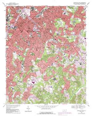
Charlotte East Topo Map North Carolina
To zoom in, hover over the map of Charlotte East
USGS Topo Quad 35080b7 - 1:24,000 scale
| Topo Map Name: | Charlotte East |
| USGS Topo Quad ID: | 35080b7 |
| Print Size: | ca. 21 1/4" wide x 27" high |
| Southeast Coordinates: | 35.125° N latitude / 80.75° W longitude |
| Map Center Coordinates: | 35.1875° N latitude / 80.8125° W longitude |
| U.S. State: | NC |
| Filename: | o35080b7.jpg |
| Download Map JPG Image: | Charlotte East topo map 1:24,000 scale |
| Map Type: | Topographic |
| Topo Series: | 7.5´ |
| Map Scale: | 1:24,000 |
| Source of Map Images: | United States Geological Survey (USGS) |
| Alternate Map Versions: |
Charlotte East NC 1948, updated 1965 Download PDF Buy paper map Charlotte East NC 1949 Download PDF Buy paper map Charlotte East NC 1967, updated 1969 Download PDF Buy paper map Charlotte East NC 1967, updated 1981 Download PDF Buy paper map Charlotte East NC 1967, updated 1989 Download PDF Buy paper map Charlotte East NC 2010 Download PDF Buy paper map Charlotte East NC 2013 Download PDF Buy paper map Charlotte East NC 2016 Download PDF Buy paper map |
1:24,000 Topo Quads surrounding Charlotte East
> Back to 35080a1 at 1:100,000 scale
> Back to 35080a1 at 1:250,000 scale
> Back to U.S. Topo Maps home
Charlotte East topo map: Gazetteer
Charlotte East: Airports
Enterprise Airport elevation 228m 748′Law Enforcement Center Airport elevation 210m 688′
Sharon Airport elevation 212m 695′
WBTV Airport elevation 193m 633′
Charlotte East: Dams
Park Road Lake Dam elevation 184m 603′Charlotte East: Parks
Abbott Park elevation 190m 623′Alexander Street Park elevation 197m 646′
American Legion Memorial Stadium elevation 198m 649′
Bank of America Stadium elevation 218m 715′
Bryant Park elevation 192m 629′
Carmel Road Park elevation 208m 682′
Clark Griffith Park elevation 223m 731′
Cordelia Park elevation 214m 702′
Freedom Park elevation 186m 610′
Highland Park elevation 214m 702′
Independence Park elevation 207m 679′
Kilborne District Park elevation 236m 774′
Latta Park elevation 211m 692′
Methodist Home Park elevation 206m 675′
Midwood Park elevation 223m 731′
Park Road Park elevation 189m 620′
Charlotte East: Populated Places
Barclay Downs elevation 197m 646′Belmont elevation 235m 770′
Beverly Woods elevation 198m 649′
Beverly Woods East elevation 206m 675′
Biddleville elevation 206m 675′
Bishops Ridge elevation 184m 603′
Brandon elevation 202m 662′
Carmel elevation 203m 666′
Carmel Park elevation 210m 688′
Carmel Woods elevation 206m 675′
Castleton Gardens elevation 221m 725′
Chantilly elevation 216m 708′
Charlotte elevation 232m 761′
Cherry elevation 206m 675′
Colonial Heights elevation 217m 711′
Cotswold elevation 218m 715′
Country Roads elevation 198m 649′
Coventry Woods elevation 225m 738′
Currituck elevation 210m 688′
Darby Acres elevation 235m 770′
Dilworth elevation 220m 721′
Eastfield elevation 229m 751′
Eastover elevation 207m 679′
Elizabeth elevation 206m 675′
Fairmeadows elevation 201m 659′
Fourth Ward elevation 220m 721′
Fox Run elevation 214m 702′
Foxcroft elevation 203m 666′
Glenwood elevation 207m 679′
Greenville elevation 210m 688′
Grier Heights elevation 198m 649′
Hampton Leas elevation 198m 649′
Hebron (historical) elevation 181m 593′
Huntingtowne Farms elevation 192m 629′
Landsdowne elevation 203m 666′
Lockewood elevation 227m 744′
Mayfair elevation 207m 679′
Midwood elevation 219m 718′
Montclaire elevation 203m 666′
Mountain Brook elevation 203m 666′
Myers Park elevation 205m 672′
North Charlotte elevation 225m 738′
Oakhurst elevation 233m 764′
Old Farm elevation 198m 649′
Old Providence elevation 194m 636′
Old Salem elevation 208m 682′
Olde Georgetowne elevation 207m 679′
Olde Heritage elevation 187m 613′
Parkstone elevation 190m 623′
Parkview East elevation 224m 734′
Pellyn Wood elevation 196m 643′
Providence Park elevation 207m 679′
Providence Woods elevation 195m 639′
Queens Grant elevation 203m 666′
Rama elevation 219m 718′
Robinson Woods elevation 215m 705′
Rosemont elevation 212m 695′
Sardis elevation 188m 616′
Sardis Cove elevation 189m 620′
Sardis Oaks elevation 202m 662′
Sedgefield elevation 217m 711′
Selwyn Park elevation 181m 593′
Severville elevation 211m 692′
Shannon Park elevation 218m 715′
Sharon Colony elevation 208m 682′
Sherwood Forest elevation 214m 702′
Singing Springs elevation 201m 659′
Southpark elevation 213m 698′
Spring Valley elevation 203m 666′
Starmount elevation 182m 597′
Stonehaven elevation 214m 702′
The Cloisters elevation 203m 666′
Third Ward elevation 215m 705′
Villa Heights elevation 222m 728′
Waverly Hall elevation 205m 672′
Wesley Heights elevation 211m 692′
Wilmore elevation 221m 725′
Windsor Park elevation 228m 748′
Winterfield elevation 230m 754′
Woodberry Forest elevation 209m 685′
Woodbridge elevation 210m 688′
Wynnwood elevation 224m 734′
Charlotte East: Reservoirs
Park Road Lake elevation 184m 603′Charlotte East: Streams
Brier Creek elevation 175m 574′Dairy Branch elevation 186m 610′
Edwards Branch elevation 192m 629′
Little Hope Creek elevation 174m 570′
Stewart Creek elevation 196m 643′
Stewart Creek elevation 196m 643′
Charlotte East digital topo map on disk
Buy this Charlotte East topo map showing relief, roads, GPS coordinates and other geographical features, as a high-resolution digital map file on DVD:
South Carolina, Western North Carolina & Northeastern Georgia
Buy digital topo maps: South Carolina, Western North Carolina & Northeastern Georgia


