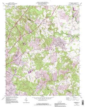
Harrisburg Topo Map North Carolina
To zoom in, hover over the map of Harrisburg
USGS Topo Quad 35080c6 - 1:24,000 scale
| Topo Map Name: | Harrisburg |
| USGS Topo Quad ID: | 35080c6 |
| Print Size: | ca. 21 1/4" wide x 27" high |
| Southeast Coordinates: | 35.25° N latitude / 80.625° W longitude |
| Map Center Coordinates: | 35.3125° N latitude / 80.6875° W longitude |
| U.S. State: | NC |
| Filename: | o35080c6.jpg |
| Download Map JPG Image: | Harrisburg topo map 1:24,000 scale |
| Map Type: | Topographic |
| Topo Series: | 7.5´ |
| Map Scale: | 1:24,000 |
| Source of Map Images: | United States Geological Survey (USGS) |
| Alternate Map Versions: |
Harrisburg NC 1949 Download PDF Buy paper map Harrisburg NC 1969, updated 1972 Download PDF Buy paper map Harrisburg NC 1969, updated 1988 Download PDF Buy paper map Harrisburg NC 1993, updated 1996 Download PDF Buy paper map Harrisburg NC 2010 Download PDF Buy paper map Harrisburg NC 2013 Download PDF Buy paper map Harrisburg NC 2016 Download PDF Buy paper map |
1:24,000 Topo Quads surrounding Harrisburg
> Back to 35080a1 at 1:100,000 scale
> Back to 35080a1 at 1:250,000 scale
> Back to U.S. Topo Maps home
Harrisburg topo map: Gazetteer
Harrisburg: Airports
World 600 Airport elevation 218m 715′Harrisburg: Dams
Keasler Lake Dam elevation 185m 606′Harrisburg: Lakes
Hechenbleikner Lake elevation 218m 715′Harrisburg: Parks
Harrisburg Community Park elevation 178m 583′Reedy Creek Park elevation 216m 708′
Harrisburg: Populated Places
Candlewood elevation 233m 764′Casa Linda Estates elevation 210m 688′
College Downs elevation 227m 744′
Eastfield (historical) elevation 215m 705′
Grierview elevation 247m 810′
Harrisburg elevation 192m 629′
Monteith (historical) elevation 208m 682′
Newell elevation 230m 754′
Newell Acres elevation 248m 813′
Pine Ridge elevation 223m 731′
Querys Dixons (historical) elevation 219m 718′
Roberta Mill elevation 180m 590′
Rolling Acres elevation 233m 764′
Whispering Oaks elevation 236m 774′
Harrisburg: Reservoirs
Keasler Lake elevation 185m 606′Twin Lakes elevation 169m 554′
Harrisburg: Streams
Fuda Creek elevation 169m 554′Mallard Creek elevation 166m 544′
McKee Creek elevation 172m 564′
Stony Creek elevation 176m 577′
Toby Creek elevation 180m 590′
Wolf Meadow Branch elevation 169m 554′
Harrisburg digital topo map on disk
Buy this Harrisburg topo map showing relief, roads, GPS coordinates and other geographical features, as a high-resolution digital map file on DVD:
South Carolina, Western North Carolina & Northeastern Georgia
Buy digital topo maps: South Carolina, Western North Carolina & Northeastern Georgia


