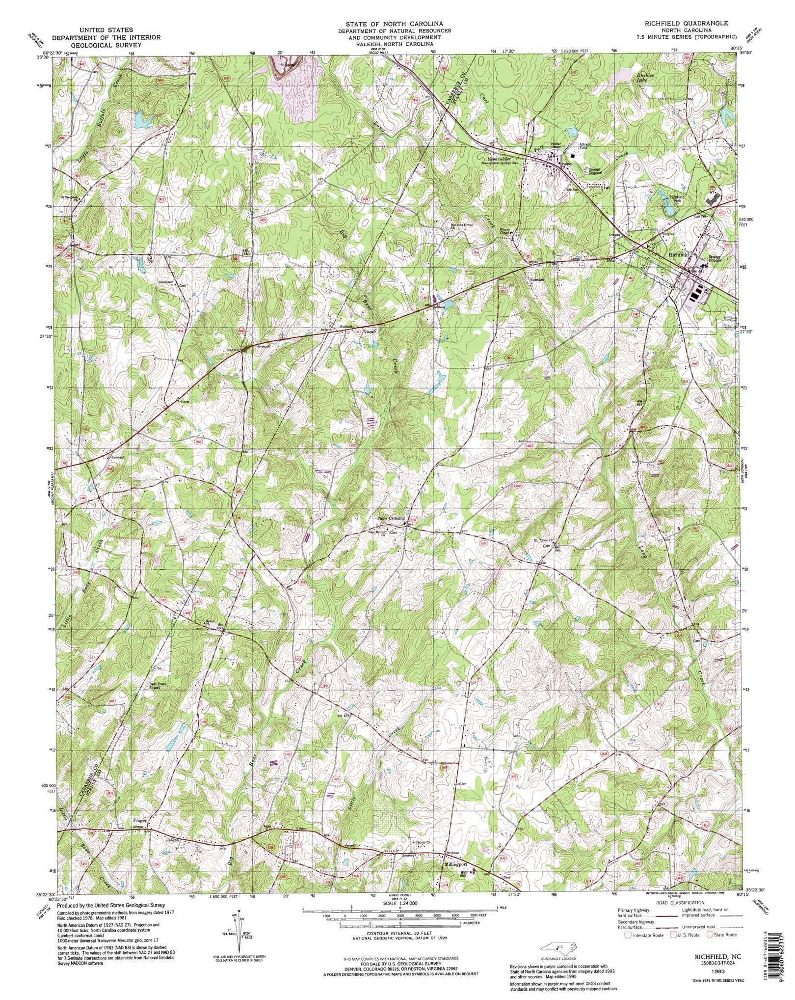
Richfield Topo Map North Carolina
To zoom in, hover over the map of Richfield
USGS Topo Quad 35080d3 - 1:24,000 scale
| Topo Map Name: | Richfield |
| USGS Topo Quad ID: | 35080d3 |
| Print Size: | ca. 21 1/4" wide x 27" high |
| Southeast Coordinates: | 35.375° N latitude / 80.25° W longitude |
| Map Center Coordinates: | 35.4375° N latitude / 80.3125° W longitude |
| U.S. State: | NC |
| Filename: | o35080d3.jpg |
| Download Map JPG Image: | Richfield topo map 1:24,000 scale |
| Map Type: | Topographic |
| Topo Series: | 7.5´ |
| Map Scale: | 1:24,000 |
| Source of Map Images: | United States Geological Survey (USGS) |
| Alternate Map Versions: |
Richfield NC 1981, updated 1981 Download PDF Buy paper map Richfield NC 1981, updated 1990 Download PDF Buy paper map Richfield NC 1993, updated 1996 Download PDF Buy paper map Richfield NC 2002, updated 2003 Download PDF Buy paper map Richfield NC 2010 Download PDF Buy paper map Richfield NC 2013 Download PDF Buy paper map Richfield NC 2016 Download PDF Buy paper map |
1:24,000 Topo Quads surrounding Richfield
Rowan Mills |
Salisbury |
Southmont |
Denton Nw |
Denton |
China Grove |
Rockwell |
Gold Hill |
High Rock |
Handy |
Concord |
Mount Pleasant |
Richfield |
New London |
Badin |
Concord Se |
Locust |
Frog Pond |
Albemarle |
Morrow Mountain |
Midland |
Stanfield |
Oakboro |
Aquadale |
Mount Gilead West |
> Back to 35080a1 at 1:100,000 scale
> Back to 35080a1 at 1:250,000 scale
> Back to U.S. Topo Maps home
Richfield topo map: Gazetteer
Richfield: Airports
Bear Creek Airport elevation 238m 780′Richfield: Dams
Ritchies Lake Dam elevation 189m 620′Richfield: Parks
Richfield Park elevation 192m 629′Richfield: Populated Places
Drys Mill (historical) elevation 218m 715′Finger elevation 192m 629′
Millingport elevation 199m 652′
Misenheimer elevation 204m 669′
Pauls Crossing elevation 197m 646′
Richfield elevation 197m 646′
Richfield: Reservoirs
Ritchies Lake elevation 189m 620′Richfield digital topo map on disk
Buy this Richfield topo map showing relief, roads, GPS coordinates and other geographical features, as a high-resolution digital map file on DVD:
South Carolina, Western North Carolina & Northeastern Georgia
Buy digital topo maps: South Carolina, Western North Carolina & Northeastern Georgia