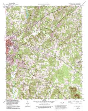
Lexington East Topo Map North Carolina
To zoom in, hover over the map of Lexington East
USGS Topo Quad 35080g2 - 1:24,000 scale
| Topo Map Name: | Lexington East |
| USGS Topo Quad ID: | 35080g2 |
| Print Size: | ca. 21 1/4" wide x 27" high |
| Southeast Coordinates: | 35.75° N latitude / 80.125° W longitude |
| Map Center Coordinates: | 35.8125° N latitude / 80.1875° W longitude |
| U.S. State: | NC |
| Filename: | o35080g2.jpg |
| Download Map JPG Image: | Lexington East topo map 1:24,000 scale |
| Map Type: | Topographic |
| Topo Series: | 7.5´ |
| Map Scale: | 1:24,000 |
| Source of Map Images: | United States Geological Survey (USGS) |
| Alternate Map Versions: |
Lexington East NC 1950, updated 1965 Download PDF Buy paper map Lexington East NC 1950, updated 1976 Download PDF Buy paper map Lexington East NC 1950, updated 1987 Download PDF Buy paper map Lexington East NC 1950, updated 1994 Download PDF Buy paper map Lexington East NC 1951 Download PDF Buy paper map Lexington East NC 1977, updated 1979 Download PDF Buy paper map Lexington East NC 2010 Download PDF Buy paper map Lexington East NC 2013 Download PDF Buy paper map Lexington East NC 2016 Download PDF Buy paper map |
1:24,000 Topo Quads surrounding Lexington East
> Back to 35080e1 at 1:100,000 scale
> Back to 35080a1 at 1:250,000 scale
> Back to U.S. Topo Maps home
Lexington East topo map: Gazetteer
Lexington East: Channels
Intracoastal Waterway elevation 238m 780′Lexington East: Dams
Lake Tom-A-Lex Dam elevation 208m 682′Lexington Storage Reservoir Dam elevation 208m 682′
Lexington East: Parks
East Fourth Street Park elevation 228m 748′Finch Park elevation 193m 633′
Raleigh Road Park elevation 224m 734′
Lexington East: Populated Places
Arbor Acres elevation 204m 669′Bryans Woods elevation 215m 705′
Colonial Heights elevation 232m 761′
Country Club Estates elevation 241m 790′
Eastern Heights elevation 213m 698′
Hedrick Grove elevation 253m 830′
Holly Grove elevation 234m 767′
Homestead Acres elevation 193m 633′
Jefferson Village elevation 236m 774′
Jimes (historical) elevation 210m 688′
North Pugh elevation 242m 793′
Ridgewood Acres elevation 235m 770′
Sandy Grove elevation 236m 774′
South Cecil elevation 229m 751′
Tussy Street elevation 233m 764′
Twin Acres elevation 213m 698′
Twin Oaks elevation 204m 669′
Lexington East: Reservoirs
City Lake elevation 208m 682′Lake Tom-A-Lex elevation 208m 682′
Lexington East: Streams
Hamby Creek elevation 195m 639′Jimmys Creek elevation 197m 646′
Leonard Creek elevation 193m 633′
Pounder Fork elevation 189m 620′
Rich Fork elevation 196m 643′
Tinkers Creek elevation 199m 652′
Lexington East: Summits
Three Hat Mountain elevation 353m 1158′Lexington East digital topo map on disk
Buy this Lexington East topo map showing relief, roads, GPS coordinates and other geographical features, as a high-resolution digital map file on DVD:
South Carolina, Western North Carolina & Northeastern Georgia
Buy digital topo maps: South Carolina, Western North Carolina & Northeastern Georgia


